 My GeoNetwork catalogue
Aqua
Provided by
Type of resources
Available actions
Topics
Keywords
Contact for the resource
Update frequencies
-
The Moderate Resolution Imaging Spectroradiometer (MODIS) is a key instrument aboard the Terra (EOS AM-1) and Aqua (EOS PM-1) satellites. The MODIS-EU image mosaic is a seamless true color composite of all Terra and Acqua passes received at DLR during a single day. Daily and Near Real Time (NRT) products are available. For the composite, MODIS channels 1, 4, 3 are used. The channels are re-projected, radiometrically enhanced, and seamlessly stitched to obtain a visually appealing result. Terra passes from north to south across the equator in the morning, while Aqua passes the equator south to north in the afternoon. Both MODIS instruments are viewing the entire Earth surface every 1 to 2 days, acquiring data in 36 spectral bands.
-

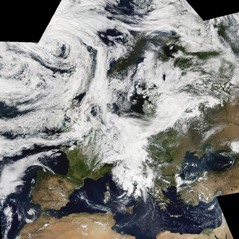
The Moderate Resolution Imaging Spectroradiometer (MODIS) is a key instrument aboard the Terra (EOS AM-1) and Aqua (EOS PM-1) satellites. Terra's orbit around the Earth is timed so that it passes from north to south across the equator in the morning, while Aqua passes south to north over the equator in the afternoon. Terra MODIS and Aqua MODIS are viewing the entire Earth's surface every 1 to 2 days, acquiring data in 36 spectral bands, or groups of wavelengths (see MODIS Technical Specifications). This mosaic has been generated from Terra and Aqua products acquired between 30 September and 03 October 2011.
-

The Global WaterPack is a dataset containing information about open surface water cover parameters on a global scale. The water detection is derived from daily, operational MODIS datasets for every year since 2003. The negative effects of polar darkness and cloud coverage are compensated by applying interpolation processing steps. Thereby, a unique global dataset can be provided that is characterized by its high temporal resolution of one day and a spatial resolution of 250 meter. This collection includes yearly composites of the dataset with information on how often a pixel was detected as open surface water with pixel values between 0 and 365 (366 for leap years). Furthermore, a reliability layer provides information on the quality of each Global WaterPack pixel.
-
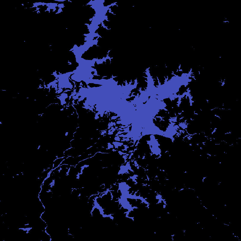
The Global WaterPack is a dataset containing information about open surface water cover parameters on a global scale. The water detection is derived from daily, operational MODIS datasets for every year since 2003. The negative effects of polar darkness and cloud coverage are compensated by applying interpolation processing steps. Thereby, a unique global dataset can be provided that is characterized by its high temporal resolution of one day and a spatial resolution of 250 meter. The daily binary layers in this collection contain information whether a pixel was detected as open surface water (1) or not (0). Furthermore, reliability and observation layers provide additional information on the quality of each Global WaterPack pixel.
-

The Global WaterPack is a dataset containing information about open surface water cover parameters on a global scale. The water detection is derived from daily, operational MODIS datasets for every year since 2003. The negative effects of polar darkness and cloud coverage are compensated by applying interpolation processing steps. Thereby, a unique global dataset can be provided that is characterized by its high temporal resolution of one day and a spatial resolution of 250 meter. This collection includes monthly composites of the dataset with information on how often a pixel was detected as open surface water with pixel values between 0 and 31. Furthermore, a reliability layer provides information on the quality of each Global WaterPack pixel.