 My GeoNetwork catalogue
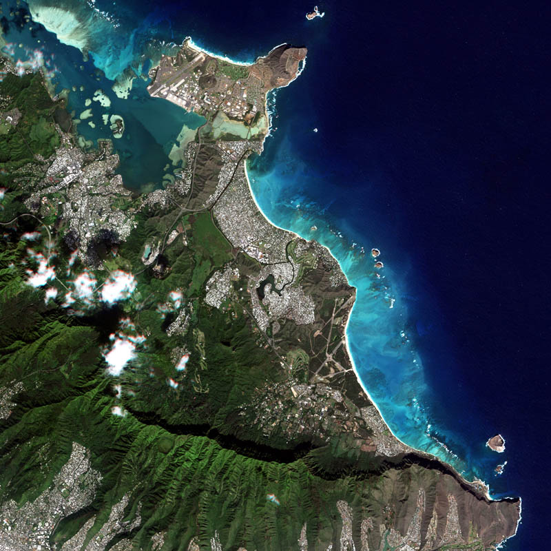
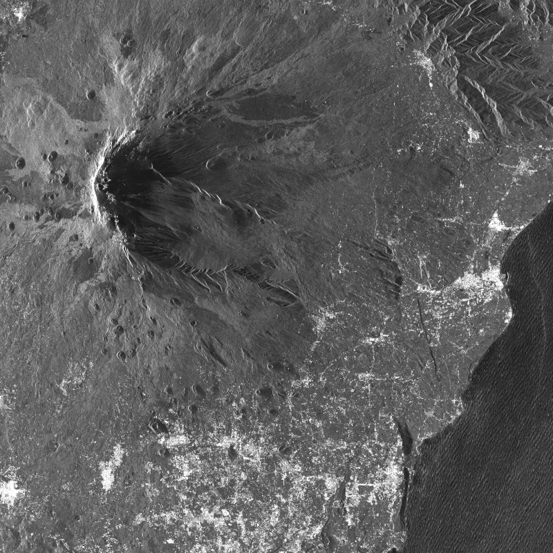
Orthoimagery
Provided by
Type of resources
Available actions
Topics
Keywords
Contact for the resource
Update frequencies
Service types
-
The RapidEye Earth observation system comprised five satellites equipped with high-resolution optical sensors. Co-funded by the German Federal Government, the fleet of satellites was launched from the Baikonur cosmodrome in Kazakhstan in 2008. RapidEye is owned by Planet Labs, Inc. It has been operated by Planet Labs Germany GmbH until the constellation was retired in March 2020. With all 5 satellites arranged in one orbit the RapidEye constellation was capable of taking images of the Earth's surface at high repeat rates with a maximum of 5 million km² per day. With a spatial resolution of 6.5m the 5-band sensors onboard the RapidEye satellites operated in the visible and near-infrared portions of the electromagnetic spectrum. For more information see: https://www.dlr.de/rd/en/desktopdefault.aspx/tabid-2440/3586_read-5336/ The PlanetScope data of this collection has been purchased by the German Space Agency with funds from the Ministry of Economy and is available for Germany-based researchers for scientific use. The data collection is maintained by the German Satellite Data Archive (D-SDA) of DLR’s Earth Observation Center and can be accessed via the EOWEB Geoportal. The RapidEye Analytic Ortho Tile (L3A) product is orthorectified, multispectral data and is suitable for many data science and analytic applications that require imagery with an accurate geolocation and cartographic projection. It eliminates the perspective effect on the ground (not on buildings), restoring the geometry of a vertical shot. In addition to orthorectification, the imagery has radiometric corrections applied to correct for any sensor artifacts and transformation to at-sensor radiance. For more details see: https://assets.planet.com/docs/Planet_Combined_Imagery_Product_Specs_letter_screen.pdf
-
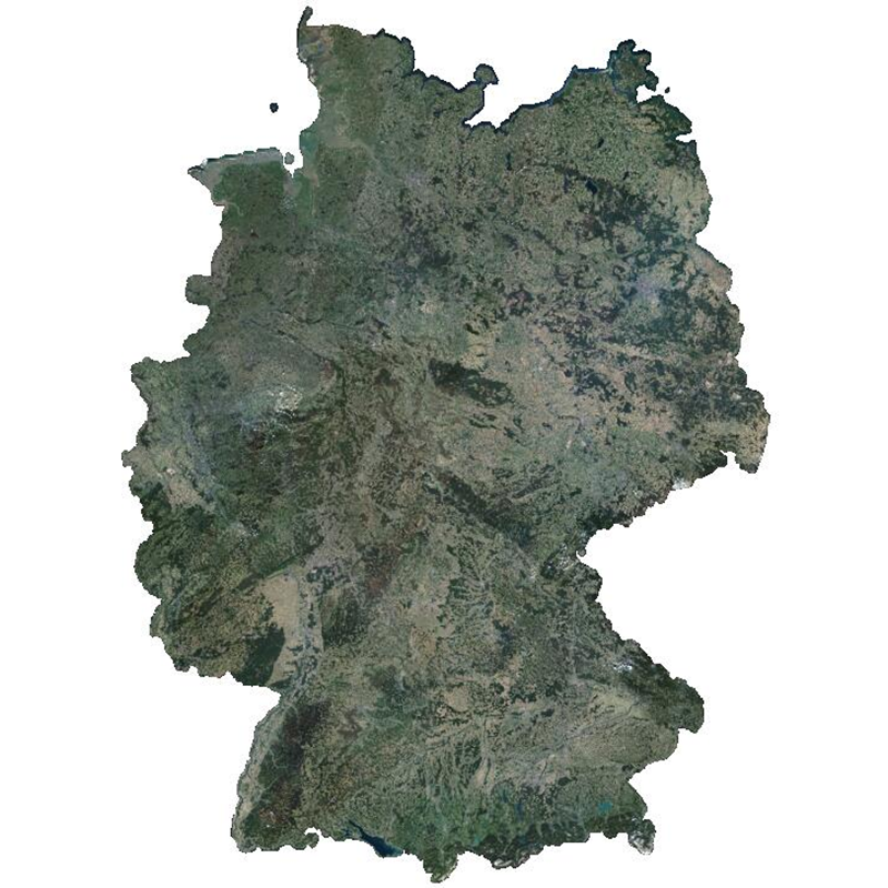
The RapidEye RESA Germany Mosaic provides a nearly cloud-free view of the country’s geography, natural resources, and infrastructure. It is composed of 374,240 sqkm of multi-spectral RapidEye imagery, acquired between April and October 2015. The product is being provided in the framework of the RapidEye Science Archive (RESA) agreement. Co-funded by the German Federal Government, the fleet of RapidEye satellites were launched from the Baikonur cosmodrome in Kazakhstan in 2008. The satellites are now owned by Planet Labs, Inc. The RapidEye Earth observation system comprises five satellites equipped with high-resolution optical sensors. With a spatial resolution of 6.5 m the 5-band instruments operate in the visible and near-infrared portions of the electromagnetic spectrum. With its high repetition rate the RapidEye constellation can image each point on the Earth’s at least once per day.
-
Indian Remote Sensing satellites (IRS) are a series of Earth Observation satellites, built, launched and maintained by Indian Space Research Organisation. The IRS series provides many remote sensing services to India and international ground stations.
-
The PlanetScope satellite constellation, called ‘Flock’, consists of multiple launches of groups of individual Dove satellites into a 400 km orbit. Some of them were launched from the ISS. Therefore, on-orbit capacity is constantly improving in capability or quantity. Each Dove satellite is a CubeSat with a size of 10 x 10 x 34 cm. The complete PlanetScope constellation of approximately 130 satellites is able to image the entire land surface of the Earth every day, equating to a daily collection capacity of 200 million km². In 2014 the first Dove satellites started operationally acquiring images from the earth’s surface. The optical sensors mounted on the individual Dove satellites operate in the visual and near-infrared parts of the electromagnetic spectrum with a spatial resolution between 3 and 5 meters. A third generation of PlanetScope sensors (known as SuperDove or PSB.SD) is currently in orbit and is producing limited quantities of imagery with 5 spectral bands (BGRNIR + Red Edge). These satellites have the potential to produce imagery with 8 separate spectral bands. The PlanetScope data of this collection has been purchased by the German Space Agency with funds from the Ministry of Economy and is available for Germany-based researchers for scientific use. The data collection is maintained by the German Satellite Data Archive (D-SDA) of DLR’s Earth Observation Center and can be accessed via the EOWEB Geoportal. This collection comprises the PlanetScope L1B Basic Scene 4-band multispectral image products with three visual RGB and one near-infrared band. The Basic Scene product is a scaled Top of Atmosphere Radiance (at sensor) and sensor corrected product, providing imagery as seen from the spacecraft without correction for any geometric distortions. It has a scene-based framing, and is not mapped to a cartographic projection. If available, the Surface Reflectance layer which corrects for the effects of the Earth's atmosphere is added to the product.
-
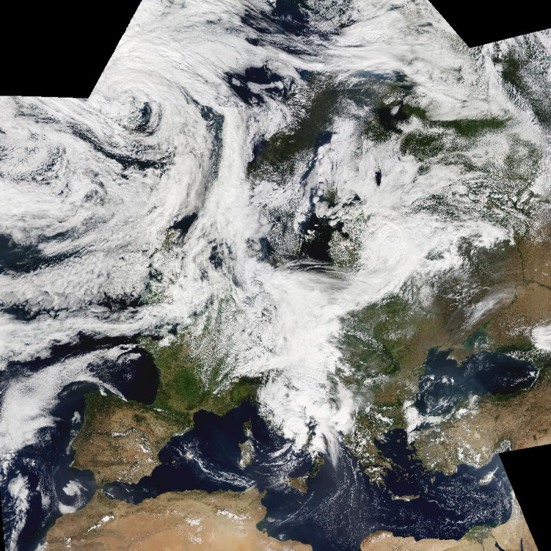
The Moderate Resolution Imaging Spectroradiometer (MODIS) is a key instrument aboard the Terra (EOS AM-1) and Aqua (EOS PM-1) satellites. The MODIS-EU image mosaic is a seamless true color composite of all Terra and Acqua passes received at DLR during a single day. Daily and Near Real Time (NRT) products are available. For the composite, MODIS channels 1, 4, 3 are used. The channels are re-projected, radiometrically enhanced, and seamlessly stitched to obtain a visually appealing result. Terra passes from north to south across the equator in the morning, while Aqua passes the equator south to north in the afternoon. Both MODIS instruments are viewing the entire Earth surface every 1 to 2 days, acquiring data in 36 spectral bands.
-
The EnMAP HSI L2A dataset collection comprises a standardized, consistent, systematically processed, and cloud-native level-2A dataset series for the entire mission. It is especially useful for big data or time series analyses. The dataset is processed with the atmospheric correction over land processor and is provided in cloud-optimized GeoTIFF format for direct access and download. The metadata follows the CEOS Analysis Ready Data (CEOS-ARD) framework. The database is constantly updated with newly acquired data. The Environmental Mapping and Analysis Program (EnMAP) is a German hyperspectral satellite mission that monitors and characterizes Earth’s environment on a global scale. EnMAP delivers accurate data that provides information on the status and evolution of terrestrial and aquatic ecosystems, supporting environmental monitoring, management, and decision-making. For more information, please see the mission website: https://www.enmap.org/mission/
-

The hyperspectral instrument DESIS (DLR Earth Sensing Imaging Spectrometer) is one of four possible payloads of MUSES (Multi-User System for Earth Sensing), which is mounted on the International Space Station (ISS). DLR developed and delivered a Visual/Near-Infrared Imaging Spectrometer to Teledyne Brown Engineering, which was responsible for integrating the instrument. Teledyne Brown designed and constructed, integrated and tested the platform before delivered to NASA. Teledyne Brown collaborates with DLR in several areas, including basic and applied research for use of data. DESIS is operated in the wavelength range from visible through the near infrared and enables precise data acquisition from Earth's surface for applications including fire-detection, change detection, maritime domain awareness, and atmospheric research. The spatial resolution is about 30m on ground. DESIS is sensitive between 400nm and 1000nm with a spectral resolution of about 3.3nm. Experimental products like the Forward Motion Compensation allow to observe the same area on ground by continuous rotating the mirror during forward motion. For more information concerning DESIS the reader is referred to https://www.dlr.de/de/eoc/forschung-transfer/projekte-und-missionen/desis
-
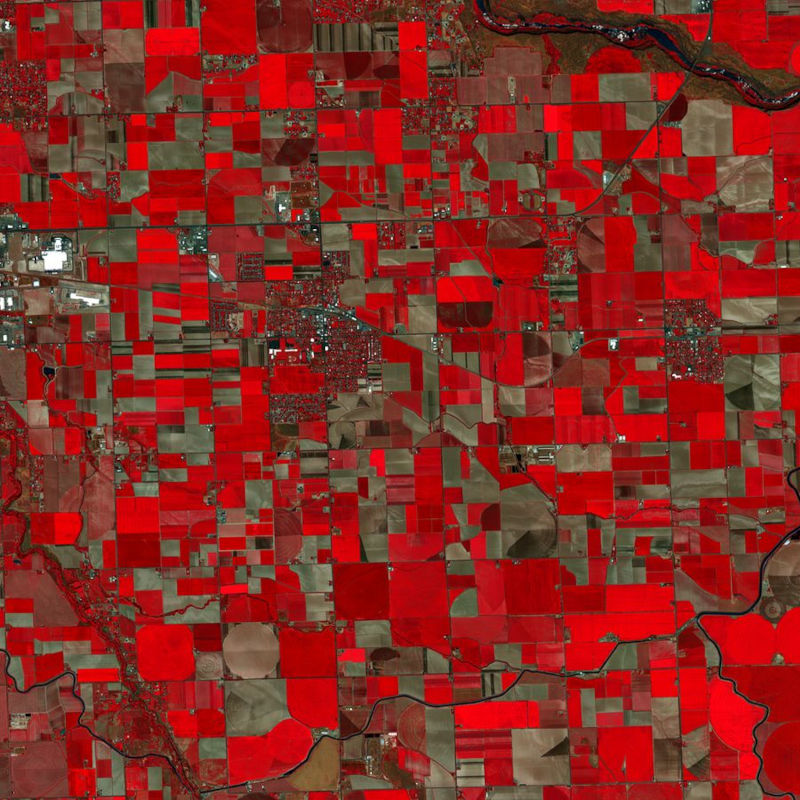
The PlanetScope satellite constellation, called ‘Flock’, consists of multiple launches of groups of individual Dove satellites into a 400 km orbit. Some of them were launched from the ISS. Therefore, on-orbit capacity is constantly improving in capability or quantity. Each Dove satellite is a CubeSat with a size of 10 x 10 x 34 cm. The complete PlanetScope constellation of approximately 130 satellites is able to image the entire land surface of the Earth every day, equating to a daily collection capacity of 200 million km². In 2014 the first Dove satellites started operationally acquiring images from the earth’s surface. The optical sensors mounted on the individual Dove satellites operate in the visual and near-infrared parts of the electromagnetic spectrum with a spatial resolution between 3 and 5 meters. A third generation of PlanetScope sensors (known as SuperDove or PSB.SD) is currently in orbit and is producing limited quantities of imagery with 5 spectral bands (BGRNIR + Red Edge). These satellites have the potential to produce imagery with 8 separate spectral bands. The RapidEye Science Archive (RESA), which allows Germany-based researchers to apply for free PlanetScope imagery, is operated by the German Satellite Data Archive (D-SDA) of DLR’s Earth Observation Center and can be accessed via the EOWEB Geoportal. New PlanetScope data as well as archive data which is not yet part of the RESA collections can be applied for at Planet Labs Germany GmbH under the RESA contract. For more information see: https://www.planet.com/resa/ This collection comprises the PlanetScope L3A OrthoTile products which are orthorectified as individual 25 km by 25 km tiles referenced to a fixed, standard image tile grid system. The OrthoTile products are radiometrically-, sensor-, and geometrically-corrected and aligned to a cartographic map projection. The Surface Reflectance layer which corrects for the effects of the Earth's atmosphere is included in the product.
-
The PlanetScope satellite constellation, called ‘Flock’, consists of multiple launches of groups of individual Dove satellites into a 400 km orbit. Some of them were launched from the ISS. Therefore, on-orbit capacity is constantly improving in capability or quantity. Each Dove satellite is a CubeSat with a size of 10 x 10 x 34 cm. The complete PlanetScope constellation of approximately 130 satellites is able to image the entire land surface of the Earth every day, equating to a daily collection capacity of 200 million km². In 2014 the first Dove satellites started operationally acquiring images from the earth’s surface. The optical sensors mounted on the individual Dove satellites operate in the visual and near-infrared parts of the electromagnetic spectrum with a spatial resolution between 3 and 5 meters. A third generation of PlanetScope sensors (known as SuperDove or PSB.SD) is currently in orbit and is producing limited quantities of imagery with 5 spectral bands (BGRNIR + Red Edge). These satellites have the potential to produce imagery with 8 separate spectral bands. The PlanetScope data of this collection has been purchased by the German Space Agency with funds from the Ministry of Economy and is available for Germany-based researchers for scientific use. The data collection is maintained by the German Satellite Data Archive (D-SDA) of DLR’s Earth Observation Center and can be accessed via the EOWEB Geoportal. This collection comprises PlanetScope L1B Basic Scene 3-band natural color RGB products. The PlanetScope Basic Scene product is a Scaled Top of Atmosphere Radiance (at sensor) and sensor corrected product, providing imagery as seen from the spacecraft without correction for any geometric distortions inherent in the imaging process. It has a scene-based framing, and is not mapped to a cartographic projection.
-
This collection contains TerraSAR-X Level 1b data acquired over the pre-defined Geohazard Supersites and a number of CEOS projects regions. The collection comprises mainly complex (SSC) with a number of detected (MGD) products. TerraSAR-X data can be ordered by a Principal Investigator (PI) of a respective Supersite region under the terms of a TerraSAR-X Science proposal accepted by DLR. Data is available for download by the Geohazard scientific community under the terms of the user license. Supersites are single sites or extended areas of high priority to the Geohazards community in which active single or multiple geological hazards pose a threat to human population and/or critical facilities. The Supersites initiative provides access to spaceborne and in-situ geophysical data of selected sites prone to earthquake, volcano or other hazards. For further information see: http://ceos.org/ourwork/workinggroups/disasters/gsnl/ Overview of permament Supersites: http://geo-gsnl.org/supersites/permanent-supersites/