 My GeoNetwork catalogue
Optical
Provided by
Type of resources
Available actions
Topics
Keywords
Contact for the resource
Update frequencies
-
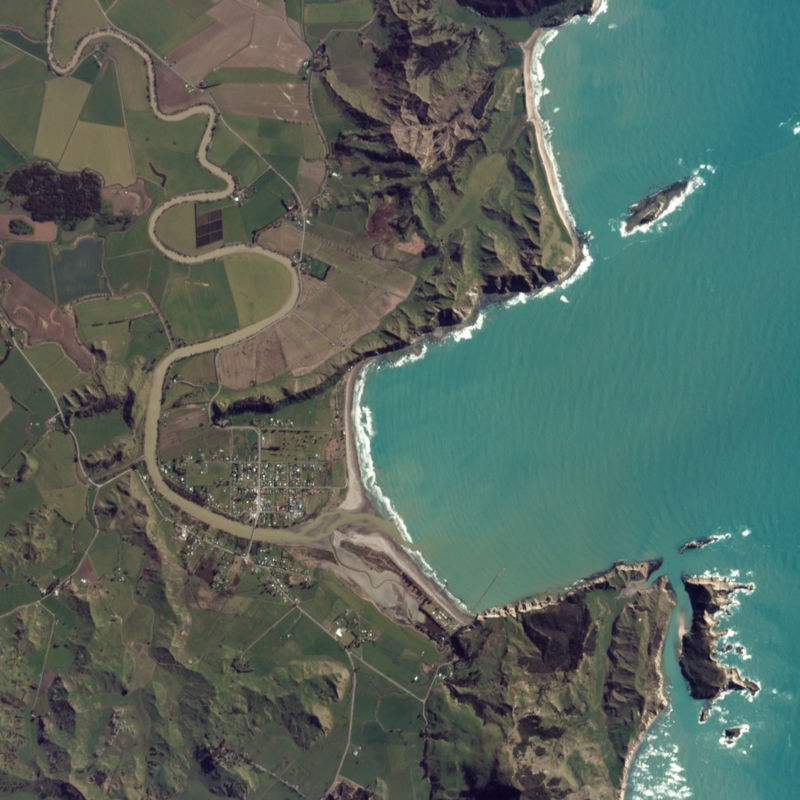
The PlanetScope satellite constellation, called ‘Flock’, consists of multiple launches of groups of individual Dove satellites into a 400 km orbit. Some of them were launched from the ISS. Therefore, on-orbit capacity is constantly improving in capability or quantity. Each Dove satellite is a CubeSat with a size of 10 x 10 x 34 cm. The complete PlanetScope constellation of approximately 130 satellites is able to image the entire land surface of the Earth every day, equating to a daily collection capacity of 200 million km². In 2014 the first Dove satellites started operationally acquiring images from the earth’s surface. The optical sensors mounted on the individual Dove satellites operate in the visual and near-infrared parts of the electromagnetic spectrum with a spatial resolution between 3 and 5 meters. A third generation of PlanetScope sensors (known as SuperDove or PSB.SD) is currently in orbit and is producing limited quantities of imagery with 5 spectral bands (BGRNIR + Red Edge). These satellites have the potential to produce imagery with 8 separate spectral bands. The PlanetScope data of this collection has been purchased by the German Space Agency with funds from the Ministry of Economy and is available for Germany-based researchers for scientific use. The data collection is maintained by the German Satellite Data Archive (D-SDA) of DLR’s Earth Observation Center and can be accessed via the EOWEB Geoportal. This collection comprises PlanetScope L1B Basic Scene 3-band natural color RGB products. The PlanetScope Basic Scene product is a Scaled Top of Atmosphere Radiance (at sensor) and sensor corrected product, providing imagery as seen from the spacecraft without correction for any geometric distortions inherent in the imaging process. It has a scene-based framing, and is not mapped to a cartographic projection.
-
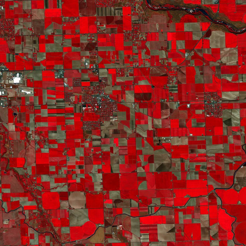
The PlanetScope satellite constellation, called ‘Flock’, consists of multiple launches of groups of individual Dove satellites into a 400 km orbit. Some of them were launched from the ISS. Therefore, on-orbit capacity is constantly improving in capability or quantity. Each Dove satellite is a CubeSat with a size of 10 x 10 x 34 cm. The complete PlanetScope constellation of approximately 130 satellites is able to image the entire land surface of the Earth every day, equating to a daily collection capacity of 200 million km². In 2014 the first Dove satellites started operationally acquiring images from the earth’s surface. The optical sensors mounted on the individual Dove satellites operate in the visual and near-infrared parts of the electromagnetic spectrum with a spatial resolution between 3 and 5 meters. A third generation of PlanetScope sensors (known as SuperDove or PSB.SD) is currently in orbit and is producing limited quantities of imagery with 5 spectral bands (BGRNIR + Red Edge). These satellites have the potential to produce imagery with 8 separate spectral bands. The PlanetScope data of this collection has been purchased by the German Space Agency with funds from the Ministry of Economy and is available for Germany-based researchers for scientific use. The data collection is maintained by the German Satellite Data Archive (D-SDA) of DLR’s Earth Observation Center and can be accessed via the EOWEB Geoportal. This collection comprises the PlanetScope L1B Basic Scene 4-band multispectral image products with three visual RGB and one near-infrared band. The Basic Scene product is a scaled Top of Atmosphere Radiance (at sensor) and sensor corrected product, providing imagery as seen from the spacecraft without correction for any geometric distortions. It has a scene-based framing, and is not mapped to a cartographic projection. If available, the Surface Reflectance layer which corrects for the effects of the Earth's atmosphere is added to the product.
-
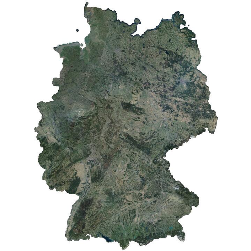
The RapidEye RESA Germany Mosaic provides a nearly cloud-free view of the country’s geography, natural resources, and infrastructure. It is composed of 374,240 sqkm of multi-spectral RapidEye imagery, acquired between April and October 2015. The product is being provided in the framework of the RapidEye Science Archive (RESA) agreement. Co-funded by the German Federal Government, the fleet of RapidEye satellites were launched from the Baikonur cosmodrome in Kazakhstan in 2008. The satellites are now owned by Planet Labs, Inc. The RapidEye Earth observation system comprises five satellites equipped with high-resolution optical sensors. With a spatial resolution of 6.5 m the 5-band instruments operate in the visible and near-infrared portions of the electromagnetic spectrum. With its high repetition rate the RapidEye constellation can image each point on the Earth’s at least once per day.
-
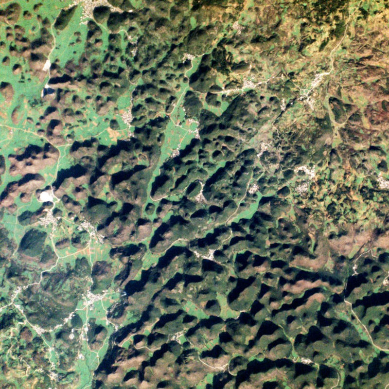
The PlanetScope satellite constellation, called ‘Flock’, consists of multiple launches of groups of individual Dove satellites into a 400 km orbit. Some of them were launched from the ISS. Therefore, on-orbit capacity is constantly improving in capability or quantity. Each Dove satellite is a CubeSat with a size of 10 x 10 x 34 cm. The complete PlanetScope constellation of approximately 130 satellites is able to image the entire land surface of the Earth every day, equating to a daily collection capacity of 200 million km². In 2014 the first Dove satellites started operationally acquiring images from the earth’s surface. The optical sensors mounted on the individual Dove satellites operate in the visual and near-infrared parts of the electromagnetic spectrum with a spatial resolution between 3 and 5 meters. A third generation of PlanetScope sensors (known as SuperDove or PSB.SD) is currently in orbit and is producing limited quantities of imagery with 5 spectral bands (BGRNIR + Red Edge). These satellites have the potential to produce imagery with 8 separate spectral bands. The RapidEye Science Archive (RESA), which allows Germany-based researchers to apply for free PlanetScope imagery, is operated by the German Satellite Data Archive (D-SDA) of DLR’s Earth Observation Center and can be accessed via the EOWEB Geoportal. New PlanetScope data as well as archive data which is not yet part of the RESA collections can be applied for at Planet Labs Germany GmbH under the RESA contract. For more information see: https://www.planet.com/resa/ This collection comprises the PlanetScope L3A OrthoTile products which are orthorectified as individual 25 km by 25 km tiles referenced to a fixed, standard image tile grid system. The OrthoTile products are radiometrically-, sensor-, and geometrically-corrected and aligned to a cartographic map projection. The Surface Reflectance layer which corrects for the effects of the Earth's atmosphere is included in the product.
-

The RapidEye Earth observation system comprised five satellites equipped with high-resolution optical sensors. Co-funded by the German Federal Government, the fleet of satellites was launched from the Baikonur cosmodrome in Kazakhstan in 2008. RapidEye is owned by Planet Labs, Inc.. It has been operated by Planet Labs Germany GmbH until the constellation was retired in March 2020. With all 5 satellites arranged in one orbit the RapidEye constellation was capable of taking images of the Earth's surface at high repeat rates with a maximum of 5 million km² per day. With a spatial resolution of 6.5m the 5-band sensors onboard the RapidEye satellites operated in the visible and near-infrared portions of the electromagnetic spectrum. For more information see: https://www.dlr.de/rd/en/desktopdefault.aspx/tabid-2440/3586_read-5336/ The PlanetScope data of this collection has been purchased by the German Space Agency with funds from the Ministry of Economy and is available for Germany-based researchers for scientific use. The data collection is maintained by the German Satellite Data Archive (D-SDA) of DLR’s Earth Observation Center and can be accessed via the EOWEB Geoportal. The RapidEye Basic Scene (L1B) product is radiometrically- and sensor-corrected, providing imagery as seen from the spacecraft without correction for any geometric distortions inherent in the imaging process, and is not mapped to a cartographic projection. The imagery data is accompanied by all spacecraft telemetry necessary for the processing of the data into a geo-corrected form. For more details see: https://assets.planet.com/docs/Planet_Combined_Imagery_Product_Specs_letter_screen.pdf
-
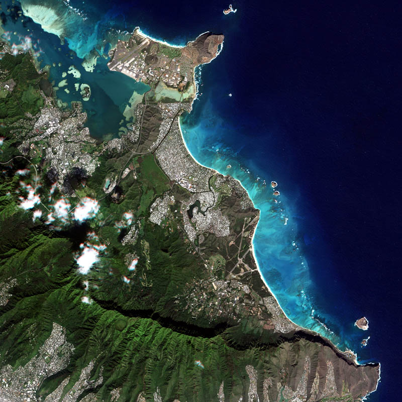
The RapidEye Earth observation system comprised five satellites equipped with high-resolution optical sensors. Co-funded by the German Federal Government, the fleet of satellites was launched from the Baikonur cosmodrome in Kazakhstan in 2008. RapidEye is owned by Planet Labs, Inc. It has been operated by Planet Labs Germany GmbH until the constellation was retired in March 2020. With all 5 satellites arranged in one orbit the RapidEye constellation was capable of taking images of the Earth's surface at high repeat rates with a maximum of 5 million km² per day. With a spatial resolution of 6.5m the 5-band sensors onboard the RapidEye satellites operated in the visible and near-infrared portions of the electromagnetic spectrum. For more information see: https://www.dlr.de/rd/en/desktopdefault.aspx/tabid-2440/3586_read-5336/ The PlanetScope data of this collection has been purchased by the German Space Agency with funds from the Ministry of Economy and is available for Germany-based researchers for scientific use. The data collection is maintained by the German Satellite Data Archive (D-SDA) of DLR’s Earth Observation Center and can be accessed via the EOWEB Geoportal. The RapidEye Analytic Ortho Tile (L3A) product is orthorectified, multispectral data and is suitable for many data science and analytic applications that require imagery with an accurate geolocation and cartographic projection. It eliminates the perspective effect on the ground (not on buildings), restoring the geometry of a vertical shot. In addition to orthorectification, the imagery has radiometric corrections applied to correct for any sensor artifacts and transformation to at-sensor radiance. For more details see: https://assets.planet.com/docs/Planet_Combined_Imagery_Product_Specs_letter_screen.pdf
-
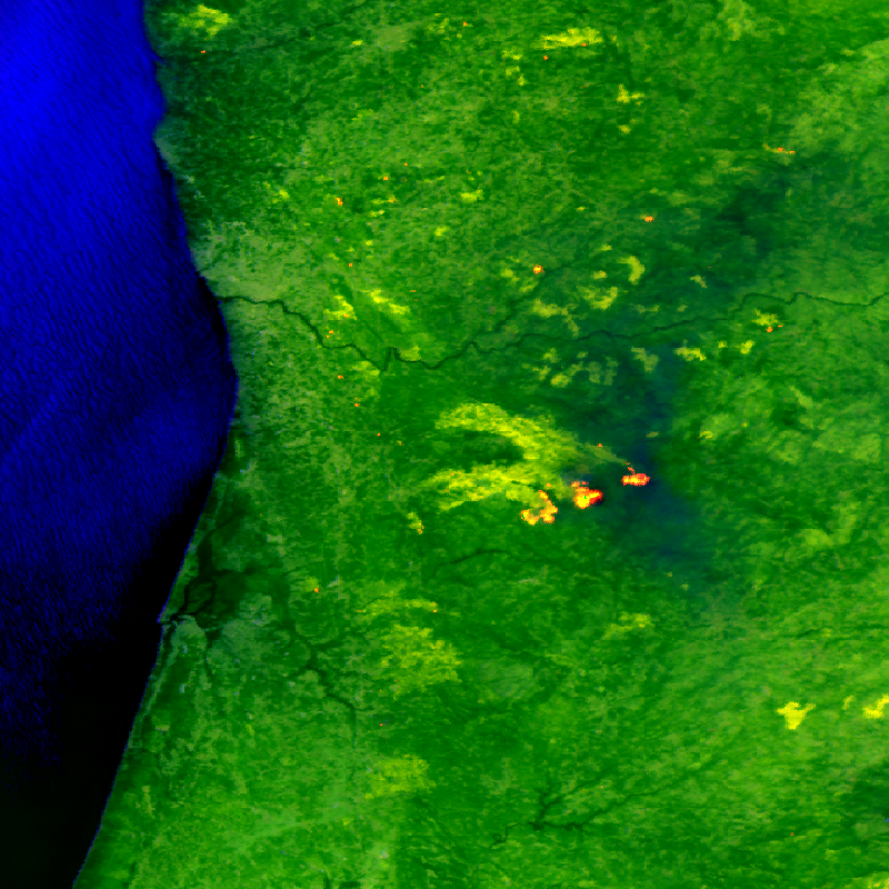
The FireBIRD mission consists of two small satellites, TET-1 and BIROS. Together, the two satellites are on an Earth observation mission that aims to detect forest fires, or high-temperature events, from space. The new infrared system provides high-quality data that is capable of measuring the spread of the fire and the amount of heat generated with great accuracy very early on - almost in real time - meaning that FireBIRD can serve as an early warning system. The data acquired from this Earth observation mission can also be used as a basis for scientific climate research. In addition to the main payload of the cameras, further experiments have been planned for developing the technology on board the small satellites. Further information can be found on the following website: http://www.dlr.de/firebird/en/ and in the FireBIRD brochure available at: http://www.dlr.de/firebird/en/Portaldata/79/Resources/dokumente/FireBIRD_Broschuere_HighRes_v3_english.pdf