 My GeoNetwork catalogue
RapidEye
Provided by
Type of resources
Available actions
Topics
Keywords
Contact for the resource
Update frequencies
Service types
-
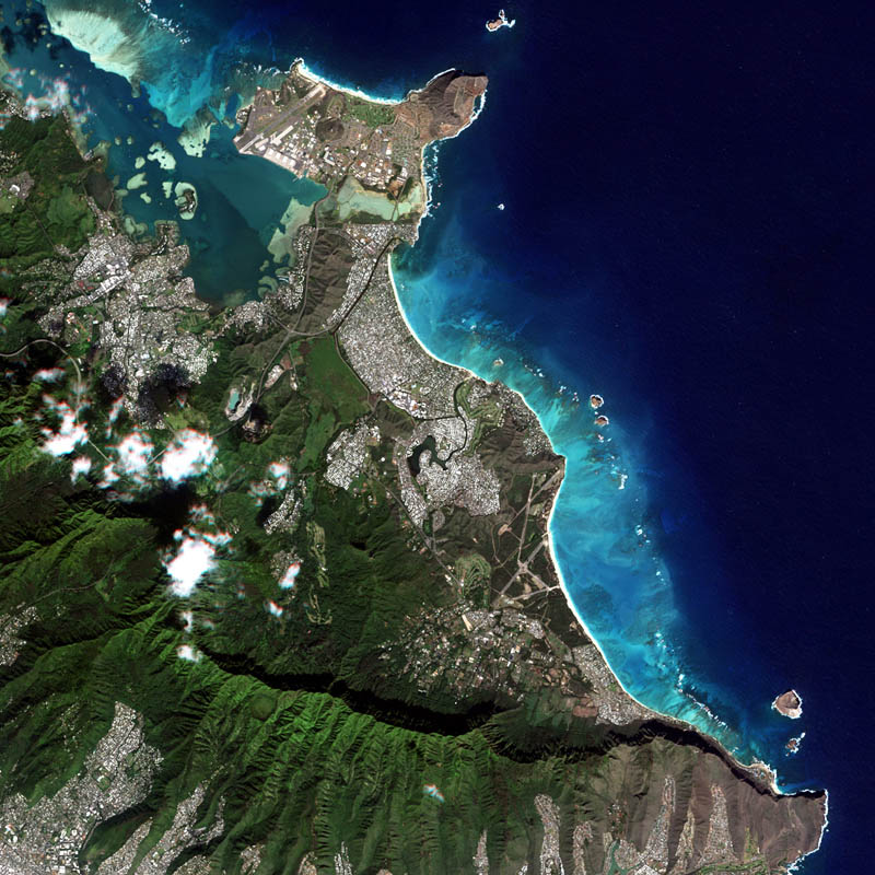
The RapidEye Earth observation system comprised five satellites equipped with high-resolution optical sensors. Co-funded by the German Federal Government, the fleet of satellites was launched from the Baikonur cosmodrome in Kazakhstan in 2008. RapidEye is owned by Planet Labs, Inc. It has been operated by Planet Labs Germany GmbH until the constellation was retired in March 2020. With all 5 satellites arranged in one orbit the RapidEye constellation was capable of taking images of the Earth's surface at high repeat rates with a maximum of 5 million km² per day. With a spatial resolution of 6.5m the 5-band sensors onboard the RapidEye satellites operated in the visible and near-infrared portions of the electromagnetic spectrum. For more information see: https://www.dlr.de/rd/en/desktopdefault.aspx/tabid-2440/3586_read-5336/ The PlanetScope data of this collection has been purchased by the German Space Agency with funds from the Ministry of Economy and is available for Germany-based researchers for scientific use. The data collection is maintained by the German Satellite Data Archive (D-SDA) of DLR’s Earth Observation Center and can be accessed via the EOWEB Geoportal. The RapidEye Analytic Ortho Tile (L3A) product is orthorectified, multispectral data and is suitable for many data science and analytic applications that require imagery with an accurate geolocation and cartographic projection. It eliminates the perspective effect on the ground (not on buildings), restoring the geometry of a vertical shot. In addition to orthorectification, the imagery has radiometric corrections applied to correct for any sensor artifacts and transformation to at-sensor radiance. For more details see: https://assets.planet.com/docs/Planet_Combined_Imagery_Product_Specs_letter_screen.pdf
-
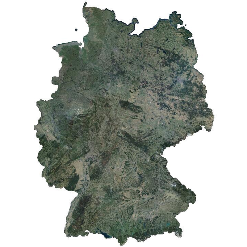
The RapidEye RESA Germany Mosaic provides a nearly cloud-free view of the country’s geography, natural resources, and infrastructure. It is composed of 374,240 sqkm of multi-spectral RapidEye imagery, acquired between April and October 2015. The product is being provided in the framework of the RapidEye Science Archive (RESA) agreement. Co-funded by the German Federal Government, the fleet of RapidEye satellites were launched from the Baikonur cosmodrome in Kazakhstan in 2008. The satellites are now owned by Planet Labs, Inc. The RapidEye Earth observation system comprises five satellites equipped with high-resolution optical sensors. With a spatial resolution of 6.5 m the 5-band instruments operate in the visible and near-infrared portions of the electromagnetic spectrum. With its high repetition rate the RapidEye constellation can image each point on the Earth’s at least once per day.
-

The RapidEye Earth observation system comprised five satellites equipped with high-resolution optical sensors. Co-funded by the German Federal Government, the fleet of satellites was launched from the Baikonur cosmodrome in Kazakhstan in 2008. RapidEye is owned by Planet Labs, Inc.. It has been operated by Planet Labs Germany GmbH until the constellation was retired in March 2020. With all 5 satellites arranged in one orbit the RapidEye constellation was capable of taking images of the Earth's surface at high repeat rates with a maximum of 5 million km² per day. With a spatial resolution of 6.5m the 5-band sensors onboard the RapidEye satellites operated in the visible and near-infrared portions of the electromagnetic spectrum. For more information see: https://www.dlr.de/rd/en/desktopdefault.aspx/tabid-2440/3586_read-5336/ The PlanetScope data of this collection has been purchased by the German Space Agency with funds from the Ministry of Economy and is available for Germany-based researchers for scientific use. The data collection is maintained by the German Satellite Data Archive (D-SDA) of DLR’s Earth Observation Center and can be accessed via the EOWEB Geoportal. The RapidEye Basic Scene (L1B) product is radiometrically- and sensor-corrected, providing imagery as seen from the spacecraft without correction for any geometric distortions inherent in the imaging process, and is not mapped to a cartographic projection. The imagery data is accompanied by all spacecraft telemetry necessary for the processing of the data into a geo-corrected form. For more details see: https://assets.planet.com/docs/Planet_Combined_Imagery_Product_Specs_letter_screen.pdf
-
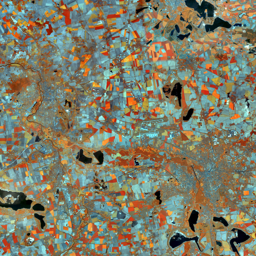
Darstellungsdienst für RapidEye Satellitenbilder Deutschland, Echt- und Falschfarbendarstellung Stand 2012 im Gebiet der Bundesrepublik Deutschland. Das BKG stellt multitemporale Satellitenbilder des Sensors RapidEye (5 Kanäle,: R, G, B, RE, IR) aus den Jahren 2009/2010 und 2012 zur Verfügung.Die Bilder sind aus einer Höhe von ca. 630 km aufgenommen und haben eine Bodenauflösung von 5 m. Der Bewölkungsanteil beträgt weniger als 5 %. Der Dienst wird ausschließlich Bundesbehörden zur Verfügung gestellt.
-

Darstellungsdienst für RapidEye Satellitenbilder Deutschland, Echt- und Falschfarbendarstellung Stand 2009 im Gebiet der Bundesrepublik Deutschland. Das BKG stellt multitemporale Satellitenbilder des Sensors RapidEye (5 Kanäle,: R, G, B, RE, IR) aus den Jahren 2009/2010 und 2012 zur Verfügung.Die Bilder sind aus einer Höhe von ca. 630 km aufgenommen und haben eine Bodenauflösung von 5 m. Der Bewölkungsanteil beträgt weniger als 5 %. Der Dienst wird ausschließlich Bundesbehörden zur Verfügung gestellt.
-
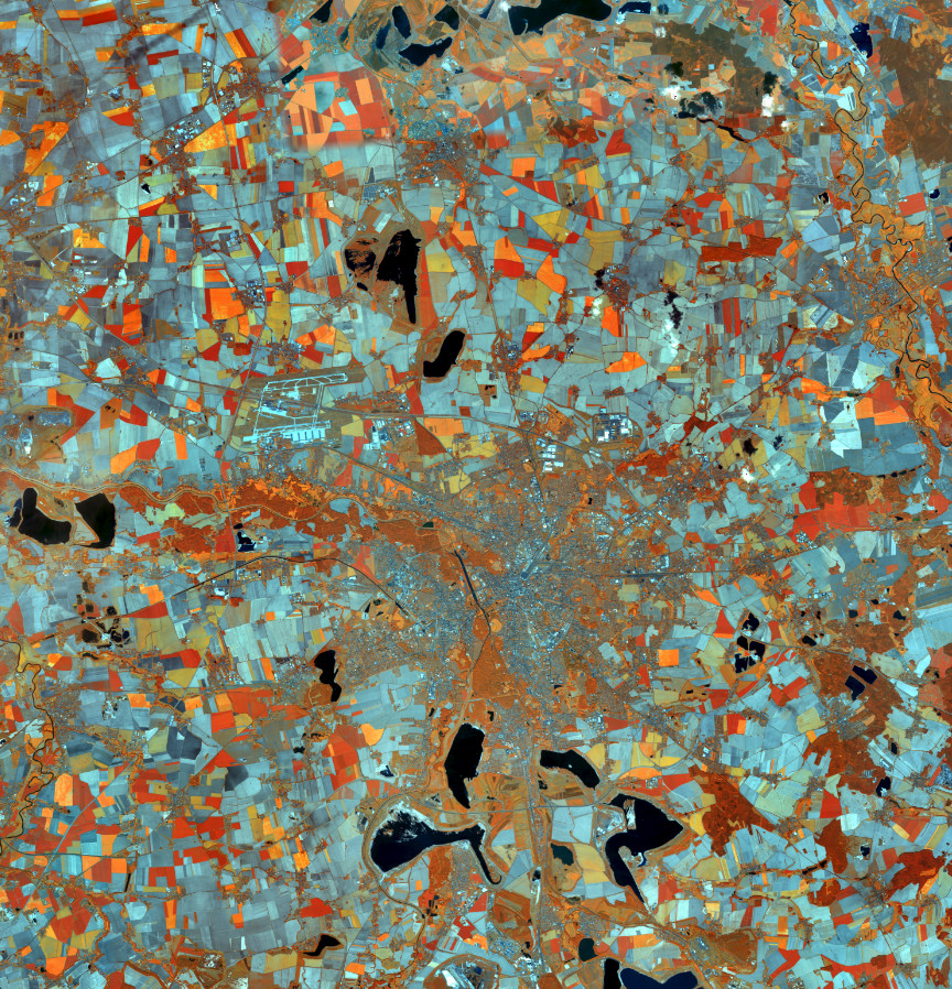
Darstellungsdienst für RapidEye Satellitenbilder Deutschland, Echt- und Falschfarbendarstellung Stand 2015 im Gebiet der Bundesrepublik Deutschland. Das BKG stellt multitemporale Satellitenbilder des Sensors RapidEye (5 Kanäle,: R, G, B, RE, IR) aus den Jahren 2009/2010 und 2012 zur Verfügung.Die Bilder sind aus einer Höhe von ca. 630 km aufgenommen und haben eine Bodenauflösung von 5 m. Der Bewölkungsanteil beträgt weniger als 5 %. Der Dienst wird ausschließlich Bundesbehörden zur Verfügung gestellt.
-
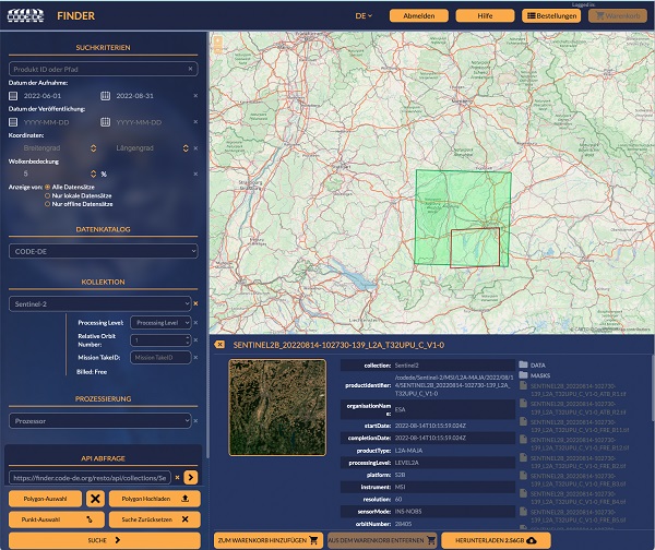
Nicht nur die CODE-DE Archive können von registrierten CODE-DE Nutzern mit einer Reihe von Funktionen abgefragt werden, sondern auch die CREODIAS und Copernicus Contributing Missions Datenkataloge sind zugänglich. Der geographische Bereich einer Abfrage kann auf der Karte durch Polygone oder Punktkoordinaten definiert werden. Eine API-Abfrage wird zur späteren Verwendung in der eigenen Anwendung zur Verfügung gestellt. Darüber hinaus können registrierte Nutzer Verarbeitungsanfragen mit Hilfe vordefinierter Prozessoren für Sentinel-1- und Sentinel-2-Daten stellen. Der EO Finder dient als einer der Zugangspunkte zu einer einsatzbereiten Prozessierungskette für Erdbeobachtungsdaten, auf die jeder registrierte Nutzer von CODE-DE Zugang hat. Die Funktionalitäten reichen dabei von einfacher Vorverarbeitung bis hin zu fortgeschritteneren Algorithmen zur Atmosphärenkorrektur. - Verfügbare Daten im CODE-DE-Katalog: Sentinel-1, Sentinel-2, Sentinel-3, Sentinel-5P, Sentinel-6, Copernicus DEM (COP-DEM), MODIS / TerraAqua - Verfügbare Daten im CREODIAS-Katalog: Sentinel-1, Sentinel-2, Sentinel-3, Sentinel-5P, Landsat-5 ESA Archive, Landsat-7 ESA Archive, Landsat-8 ESA Archive - Verfügbare Daten im Copernicus Contributing Missions-Katalog: IRS-P5 CartoSat-1, Deimos-2, GeoEye-1, Ikonos-2, KOMPSAT-2, KOMPSAT-3, PlanetScope, Pleiades-1, QuickBird-2, RapidEye, IRS-P6 Resourcesat-1, IRS-P2 Resourcesat-2, SPOT-5, SPOT-6, SPOT-7, SkySat, SuperView-1, WorldView-1, WorldView-2, WorldView-3 - Verfügbare Prozessoren für Sentinel-1: SLC Interferometry (12 days), SLC Interferometry (6 days), Terrain-corrected backscatter - Verfügbare Prozessoren für Sentinel-2: FORCE Atmospheric Correction / Cloud Mask generation, SNAP-Biophysical, SNAP-C2RCC