 My GeoNetwork catalogue
multispectral
Provided by
Type of resources
Topics
Keywords
Contact for the resource
Update frequencies
-
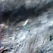
Indian Remote Sensing satellites (IRS) are a series of Earth Observation satellites, built, launched and maintained by Indian Space Research Organisation. The IRS series provides many remote sensing services to India and international ground stations. IRS LISS-III data are well suited for agricultural and forestry monitoring tasks. Because of their simultaneous acquisition with IRS PAN data and the availability of a synthetic blue band, LISS-III data are ideal for colouring IRS PAN products.
-

Indian Remote Sensing satellites (IRS) are a series of Earth Observation satellites, built, launched and maintained by Indian Space Research Organisation. The IRS series provides many remote sensing services to India and international ground stations. \\n\\nIRS LISS-III data are well suited for agricultural and forestry monitoring tasks. Because of their simultaneous acquisition with IRS PAN data and the availability of a synthetic blue band, LISS-III data are ideal for colouring IRS PAN products.
-
Indian Remote Sensing satellites (IRS) are a series of Earth Observation satellites, built, launched and maintained by Indian Space Research Organisation. The IRS series provides many remote sensing services to India and international ground stations. IRS LISS-III data are well suited for agricultural and forestry monitoring tasks.
-
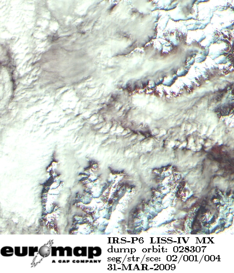
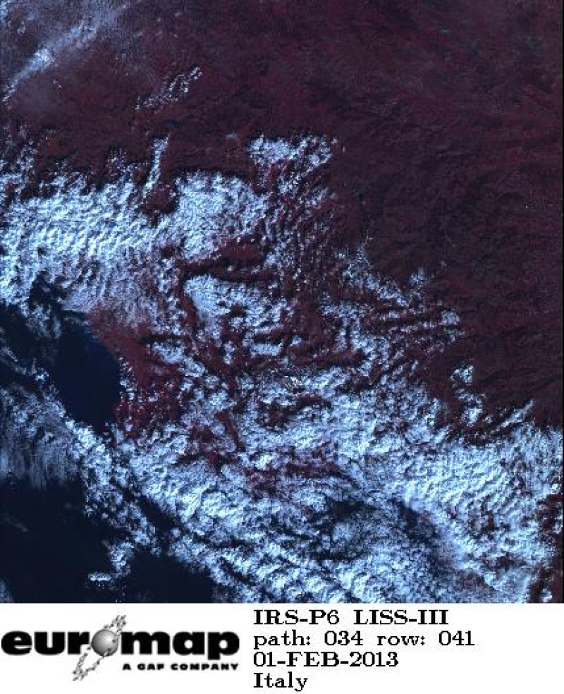
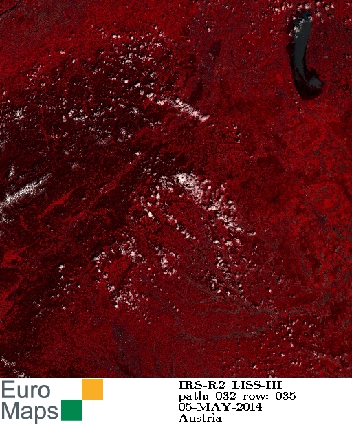
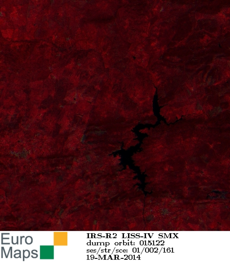
Indian Remote Sensing satellites (IRS) are a series of Earth Observation satellites, built, launched and maintained by Indian Space Research Organisation. The IRS series provides many remote sensing services to India and international ground stations. With 5 m resolution and products covering areas up to 23.5 km x 23.5 km IRS LISS-IV multispectral data provide a cost effective solution for mapping tasks up to 1:25'000 scale.
-
Spatially and temporally high-resolution data was acquired with the aid of multispectral sensors mounted on UAV and a gyrocopter platform for the purpose of classification. The work was part of the research and development project „Modern sensors and airborne remote sensing for the mapping of vegetation and hydromorphology along Federal waterways in Germany“ (mDRONES4rivers) in cooperation of the German Federal Institute of Hydrology (BfG), Geocoptix GmbH, Hochschule Koblenz und JB Hyperspectral Devices. Within the project period (2019-2022) data was collected at different sites situated in Germany along the Rivers Rhine and Oder. All published data produced within the project can be found by searching for the keyword ‘mDRONES4rivers‘. In this dataset, the following UAS data and metadata of the project site ‘Nonnenwerth’ (center coordinates [WGS84]: 50.637541°N, 7.208834°E; area: 45 ha) at the Rhine River in Germany is available for download: • Multispectral orthophotos (GeoTiff; 5 bands: B, G, R, NIR, Flag; camera system: PanX 2.0 and PanX 3.0; resolution: ca. 30 cm/ca. 16 cm; abbreviation: PanX2_ORTHO/PanX3_ORTHO) • Digital Surface Models (GeoTiff; 1 band; camera system: PanX 2.0 and PanX 3.0; resolution: ca. 30 cm; abbreviation: PanX_DEM) • associated Technical Reports (PDF; technical metadata concerning data acquisition, and processing using Agisoft Metashape, 1x for multispectral orthophotos + digital surface model) The above-mentioned files are provided for download as dataset stored in one directory per season depending on the date of data acquisition (e.g. mDRONES4rivers_NW_GYRO_2019_01_Winter.zip = projectname_projectsite_platform_year_no.season_name.season). To provide an overview of all files and general background information plus data preview the following files are stored in the info.zip folder: • Overview table and metadata of the above-mentioned data (xlsx) • Summary (PDF, Detailed description of sensors and data acquisition procedure, 1x for multispectral orthophotos + digital surface models) Note: the data was processed with focus on spectral information and not for geodetic purposes. Georeferencing accuracy has not been checked in detail.
-
Spatially and temporally high-resolution data was acquired with the aid of multispectral sensors mounted on UAV and a gyrocopter platform for the purpose of classification. The work was part of the research and development project „Modern sensors and airborne remote sensing for the mapping of vegetation and hydromorphology along Federal waterways in Germany“ (mDRONES4rivers) in cooperation of the German Federal Institute of Hydrology (BfG), Geocoptix GmbH, Hochschule Koblenz und JB Hyperspectral Devices. Within the project period (2019-2022) an object oriented image classification was conducted based on UAV and gyrocopter data for different sites situated in Germany along the Rivers Rhine and Oder. All published data produced within the project can be found by searching for the keyword ‘mDRONES4rivers‘. In this dataset, the following classification results and metadata of the project sites situated in riparian zones along federal waterways in Germany with focus on the Rhine River, Germany is available for download: • Basic & Vegetation Classification (ESRI Shapefile; abbreviation: lvl2_vegetation_units) • Classification of dominant stands (ESRI Shapefile; abbreviation: lvl4_dominant_stands ) • Classification of substrat types (ESRI Shapefile; abbreviation: lvl4_substrate_types) • associated reports (PDF; statistical and additional information on the classifiaction results and workflow) The above-mentioned files are provided for download as dataset stored in one directory per projekt site and season (e.g. mDRONES4rivers_Niederwerth_2019_03_Summer_Classification.zip = projectname_projectsite_year_no.season_name.season_product). To provide an overview of all files and general background information plus data preview the following files are additionally provided: • Portfolios (PDF, Detailed description of classification products and classification workflow, 1x for basic surface types, 1x for classification of vegetation units, 1x for classification of dominant stands, 1x for classification of substrate types) • Color Coding table for the visualization of the classifiaction units (.xlsx)
-
Spatially and temporally high-resolution data was acquired with the aid of multispectral sensors mounted on UAV and a gyrocopter platform for the purpose of classification. The work was part of the research and development project „Modern sensors and airborne remote sensing for the mapping of vegetation and hydromorphology along Federal waterways in Germany“ (mDRONES4rivers) in cooperation of the German Federal Institute of Hydrology (BfG), Geocoptix GmbH, Hochschule Koblenz und JB Hyperspectral Devices. Within the project period (2019-2022) data was collected at different sites situated in Germany along the Rivers Rhine and Oder. All published data produced within the project can be found by searching for the keyword ‘mDRONES4rivers‘. In this dataset, the following UAS data and metadata of the project site ‘Nonnenwerth’ (center coordinates [WGS84]: 50.637541°N, 7.208834°E; area: 8 ha) at the Rhine River in Germany is available for download: • Multispectral orthophotos (GeoTiff; 6 bands: B, G, R, Red-Edge, NIR, Flag; camera: Micasense; resolution: 25 cm; abbreviation: MS_RAW) • RGB-orthophotos (GeoTiff; 3 bands: R, G, B; camera: Phantom; resolution: 25 cm; abbreviation: PH_ORTHO) • Digital Surface Models (GeoTiff; 1 band; camera: Phantom; resolution: ca. 5 cm; abbreviation: PH_DEM) • associated Technical Reports (PDF; technical metadata concerning data acquisition, and processing using Agisoft Metashape, 1x for multispectral orthophotos, 1x for RGB-orthophotos + digital surface model) The above-mentioned files are provided for download as dataset stored in one directory per season depending on the date of data acquisition (e.g. mDRONES4rivers_NW_UAV_2019_01_Winter.zip = projectname_projectsite_platform_year_no.season_name.season). To provide an overview of all files and general background information plus data preview the following files are stored in the info.zip folder: • Overview table and metadata of the above-mentioned data (xlsx) • Summary (PDF, Detailed description of sensors and data acquisition procedure, 1x for multispectral orthophotos, 1x for RGB-orthophotos + digital surface models) Note: the data was processed with focus on spectral information and not for geodetic purposes. Georeferencing accuracy has not been checked in detail.
-
Spatially and temporally high-resolution data was acquired with the aid of multispectral sensors mounted on UAV and a gyrocopter platform for the purpose of classification. The work was part of the research and development project „Modern sensors and airborne remote sensing for the mapping of vegetation and hydromorphology along Federal waterways in Germany“ (mDRONES4rivers) in cooperation of the German Federal Institute of Hydrology (BfG), Geocoptix GmbH, Hochschule Koblenz und JB Hyperspectral Devices. Within the project period (2019-2022) data was collected at different sites situated in Germany along the Rivers Rhine and Oder. All published data produced within the project can be found by searching for the keyword ‘mDRONES4rivers‘. In this dataset, the following UAS data and metadata of the project site ‘Emmericher Ward’ (center coordinates [WGS84]: 50.385264°N, 6.198692°E; area: 53ha) at the Rhine River in Germany is available for download: • Multispectral orthophotos (GeoTiff; 6 bands: B, G, R, Red-Edge, NIR, Flag; camera: Micasense; resolution: 25 cm; abbreviation: MS_RAW) • RGB-orthophotos (GeoTiff; 3 bands: R, G, B; camera: Phantom; resolution: 25 cm; abbreviation: PH_ORTHO) • Digital Surface Models (GeoTiff; 1 band; camera: Phantom; resolution: ca. 5 cm; abbreviation: PH_DEM) • associated Technical Reports (PDF; technical metadata concerning data acquisition, and processing using Agisoft Metashape, 1x for multispectral orthophotos, 1x for RGB-orthophotos + digital surface model) The above-mentioned files are provided for download as dataset stored in one directory per season depending on the date of data acquisition (e.g. mDRONES4rivers_EW_UAV_2019_01_Winter.zip = projectname_projectsite_platform_year_no.season_name.season). To provide an overview of all files and general background information plus data preview the following files are stored in the info.zip folder: • Overview table and metadata of the above-mentioned data (xlsx) • Summary (PDF, Detailed description of sensors and data acquisition procedure, 1x for multispectral orthophotos, 1x for RGB-orthophotos + digital surface models) Note: the data was processed with focus on spectral information and not for geodetic purposes. Georeferencing accuracy has not been checked in detail.