 My GeoNetwork catalogue
Sea regions
Provided by
Type of resources
Available actions
Topics
Keywords
Contact for the resource
Update frequencies
Service types
-

The Medium Resolution Imaging Spectrometer (MERIS) on Board ESA’s ENVISAT provides spectral high resolution image data in the visible-near infrared spectral region (412-900 nm) at a spatial resolution of 300 m. For more details on ENVISAT and MERIS see http://envisat.esa.int/ This product developed in the frame of the MAPP project (MERIS Application and Regional Products Projects) represents the chlorophyll concentration of Lake Constance derived from MERIS data. The product is a cooperative effort of DLR-DFD and the Institute for Coastal Research at the GKSS Research Centre Geesthacht. DFD pre-processed up to the value added level whenever MERIS data for the North Sea region was received and positively checked for a water area large enough for a suitable interpretation. For more details the reader is referred to http://wdc.dlr.de/sensors/meris/ and http://wdc.dlr.de/sensors/meris/documents/Mapp_ATBD_final_i3r0dez2001.pdf This product provides daily maps.
-

INSPIRE theme Sea Regions.
-
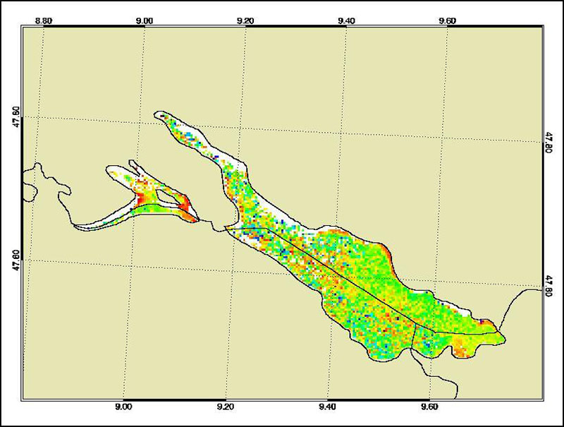
The Medium Resolution Imaging Spectrometer (MERIS) on Board ESA’s ENVISAT provides spectral high resolution image data in the visible-near infrared spectral region (412-900 nm) at a spatial resolution of 300 m. For more details on ENVISAT and MERIS see http://envisat.esa.int/ This product developed in the frame of the MAPP project (MERIS Application and Regional Products Projects) represents the chlorophyll concentration of Lake Constance derived from MERIS data. The product is a cooperative effort of DLR-DFD and the Institute for Coastal Research at the GKSS Research Centre Geesthacht. DFD pre-processed up to the value added level whenever MERIS data for the North Sea region was received and positively checked for a water area large enough for a suitable interpretation. For more details the reader is referred to http://wdc.dlr.de/sensors/meris/ and http://wdc.dlr.de/sensors/meris/documents/Mapp_ATBD_final_i3r0dez2001.pdf This product provides 10-days maps.
-
INSPIRE theme Sea Regions.
-

The Medium Resolution Imaging Spectrometer (MERIS) on Board ESA’s ENVISAT provides spectral high resolution image data in the visible-near infrared spectral region (412-900 nm) at a spatial resolution of 300 m. For more details on ENVISAT and MERIS see http://envisat.esa.int/ This product developed in the frame of the MAPP project (MERIS Application and Regional Products Projects) represents the chlorophyll concentration of Lake Constance derived from MERIS data. The product is a cooperative effort of DLR-DFD and the Institute for Coastal Research at the GKSS Research Centre Geesthacht. DFD pre-processed up to the value added level whenever MERIS data for the North Sea region was received and positively checked for a water area large enough for a suitable interpretation. For more details the reader is referred to http://wdc.dlr.de/sensors/meris/ and http://wdc.dlr.de/sensors/meris/documents/Mapp_ATBD_final_i3r0dez2001.pdf This product provides monthly maps.
-

INSPIRE theme Sea Regions.
-
INSPIRE theme Sea Regions.
-
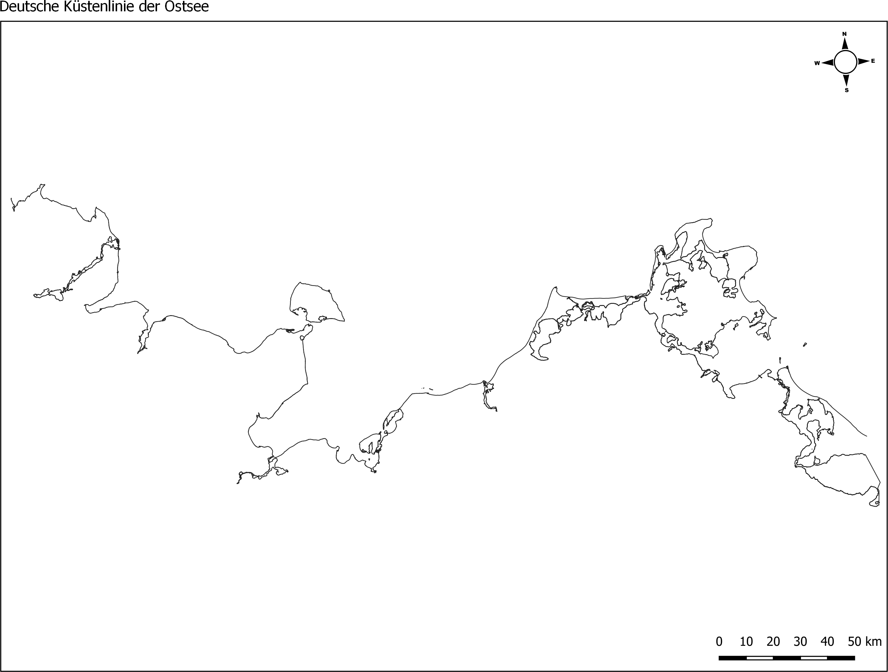
Die Küstenlinie der deutschen Ostseeküste, erstellt vom Landesamt für Umwelt (LfU) von Schleswig Holstein. Grundlage dafür waren MSRL- und WRRL-Shapefiles der Küsten- Übergangsgewässer. Der Dienst stellt Shapefiles der Küstenlinien für die Nordsee (ANS-DE) und die Ostsee (BAL-DE) aus den abgestimmten und an die EU gemeldeten Berichtsgeometrien für die gesamte deutsche Küste bereit. Hierfür wurden Shapes der MSRL und der WRRL (Küsten- und Übergangsgewässer) genutzt. Die Daten wurden im Dezember 2017 (Ostsee) / bzw. im Januar 2018 (Nordsee) erstellt.
-
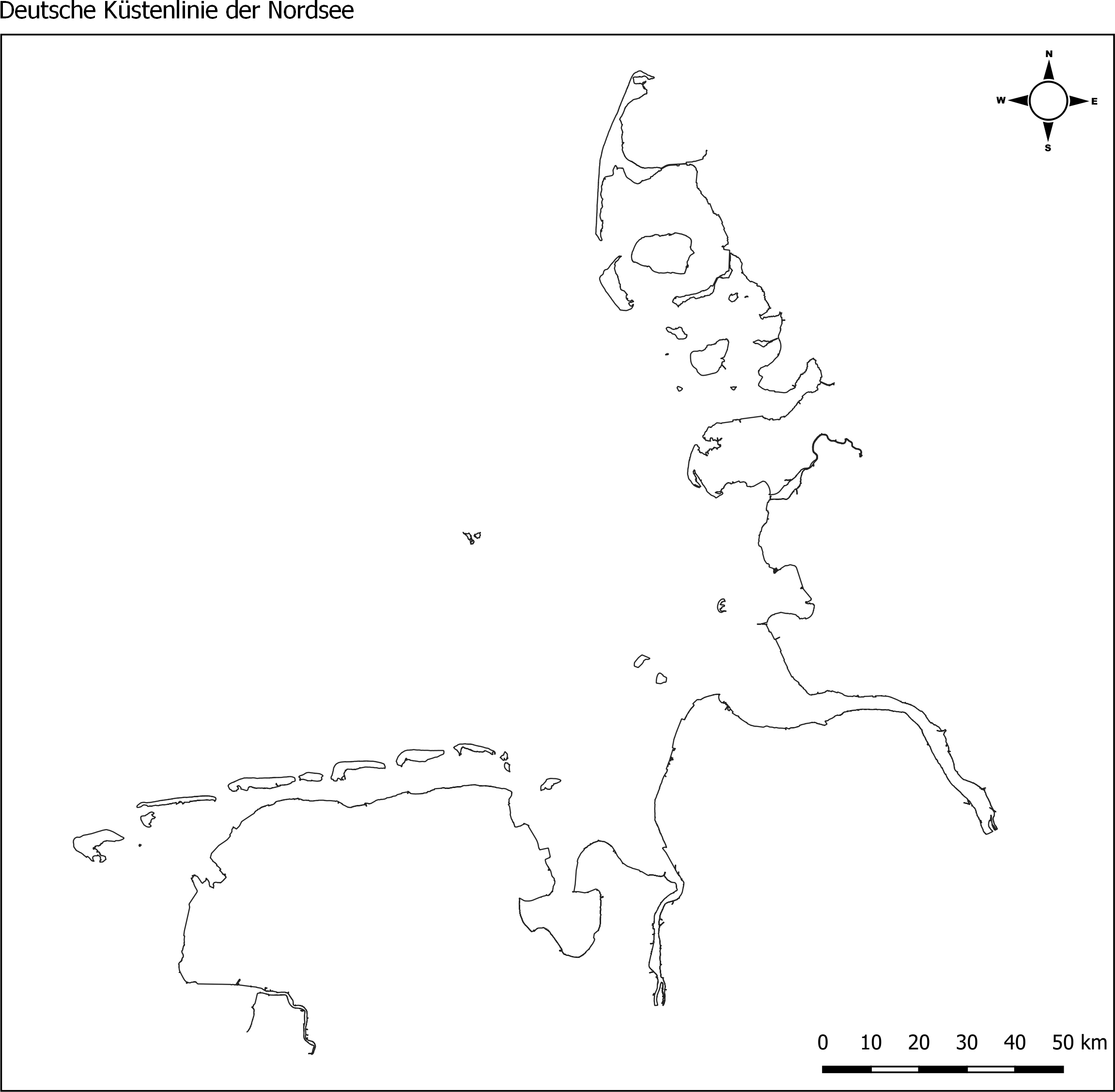
Die Küstenlinie der deutschen Nordseeküste, erstellt vom Landesamt für Umwelt (LfU) von Schleswig Holstein. Grundlage dafür waren MSRL- und WRRL-Shapefiles der Küsten- Übergangsgewässer. Der Dienst stellt Shapefiles der Küstenlinien für die Nordsee (ANS-DE) und die Ostsee (BAL-DE) aus den abgestimmten und an die EU gemeldeten Berichtsgeometrien für die gesamte deutsche Küste bereit. Hierfür wurden Shapes der MSRL und der WRRL (Küsten- und Übergangsgewässer) genutzt. Die Daten wurden im Dezember 2017 (Ostsee) / bzw. im Januar 2018 (Nordsee) erstellt.