 My GeoNetwork catalogue
TROPOMI
Provided by
Type of resources
Available actions
Topics
Keywords
Contact for the resource
Update frequencies
-
We present an updated (v2) catalog of NOx emissions from point sources as derived from TROPOMI measurements of NO2 (PAL product, May 2018 - Nov 2021) combined with wind fields from ERA5. Compared to version 1 of the catalog, several improvements have been introduced to the algorithm. Most importantly, several corrections are applied, accounting for the effects of plume height on satellite sensitivity, 3D topographic effects, and the chemical loss of NOx , resulting in considerably higher and more accurate NOx emissions. In addition, error estimates are provided for each point source, taking into account the uncertainties of the individual retrieval steps. The catalog v2 is based on a fully automated iterative detection algorithm of point sources worldwide. It lists 1139 locations that have been found to be significant NOx sources. The majority of these locations match to power plants listed in the global power plant database. Other NOx point sources correspond to cement plants, metal smelters, industrial areas, or medium-sized cities.
-
We detect and quantify NOx point sources from the divergence of the horizontal NOx flux based on the continuity equation. The analysis steps are: - The NOx flux is determined for each TROPOMI (TROPOspheric Monitoring Instrument) orbit by upscaling the TROPOMI tropospheric NO2 column to NOx and multiplying it with horizontal wind fields from ECMWF (300m above ground). - The NOx fluxes are averaged for 2018-2019. - The divergence, i.e. spatial derivative, of the mean NOx flux is calculated, which is particularly sensitive for point sources. - NOx point sources are detected in the divergence map by an automated search algorithm for local maxima, and quantified by fitting a Gaussian function to these maxima. Ambiguous cases are skipped. TROPOMI is the satellite instrument on board of the Copernicus Sentinel-5 Precursor satellite. The approach of deriving emission information from the divergence of the NOx flux is described in Beirle et al., 2019: Beirle, S., Borger, C., Dörner, S., Li, A., Hu, Z., Liu, F., Wang, Y. and Wagner, T.: Pinpointing nitrogen oxide emissions from space, Science Advances, 5(11), eaax9800, doi:10.1126/sciadv.aax9800, 2019. The details and modifications made for the automated detection of NOx point sources on global scale are provided in Beirle et al., 2020: Beirle, S., Borger, C., Dörner, S., Eskes, H., Kumar, V., de Laat, A., and Wagner, T.: Catalog of NOx emissions from point sources as derived from the divergence of the NO2 flux for TROPOMI, to be submitted to Earth System Science Data, 2020.
-
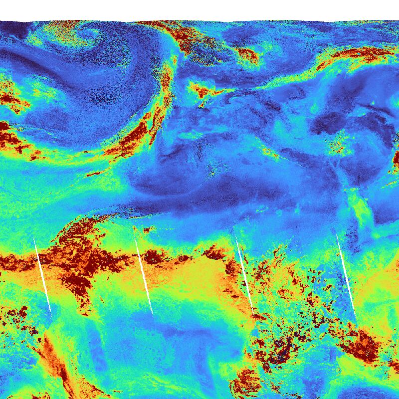
Water Vapour (H2O) concentration (globally) as derived from Sentinel-5P/TROPOMI observations. H2O is the most abundant greenhouse gas in the atmosphere. In addition it is one of the most powerful drivers for weather phenomena in the troposphere. Daily observations are binned onto a regular latitude-longitude grid. The TROPOMI instrument aboard the SENTINEL-5P space craft is a nadir-viewing, imaging spectrometer covering wavelength bands between the ultraviolet and the shortwave infra-red. TROPOMI's purpose is to measure atmospheric properties and constituents. It is contributing to monitoring air quality and providing critical information to services and decision makers. The instrument uses passive remote sensing techniques by measuring the Top Of Atmosphere (TOA) solar radiation reflected by and radiated from the earth and its atmosphere. The four spectrometers of TROPOMI cover the ultraviolet (UV), visible (VIS), Near Infra-Red (NIR) and Short Wavelength Infra-Red (SWIR) domains of the electromagnetic spectrum, allowing operational retrieval of the following trace gas constituents: Ozone (O3), Nitrogen Dioxide (NO2), Sulfur Dioxide (SO2), Water Vapour (H2O), Carbon Monoxide (CO) and Methane (CH4). Within the INPULS project, innovative algorithms and processors for the generation of Level 3 and Level 4 products, improved data discovery and access technologies as well as server-side analytics for the users are developed.
-

This product displays the Cloud Optical Thickness (COT) around the globe. Clouds play a crucial role in the Earth's climate system and have significant effects on trace gas retrievals. The cloud optical thickness is retrieved from the O2-A band using the ROCINN algorithm. The TROPOMI instrument aboard the SENTINEL-5P space craft is a nadir-viewing, imaging spectrometer covering wavelength bands between the ultraviolet and the shortwave infra-red. TROPOMI's purpose is to measure atmospheric properties and constituents. It is contributing to monitoring air quality and providing critical information to services and decision makers. The instrument uses passive remote sensing techniques by measuring the Top Of Atmosphere (TOA) solar radiation reflected by and radiated from the earth and its atmosphere. The four spectrometers of TROPOMI cover the ultraviolet (UV), visible (VIS), Near Infra-Red (NIR) and Short Wavelength Infra-Red (SWIR) domains of the electromagnetic spectrum, allowing operational retrieval of the following trace gas constituents: Ozone (O3), Nitrogen Dioxide (NO2), Sulfur Dioxide (SO2), Formaldehyde (HCHO), Carbon Monoxide (CO) and Methane (CH4). Within the INPULS project, innovative algorithms and processors for the generation of Level 3 and Level 4 products, improved data discovery and access technologies as well as server-side analytics for the users are developed.
-

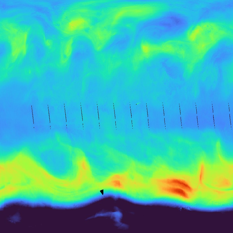
UV Index (UVI) as derived from TROPOMI observations. The UVI describes the intensity of the solar ultraviolet radiation. Values around zero indicate low, values greater than 10 indicate very high UV exposure on the ground. The TROPOMI instrument onboard the Copernicus SENTINEL-5 Precursor satellite is a nadir-viewing, imaging spectrometer that provides global measurements of atmospheric properties and constituents on a daily basis. It is contributing to monitoring air quality and climate, providing critical information to services and decision makers. The instrument uses passive remote sensing techniques by measuring the top of atmosphere solar radiation reflected by and radiated from the earth and its atmosphere. The four spectrometers of TROPOMI cover the ultraviolet (UV), visible (VIS), Near Infra-Red (NIR) and Short Wavelength Infra-Red (SWIR) domains of the electromagnetic spectrum. The operational trace gas products generated at DLR on behave ESA are: Ozone (O3), Nitrogen Dioxide (NO2), Sulfur Dioxide (SO2), Formaldehyde (HCHO), Carbon Monoxide (CO) and Methane (CH4), together with clouds and aerosol properties. This product is created in the scope of the project INPULS. It develops (a) innovative retrieval algorithms and processors for the generation of value-added products from the atmospheric Copernicus missions Sentinel-5 Precursor, Sentinel-4, and Sentinel-5, (b) cloud-based (re)processing systems, (c) improved data discovery and access technologies as well as server-side analytics for the users, and (d) data visualization services.
-
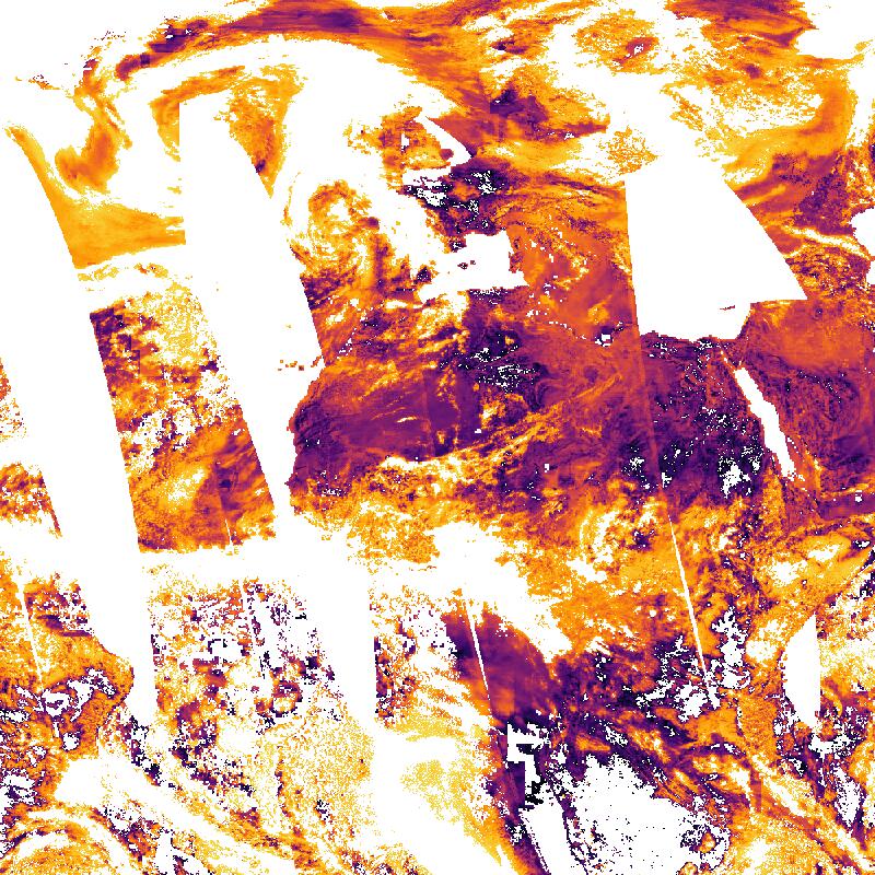
Aerosol single-scattering albedo (ASSA) as derived from TROPOMI observations. ASSA is a measure of how much light is scattered by aerosols compared to how much is absorbed. It is important for understanding the impact of aerosols on climate and radiative forcing. ASSA is unitless; a value of unity implies that extinction is completely due to scattering; conversely, a single-scattering albedo of zero implies that extinction is completely due to absorption. Daily ASSA observations are binned onto a regular latitude-longitude grid. The TROPOMI instrument onboard the Copernicus SENTINEL-5 Precursor satellite is a nadir-viewing, imaging spectrometer that provides global measurements of atmospheric properties and constituents on a daily basis. It is contributing to monitoring air quality and climate, providing critical information to services and decision makers. The instrument uses passive remote sensing techniques by measuring the top of atmosphere solar radiation reflected by and radiated from the earth and its atmosphere. The four spectrometers of TROPOMI cover the ultraviolet (UV), visible (VIS), Near Infra-Red (NIR) and Short Wavelength Infra-Red (SWIR) domains of the electromagnetic spectrum. The operational trace gas products generated at DLR on behave ESA are: Ozone (O3), Nitrogen Dioxide (NO2), Sulfur Dioxide (SO2), Formaldehyde (HCHO), Carbon Monoxide (CO) and Methane (CH4), together with clouds and aerosol properties. This product is created in the scope of the project INPULS. It develops (a) innovative retrieval algorithms and processors for the generation of value-added products from the atmospheric Copernicus missions Sentinel-5 Precursor, Sentinel-4, and Sentinel-5, (b) cloud-based (re)processing systems, (c) improved data discovery and access technologies as well as server-side analytics for the users, and (d) data visualization services.
-
Ozone vertical column density in Dobson Units as derived from Sentinel-5P/TROPOMI observations. The stratospheric ozone layer protects the biosphere from harmful solar ultraviolet radiation. Ozone in troposphere can pose risks to the health of humans, animals, and vegetation. The TROPOMI instrument aboard the SENTINEL-5P space craft is a nadir-viewing, imaging spectrometer covering wavelength bands between the ultraviolet and the shortwave infra-red. TROPOMI's purpose is to measure atmospheric properties and constituents. It is contributing to monitoring air quality and providing critical information to services and decision makers. The instrument uses passive remote sensing techniques by measuring the Top Of Atmosphere (TOA) solar radiation reflected by and radiated from the earth and its atmosphere. The four spectrometers of TROPOMI cover the ultraviolet (UV), visible (VIS), Near Infra-Red (NIR) and Short Wavelength Infra-Red (SWIR) domains of the electromagnetic spectrum, allowing operational retrieval of the following trace gas constituents: Ozone (O3), Nitrogen Dioxide (NO2), Sulfur Dioxide (SO2), Formaldehyde (HCHO), Carbon Monoxide (CO) and Methane (CH4). Daily observations are binned onto a regular latitude-longitude grid. Within the INPULS project, innovative algorithms and processors for the generation of Level 3 and Level 4 products, improved data discovery and access technologies as well as server-side analytics for the users are developed.
-
Global Cloud-Top Height (CTH) as derived from the Sentinel-5P/TROPOMI instrument. Clouds play a crucial role in the Earth's climate system and have significant effects on trace gas retrievals. The cloud-top height is retrieved from the O2-A band using the ROCINN algorithm. Daily observations are binned onto a regular latitude-longitude grid. The TROPOMI instrument aboard the SENTINEL-5P space craft is a nadir-viewing, imaging spectrometer covering wavelength bands between the ultraviolet and the shortwave infra-red. TROPOMI's purpose is to measure atmospheric properties and constituents. It is contributing to monitoring air quality and providing critical information to services and decision makers. The instrument uses passive remote sensing techniques by measuring the Top Of Atmosphere (TOA) solar radiation reflected by and radiated from the earth and its atmosphere. The four spectrometers of TROPOMI cover the ultraviolet (UV), visible (VIS), Near Infra-Red (NIR) and Short Wavelength Infra-Red (SWIR) domains of the electromagnetic spectrum, allowing operational retrieval of the following trace gas constituents: Ozone (O3), Nitrogen Dioxide (NO2), Sulfur Dioxide (SO2), Formaldehyde (HCHO), Carbon Monoxide (CO) and Methane (CH4). Within the INPULS project, innovative algorithms and processors for the generation of Level 3 and Level 4 products, improved data discovery and access technologies as well as server-side analytics for the users are developed.
-

Global sulphur dioxide (SO2) layer height as derived from Sentinel-5P/TROPOMI observations. Sulphur dioxide enters the atmosphere through volcanic eruptions and human-related activities. Daily observations are binned onto a regular latitude-longitude grid. The SO2 layer height is provided in kilometres. The TROPOMI instrument onboard the Copernicus SENTINEL-5 Precursor satellite is a nadir-viewing, imaging spectrometer that provides global measurements of atmospheric properties and constituents on a daily basis. It is contributing to monitoring air quality and climate, providing critical information to services and decision makers. The instrument uses passive remote sensing techniques by measuring the top of atmosphere solar radiation reflected by and radiated from the earth and its atmosphere. The four spectrometers of TROPOMI cover the ultraviolet (UV), visible (VIS), Near Infra-Red (NIR) and Short Wavelength Infra-Red (SWIR) domains of the electromagnetic spectrum. The operational trace gas products generated at DLR on behave ESA are: Ozone (O3), Nitrogen Dioxide (NO2), Sulfur Dioxide (SO2), Formaldehyde (HCHO), Carbon Monoxide (CO) and Methane (CH4), together with clouds and aerosol properties. This product is created in the scope of the project INPULS. It develops (a) innovative retrieval algorithms and processors for the generation of value-added products from the atmospheric Copernicus missions Sentinel-5 Precursor, Sentinel-4, and Sentinel-5, (b) cloud-based (re)processing systems, (c) improved data discovery and access technologies as well as server-side analytics for the users, and (d) data visualization services.