 My GeoNetwork catalogue
GeoForPy
Provided by
Type of resources
Available actions
Topics
Keywords
Contact for the resource
Update frequencies
-

The dataset is based on the analysis of forest cover dynamics in the Paraguayan Chaco (northeastern part of Paraguay) between 1987 and 2020. The underlying forest masks were derived through annual forst classifications with a Random-Forest-Classifier trained on Landsat data from 1987 until 2020. The map shows the year in which the forest area was lost.
-

This product is a vector file of the districts of the Paraguayan Chaco. It contains information on the forest cover within each district for the years 1986 until 2020. Hence, this product aggregates the information of 34 annual forest maps of the Paraguayan Chaco to a district level and provides the basis for further analysis as conducted in the following publication: https://doi.org/10.3390/f13010025
-
The dataset is based on an analysis combining Sentinel-1 (SAR), -2 (Multispectral) and GEDI (Global Ecosystem Dynamics Investigation, LiDAR) data to model vegetation structure information. The derived products show high-spatial resolution maps (10 m) of total canopy cover (cover density in %), Foliage height diversity (Fhd) index in meter, Plant area index (Pai) in meter and canopy height (rh95) in meter.
-
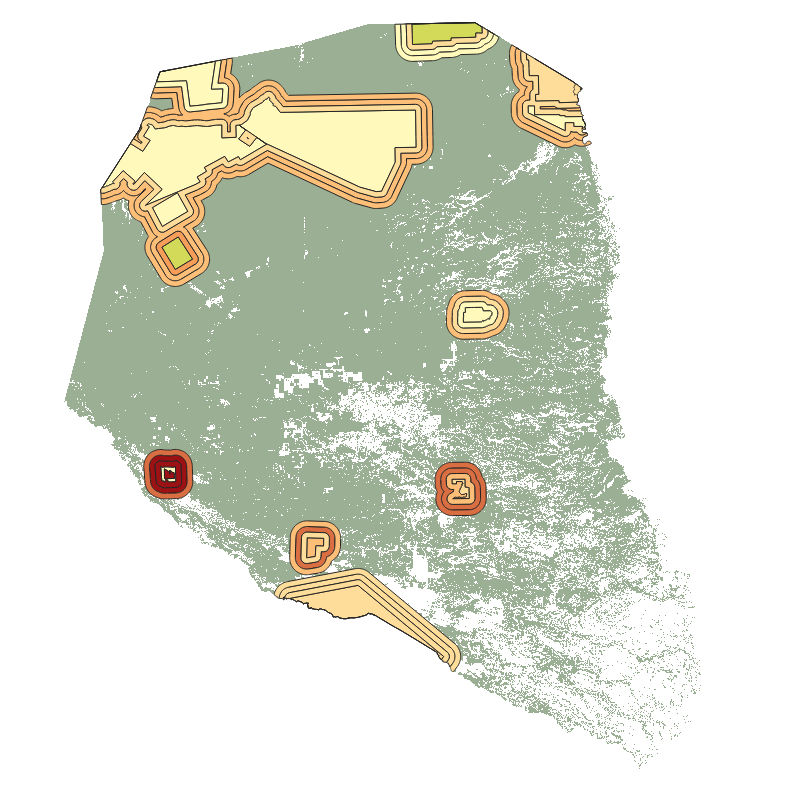
This product is a vector file of the protected areas of the Paraguayan Chaco. It contains information on the forest cover within each protected area and a 5, 10, and 15 km buffer zone around these areas, for the years 2000 until 2020. Hence, this product aggregates the information of 21 annual forest maps of the Paraguayan Chaco to the level of protected areas and provides the basis for further analysis as conducted in the following publication: https://doi.org/10.3390/f13010025