 My GeoNetwork catalogue
Norddeutschland
Provided by
Type of resources
Available actions
Topics
Keywords
Contact for the resource
Update frequencies
Service types
-
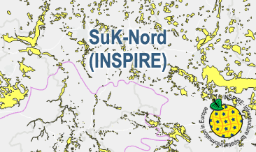
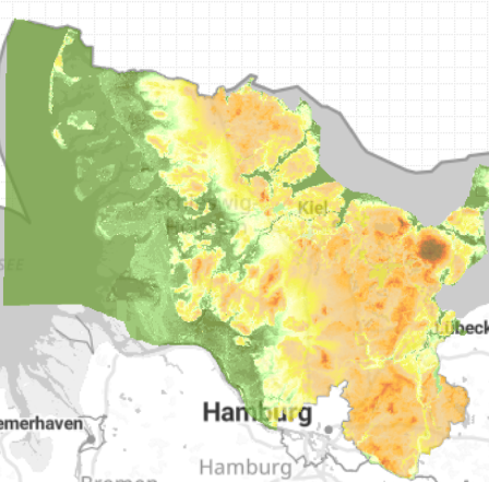
The WMS SuK-Nord (INSPIRE) shows the geological distribution of aggregates (sand and gravel) in Northern Germany, especially north of the southernmost maximum of the Scandinavian inland ice sheet (Saalian and Elsterian glaciation). According to the Data Specification on Mineral Resources (D2.8.III.21) and Geology (D2.8.II.4_v3.0) the map provides INSPIRE-compliant data. The WMS GK2000 Lagerstätten (INSPIRE) contains the following layers: MR.MineralOccurence.Commodity represents the distribution of sand and gravel. GE.GeomorphologicFeature shows the southernmost maximum of the Scandinavian inland ice sheet (Saalian and Elsterian glaciation).
-
The SuK-Nord (INSPIRE) shows the geological distribution of aggregates (sand and gravel) in Northern Germany, especially north of the southernmost maximum of the Scandinavian inland ice sheet (Saalian and Elsterian glaciation). According to the Data Specifications on Mineral Resources (D2.8.III.21) and Geology (D2.8.II.4_v3.0) the content of the map is stored in two INSPIRE-compliant GML files: SuK_Nord_EarthResource_polygon.gml contains the distribution of aggreagtes (sand and gravel) as polygons. SuK_Nord_GeomorphologicFeature.gml contains the southernmost maximum of the Scandinavian inland ice sheet (Saalian and Elsterian glaciation) as lines. The GML files together with a Readme.txt file are provided in ZIP format (SuK_Nord-INSPIRE.zip). The Readme.text file (German/English) contains detailed information on the GML files content. Data transformation was proceeded by using the INSPIRE Solution Pack for FME according to the INSPIRE requirements.
-
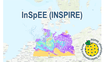
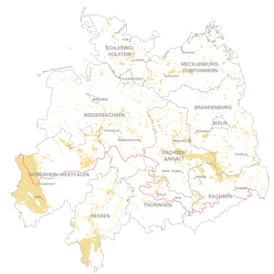
The WMS InSpEE (INSPIRE) provides information about the areal distribution of salt structures (salt domes and salt pillows) in Northern Germany. Contours of the salt structures can be displayed at horizontal cross-sections at four different depths up to a maximum depth of 2000 m below NN. The geodata have resulted from a BMWi-funded research project “InSpEE” running from the year 2012 to 2015. The acronym stands for "Information system salt structures: planning basis, selection criteria and estimation of the potential for the construction of salt caverns for the storage of renewable energies (hydrogen and compressed air)”. Taking into account the fact that this work was undertaken at a scale for providing an overview and not for investigation of single structures, the scale of display is limited to a minimum of 1:300.000. Additionally four horizontal cross-section maps display the stratigraphical situation at a given depth. In concurrence of maps at different depths areal bedding conditions can be determined, e.g. to generally assess and interpret the spread of different stratigraphic units. Clearly visible are extent and shape of the salt structures within their regional context at the different depths, with extent and boundary of the salt structures having been the main focus of the project. Four horizontal cross-section maps covering the whole onshore area of Northern Germany have been developed at a scale of 1:500.000. The maps cover the depths of -500, -1000, -1500, -2000 m below NN. The four depths are based on typical depth requirements of existing salt caverns in Northern Germany, mainly related to hydrocarbon storage. The shapes of the structures show rudimentary information of their geometry and their change with depths. In addition they form the starting point for rock mechanical calculations necessary for the planning and construction of salt caverns for storage as well as for assessing storage potentials. The maps can be used as a pre-selection tool for subsurface uses. It can also be used to assess coverage and extension of salt structures. Offshore areas were not treated within the project. All horizontal cross-section maps were adjusted with the respective state geological survey organisations. According to the Data Specification on Geology (D2.8.II.4_v3.0) the WMS InSpEE (INSPIRE) provides INSPIRE-compliant data. The WMS InSpEE (INSPIRE) contains two group layers: The first group layer “INSPIRE: Salt structures in Northern Germany“ comprises the layers GE.Geologic.Unit.Salt structure types, GE.GeologicUnit.Salt pillow remnants, GE.GeologicUnit.Structure-building salinar and GE.GeologicUnit.Structural outlines. The layer GE.GeologicUnit.Structural outlines contains according to the four depths four sublayers, e.g. GE.GeologiUnit.Structural outlines 500 m below NN. The second group layer „INSPIRE: Horizontal cross-section maps of Northern Germany“ comprises according to the four depths four layers, e.g. Horizontal cross-section map – 500 m below NN. This layer, in turns, contains two sublayers: GE.GeologicFault.Relevant fault traces and GE.GeologicUnit.Stratigraphic Units. Via the getFeatureInfo request the user obtains additional information on the different geometries. In case of the GE.Geologic.Unit.Salt structure types the user gets access to a data sheet with additional information and further reading in German for the respective salt structure via the getFeatureInfo request.
-
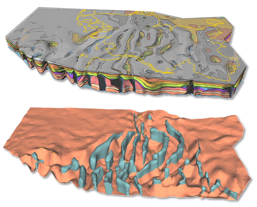
Der Geologische Dienst SH beschäftigte sich mit der 3D Modellierung und lithologischen Charakterisierung von potenziellen Reservoir- und Barrierekomplexen. Für verschiedene Strukturtypen wurden geologische 3D Modelle des Untergrundes in drei Teilgebieten konstruiert: (1) söhliche Lagerung, (2) Salzstockflanke, Synklinale, Transgressionsstruktur und (3) Antiklinalstruktur. Die Modelle bestehen aus lithostratigraphischen Grenzflächen zwischen der Geländeoberfläche und der Basis des Zechsteins und enthalten je nach Lage Störungsflächen und Hüllflächen von Salzdiapiren. Die Modelle des tieferen Untergrundes werden jeweils ergänzt durch oberflächennahe hydrostratigraphische Modelle. Die Modelle und weitere Parameter stellen realistische virtuelle Fallbeispiele dar, die auf andere Gebiete des NW-Deutschen Beckens übertragbar sind und weiterführenden Studien dienen. Die Daten sind Grundlage für Risikobetrachtungen und wichtiger Bestandteil von Studien zur Untersuchung von Monitoring-Methoden oder numerischen Prozess-Simulationen.
-
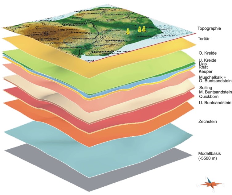
Für den festländischen Bereich des Landes Schleswig-Holstein wurde ein geologisches 3D-Modell des Nordwestdeutschen Beckens erstellt, das eine räumliche Abbildung der Daten des Geotektonischen Atlas von NW-Deutschland (Baldschuhn et al. 2001) darstellt und den geologischen Rahmen und die regionale Grundlage für diverse nachfolgende Studien bildet. Das Modellgebiet umfasst den gesamten festländischen Bereich des Landes Schleswig-Holstein und den östlichen Teil des Deutschen Nordseesektors. Die E-W Ausdehnung beträgt ca. 280 km und die N-S Ausdehnung ca. 160 km (Gesamtfläche 38.500 km²). Vertikal erstreckt sich das Modell von der Geländeoberfläche (max. 168 m ü. NHN) bis zur der Basis des Zechsteins (max. etwa 10,5 km u. NHN) und besteht aus 14 Basisflächen lithostratigraphischer Einheiten, vertikalen Störungsflächen (Störungsspuren) in verschiedenen Tiefenniveaus und Grenzflächen der Salzdiapire.
-
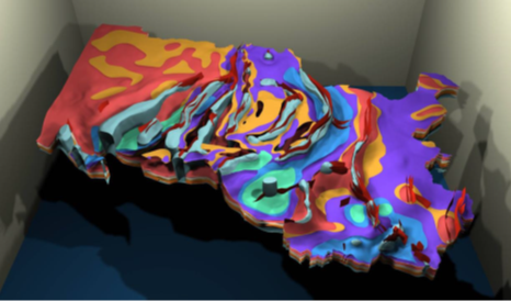
Der Geologische Dienst SH beschäftigt sich mit der Erkundung des tieferen Untergrundes. Zur Landesaufnahme und für Potenzialstudien wurde ein landesweites geologisches 3D-Modell entwickelt, das die Tiefe und Verbreitung von relevanten Formationen des Norddeutschen Beckens zeigt. Die Arbeiten erfolgten im Rahmen des Projektes Potenziale des unterirdischen Speicher- und Wirtschaftsraumes im Norddeutschen Becken - TUNB, das die Bundesanstalt für Geowissenschaften und Rohstoffe in Zusammenarbeit mit den Norddeutschen Geologischen Diensten durchführte. Das Modell besteht aus 17 Basisflächen lithostratigraphischer Horizonte zwischen der Basis des Zechsteins und der Geländeroberfläche, Hüllflächen von Salzdiapiren und Störungsflächen. Die Eingangsdaten der Modellierung sind Daten des Geotektonischen Atlas von NW-Deutschlands (Baldschuhn et al. 2001), Bohrungen und seismische Profile der KW-Industrie sowie Bohrungen des Landesarchivs SH.
-
Bei dem Datensatz "Geländeoberkante / DGM" handelt es sich um einen auf die Rasterweite von 100m resampelten Auszug aus dem Digitalen Geländemodell 200 (DGM200) des Bundesamt für Kartographie und Geodäsie (BKG). Das resampeln der Rastwerweite auf 100m dient nur dem Zweck, die Höhendaten an die Modelflächen des geologischen 3D Landesmodell von Schleswig-Holstein anzupassen und so gemeinsame Auswertungen wie z.B. die Berechnung von Schichtmächtigkeiten zu erleichtern. Die Genauigkeit der Höhendaten wurde durch nicht erhöht. Die Verwendung dieses modifizierten Datensatz wird ausschließlich im Zusammenhang mit dem Geologischen 3D Modell empfohlen, für alle anderen Auswertungen und Fragestellungen sollten die Originaldaten des BKG verwendet werden. Herkunftsvermerk: © GeoBasis-DE / BKG 2020
-
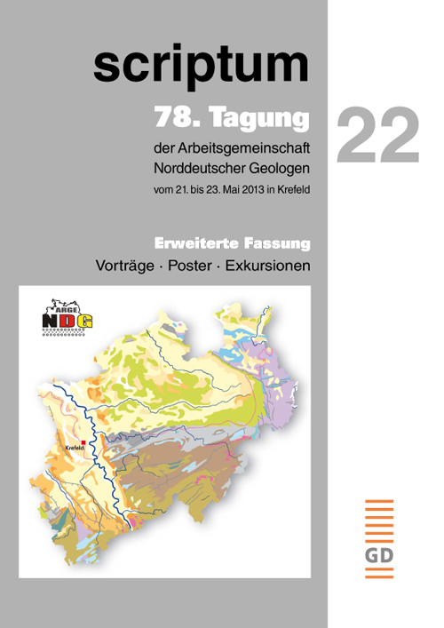
Das Heft Nr. 22 aus der Serie „scriptum – Arbeitsergebnisse aus dem Geologischen Dienst Nordrhein-Westfalen“ wurde anlässlich der 78. Tagung der Arbeitsgemeinschaft Norddeutscher Geologen, die vom 21. bis 23. Mai 2013 in Krefeld stattfand, herausgegeben. Der ausführliche Tagungsband beinhaltet Textfassungen sämtlicher Vorträge, Poster und Exkursionsbeiträge, die auf der Veranstaltung präsentiert wurden. [2014. 148 S., 126 Abb., 2 Tab.; ISSN 1430-5267]
-
Geological distribution of aggregates (sand and gravel) in northern Germany, especially north of the southernmost maximum of the Scandinavian inland ice sheet (Saalian and Elsterian glaciation).
-
Geological distribution of aggregates (sand and gravel) in Northern Germany, especially north of the southernmost maximum of the Scandinavian inland ice sheet (Saalian and Elsterian glaciation).