 My GeoNetwork catalogue
Meeresregionen
Provided by
Type of resources
Available actions
Topics
Keywords
Contact for the resource
Update frequencies
Service types
-

The digital terrain model of waterways for the estuary of river Elbe (DGM-W 2022) in high resolution based on airborne laser scanning and echo sounder data is produced and published by the German Federal Waterways and Shipping Administration (Wasserstraßen- und Schifffahrtsverwaltung des Bundes, WSV). The data includes the Outer Elbe and the tidally influenced tributaries and branches of the Elbe estuary upstream to the town Geesthacht. The data is available in a raster resolution of 1 meter. Coordinate reference system: EPSG 25852, ETRS89 / UTM Zone 32N Elevation reference system: DHHN2016, NHN Survey methods: Airborne laser scanning (ALS) 02.04.2022 - 19.04.2022 Multibeam echo sounder, single beam echo sounder 09.02.2017 - 09.04.2023 It is strongly recommended to use the data source map for quality assessment.
-

The digital terrain model of waterways for the estuary of river Elbe (DGM-W 2016) in high resolution based on airborne laser scanning and echo sounder data is produced and published by the German Federal Waterways and Shipping Administration (Wasserstraßen- und Schifffahrtsverwaltung des Bundes, WSV). The data includes the Outer Elbe and the tidally influenced side branches of the Elbe estuary upstream to the town Geesthacht. The data is available in a raster resolution of 1 meter. Coordinate reference system: EPSG 25852, ETRS89 / UTM Zone 32N Elevation reference system: DHHN92, NHN Survey methods: Airborne laser scanning (ALS) 02. - 04.2016 Multibeam echo sounder, single beam echo sounder 2015-2017 It is strongly recommended to use the data source map for quality assessment.
-
Wasserkörper der Küstengewässer gemäß WRRL
-

INSPIRE theme Sea Regions.
-

INSPIRE theme Sea Regions.
-
German Marine reporting units (marine regions and sub-regions including assessment units) reported under Directive 2008/56/EC of the European Parliament and of the Council of 17 June 2008 establishing a framework for community action in the field of marine environmental policy (Marine Strategy Framework Directive).
-
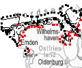
(1) Die Grenzen des Nationalparks ergeben sich aus dem beigefügten Kartenwerk, das Bestandteil dieses Gesetzes ist: 1. Digitale Topografische Karte (DTK) im Maßstab 1 : 100 000 (Anlage 2), 2. verkleinerte Amtliche Karte 1 : 5 000 (AK5) im Maßstab 1 : 10 000 (Anlage 3). Die geografischen Koordinaten der Anlagen 2 und 3 sind im geodätischen Referenzsystem WGS 84 sowie als projizierte Koordinaten im Europäischen Terrestrischen Referenzsystem 1989 (ETRS 89) mit der Universalen Transversalen Mercator-Abbildung bezogen auf die Zone 32 N (UTM 32N) dargestellt (Anlage 4); Gleiches gilt für die geografischen Koordinaten in den Anlagen 1 und 6. 3Die vom Nationalparkgebiet umschlossenen Flächen, die keiner der in § 5 Abs. 1 genannten Zonen zugeordnet sind, sind nicht Bestandteil des Nationalparks. (2) Für die Abgrenzung des Nationalparks ist seewärts und in den Mündungstrichtern von Ems, Weser und Elbe sowie in der Jade die Verbindungslinie zwischen den in der Anlage 2 eingetragenen, durch geografische Koordinaten bestimmten Punkten maßgeblich, soweit nicht in den Mündungstrichtern von Elbe und Weser zwischen zwei Koordinatenpunkten die niedersächsische Landesgrenze oder ein Leitwerk verläuft; in diesem Fall wird die Grenze durch die Landesgrenze oder den stromabgewandten Fuß des Leitwerks gebildet. (3) Die landwärtigen Grenzen des Nationalparks sind in den Anlagen 2 und 3 durch Punktlinien dargestellt. 2Auf den in den Anlagen 2 und 3 durch eine unterbrochene Punktlinie gekennzeichneten Grenzabschnitten ist die mittlere Hochwasserlinie maßgeblich. 3Auf den in den Anlagen 2 und 3 durch eine rote Punktlinie gekennzeichneten Abschnitten ist die seeseitige Grenze des Deiches (§ 4 Abs. 3 des Niedersächsischen Deichgesetzes) maßgeblich. 4Für den Verlauf der in den Anlagen 2 und 3 durch eine schwarze nicht unterbrochene Punktlinie gekennzeichneten Grenzen ist die Karte maßgeblich. 5Soweit gemäß Satz 3 die seeseitige Grenze des Deiches die Grenze des Nationalparks bildet, verändert sich diese Grenze mit den zugelassenen Veränderungen des vorhandenen Deiches. 6In diesem Fall macht das für den Naturschutz zuständige Ministerium soweit erforderlich die Anlagen 2 und 3 neu bekannt. Der Datensatz liefert die Grenzen als Vektoren. Die GIS-Daten können unter der Rubrik "Verweise" herunter geladen werden.
-
German Marine reporting units (marine regions and sub-regions including assessment units) reported under Directive 2008/56/EC of the European Parliament and of the Council of 17 June 2008 establishing a framework for community action in the field of marine environmental policy (Marine Strategy Framework Directive).
-
INSPIRE theme Sea Regions.
-
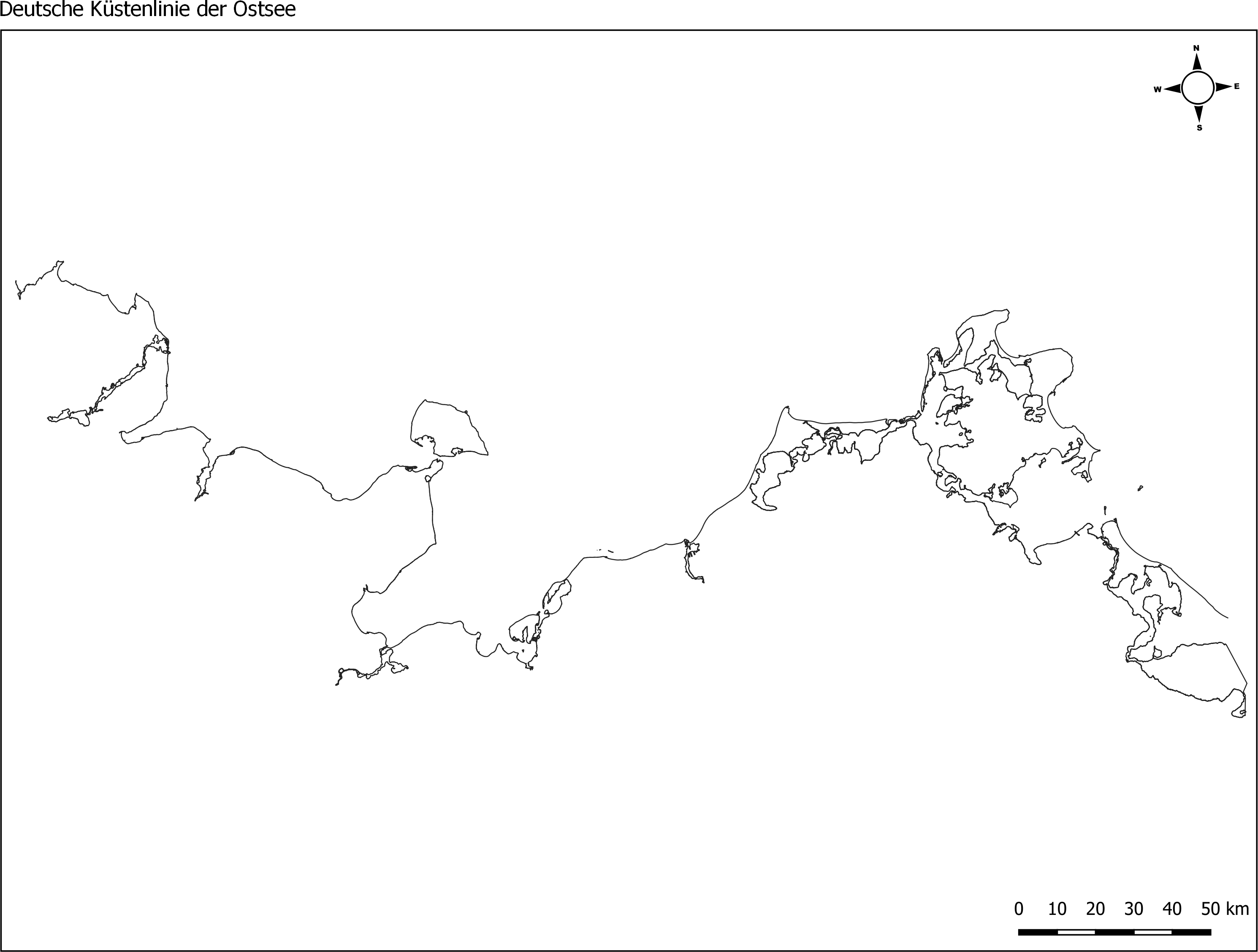
Die Küstenlinie der deutschen Ostseeküste, erstellt vom Landesamt für Umwelt (LfU) von Schleswig Holstein. Grundlage dafür waren MSRL- und WRRL-Shapefiles der Küsten- Übergangsgewässer. Der Dienst stellt Shapefiles der Küstenlinien für die Nordsee (ANS-DE) und die Ostsee (BAL-DE) aus den abgestimmten und an die EU gemeldeten Berichtsgeometrien für die gesamte deutsche Küste bereit. Hierfür wurden Shapes der MSRL und der WRRL (Küsten- und Übergangsgewässer) genutzt. Die Daten wurden im Dezember 2017 (Ostsee) / bzw. im Januar 2018 (Nordsee) erstellt.