 www.geodatenkatalog.de (S3L)
Keyword
Lithologie
75 record(s)
Provided by
Type of resources
Available actions
Topics
Keywords
Contact for the resource
Update frequencies
Service types
-
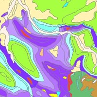
The “Geological Map of Germany 1:1,000,000 OneGeology-Europe (GK1000-1GE)” shows Germany’s surface geology: All geological units are described by their age (stratigraphy) and composition (lithology). The geological units and terms used in this map were semantically harmonized within the OneGeology-Europe project and have been - in a number of regions - geometrically and semantically made consistent with the neighbouring OneGeology-Europe participants.
-
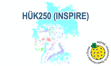
The HÜK250 (INSPIRE) describes the hydrogeological characteristics of the upper continuous aquifers in Germany at a scale of 1:250,000. According to the Data Specification on Geology (D2.8.II.4_v3.0) the map provides INSPIRE-compliant data. The hydrogeologic units are represented graphically – mostly according to the INSPIRE portrayal rules – by GE.Aquifer.MediaType, GE.Aquifer.HydrogeochemicalRockType, GE.Aquifer.permeabilityCoefficient (BGR colours), GE.Aquitard.approximatePermeabilityCoefficient (BGR colours), GE.Aquitard and GE.Aquiclude.ConstitutionOfAquiclude. The geologic units are represented graphically – according to the INSPIRE portrayal rules – by GE.GeologicUnit.AgeOfRocks and GE.GeologicUnit.Lithology. The HÜK250 is a joint project of the SGD under the leadership of the BGR.
-
The HÜK250 (INSPIRE) describes the hydrogeological characteristics of the upper continuous aquifers in Germany at a scale of 1:250,000. According to the Data Specification on Geology (D2.8.II.4_v3.0) the content of the map is stored in a INSPIRE-compliant GML file: HUEK250.gml. The GML file together with a Readme.txt file is provided in ZIP format. The Readme.txt file (German/English) contains detailed information on the GML file content. Data transformation was proceeded by using the INSPIRE Solution Pack for FME according to the INSPIRE requirements.
-
Der Kartendienst (WFS-Gruppe) stellt ausgewählte Geodaten aus dem Bereich Geologiedes Saarlandes dar.:Geologische Karte 1: 25.000 Lithologie
-
Der Kartendienst (WFS-Gruppe) stellt ausgewählte Geodaten aus dem Bereich Geologiedes Saarlandes dar.:Geologische Karte 1: 25.000 Lithologie
-
Der Band Nr. 7 aus der Publikationsreihe „Fortschritte in der Geologie von Rheinland und Westfalen“ dokumentiert den damaligen Kenntnisstand in der Erforschung der westfälischen Kreide. Die schrittweise Überflutung der Rheinischen Masse, die terrestrische und tektonische Verzahnung mit ihr sowie das Alternieren von Sand- und Pelitfazies geben der Kreide Westfalens ein eigenes Gepräge. [1964. 748 S., 166 Abb., 35 Tab., 77 Taf.; ISBN 978-3-86029-826-8]
-
The International Map of the Iron Ore Deposits of Europe 1 : 2.500.000 completed in 1977 is published by the Federal Institute for Geosciences and Natural Resources (BGR) About 70 geoscientists from Europe, North Africa, Eastern Europe and Middle East collaborated with the Editorial Staff in the compilation of the map and the Editorial Notes. More than 800 iron ore deposits are represented on the map which covers 42 countries in 16 map sheets. All deposits of importance, either actually being mined or recently abandoned, are included. Deposits of only genetic or historic interest are also shown. Detailed information on the Map of Iron Ore Deposits of Europe - to its structure, arrangement and background data - can be found in the Explanatory Notes to the Map
-
Beschreibung des INSPIRE Download Service (predefined Atom): Die geologische Karte stellt die an der Erdoberfläche anstehenden Gesteine hinsichtlich ihrer Verbreitung, Beschaffenheit, Genese, Lagerungsverhältnisse und Altersbeziehungen dar. In Profilschnitten wird die Fortsetzung der Schichten in die Tiefe dargestellt. Die GK 25 stellt eine Neubearbeitung dar, in der die Ergebnisse der älteren Geologischen Karte von Preußen und Bayern, sowie die Resultate von aktuellen Kartierungen kompiliert werden. In dem Datensatz „Lithostratigraphie“ wird die Verbreitung unterschiedlich alter Gesteinseinheiten dargestellt. Die Felder der Attributtabelle erklären sich selbst und beinhalten „Stratigraphie“, „stratigraphische Kurzbezeichnung“ und „Petrographie“, sowie die in der gedruckten Karte verwendeten stratigraphischen Bezeichnungen und Kürzel. Geologische Karte 1:25 000 Lithologie ist in Bearbeitung und noch nicht flächendeckend vorhanden. Die Daten wurden ins GDZ importiert und dort als Werte der Multifeatureklasse Wert Geologie modelliert, die sich zusammensetzt aus der flächenhaften Featureklasse GDZ2010.A_ghgeowt (enthält die Gk100, die GK25, und die Rohstoffflächen) der linienhaften Featureklasse GDZ2010.L_ghgeowt (enthält die GK15_Bänke, die GK25_Tektonik und die GK100_Tektonik) , der punkthaften Featureklasse GDZ2010.P_ghgeowt (enthält die Geotope) und der dazugehörigen Businessklasse GDZ2010.ghgeowt. Anschließend wurden die Werte für die Objektart = gk25 und Parameter Langtext = Llithologie exportiert in die Filegeodatabase GDZ_GDB. Folgende Attribute sind relevant: STRAT_KZ:Kennziffer für die Stratographie; FORMATION; SUPERGRUPPE. SUBGRUPPE GRUPPE STRAT_KURZ (Kürzel für die Stratigraphie) - Der/die Link(s) für das Herunterladen der Datensätze wird/werden dynamisch aus GetFeature Anfragen an einen WFS 1.1.0+ generiert
-
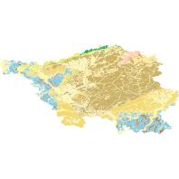
Dieser Dienst stellt für das INSPIRE-Thema Geologie aus der geologischen Karte im Maßstab 1:100000 umgesetzte Daten, des Landesamt für Umwelt- und Arbeitsschutz bereit.:Dieser Layer visualisiert die räumlichen MappedFeature-Objekte der saarländischen Geologischen Daten (GK100), deren Spezifikationseigenschaft vom Typ GeologicUnit ist. Die Datengrundlage erfüllt die INSPIRE Datenspezifikation.