 My GeoNetwork catalogue
TanDEM-X
Provided by
Type of resources
Available actions
Topics
Keywords
Contact for the resource
Update frequencies
Service types
-

The global TanDEM-X High-Resolution Coastline Product was developed by the German Remote Sensing Data Center (DFD) at the German Aerospace Center (DLR) as part of the TanDEM-X Mission and the HydroSHEDS v2.0 project. It is a global vector dataset that outlines the boundary between terrestrial and marine environments at a resolution of 10 meters. Between 2010 and 2015, the TanDEM-X mission acquired a complete coverage of the Earth's landmass, resulting in a global digital elevation model (DEM). Since the TanDEM-X coastline is derived from the TanDEM-X dataset, it provides an optimal fit for improving the DEM. Additionally, the TanDEM-X coastline is a key component in the derivation of hydrographic data within the HydroSHEDS v2.0 project, where it defines the outer boundary of watersheds and river networks. To meet hydrological requirements and to ensure global consistency, the TanDEM-X coastline was extracted automatically in a first step and subsequently manually verified and refined. Since the coastline is a mapping feature located in the coastal zone, its position is a function of the source data, the method used to identify the coastline, the time of acquisition, and the purpose of mapping.
-

The TanDEM-X Forest/Non-Forest Map is a project developed by the Microwaves and Radar Institute at the German Aerospace Center (DLR), within the activities of the TanDEM-X mission. The goal is the derivation of a global forest/non-forest classification mosaic from TanDEM-X bistatic interferometric synthetic aperture radar (InSAR) data, acquired for the generation of the global digital elevation model (DEM) in Stripmap single polarization (HH) mode. The TanDEM-X Forest/Non-Forest Map (FNF) has been generated by processing and mosaicking more than 500,000 TanDEM-X bistatic images acquired from 2011 until 2015. The map has a spatial resolution of 50 x 50m. Forested and non-forested areas are depicted in green and white, respectively. Water bodies are depicted in blue and black is used for identifying urban areas and invalid pixels. For more information, please visit: https://www.dlr.de/hr/en/desktopdefault.aspx/tabid-12538/21873_read-50027/
-
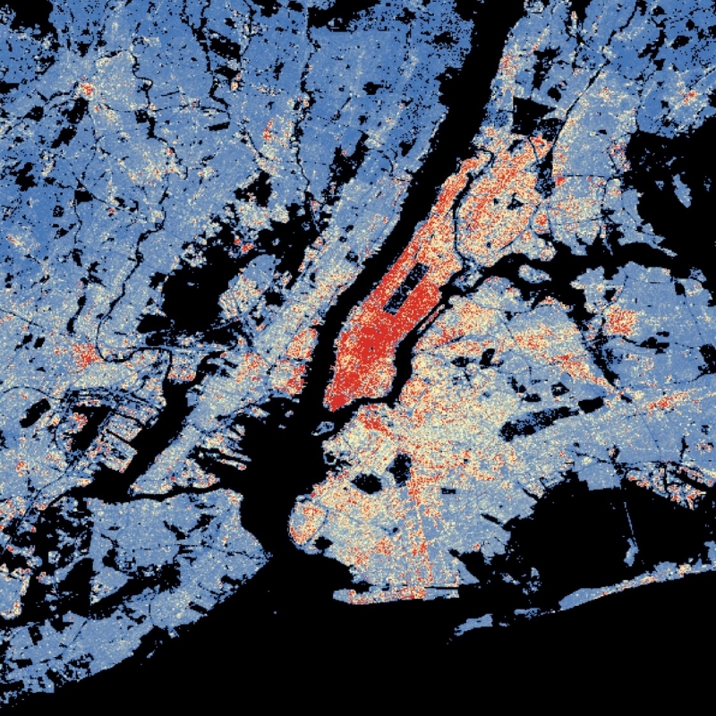
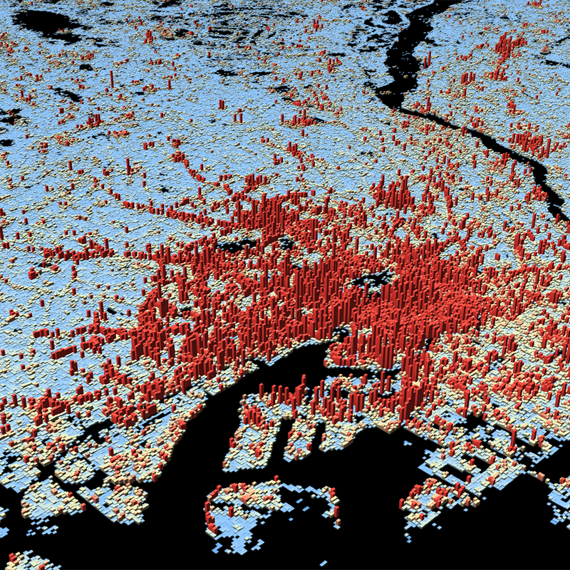
The World Settlement Footprint (WSF) 3D provides detailed quantification of the average height, total volume, total area and the fraction of buildings at 90 m resolution at a global scale. It is generated using a modified version of the World Settlement Footprint human settlements mask derived from Sentinel-1 and Sentinel-2 satellite imagery in combination with digital elevation data and radar imagery collected by the TanDEM-X mission. The framework includes three basic workflows: i) the estimation of the mean building height based on an analysis of height differences along potential building edges, ii) the determination of building fraction and total building area within each 90 m cell, and iii) the combination of the height information and building area in order to determine the average height and total built-up volume at 90 m gridding. In addition, global height information on skyscrapers and high-rise buildings provided by the Emporis database is integrated into the processing framework, to improve the WSF 3D Building Height and subsequently the Building Volume Layer. A comprehensive validation campaign has been performed to assess the accuracy of the dataset quantitatively by using VHR 3D building models from 19 globally distributed regions (~86,000 km2) as reference data. The WSF 3D standard layers are provided in the format of Lempel-Ziv-Welch (LZW)-compressed GeoTiff files, with each file - or image tile - covering an area of 1 x 1 ° geographical lat/lon at a geometric resolution of 2.8 arcsec (~ 90 m at the equator). Following the system established by the TDX-DEM mission, the latitude resolution is decreased in multiple steps when moving towards the poles to compensate for the reduced circumference of the Earth.
-
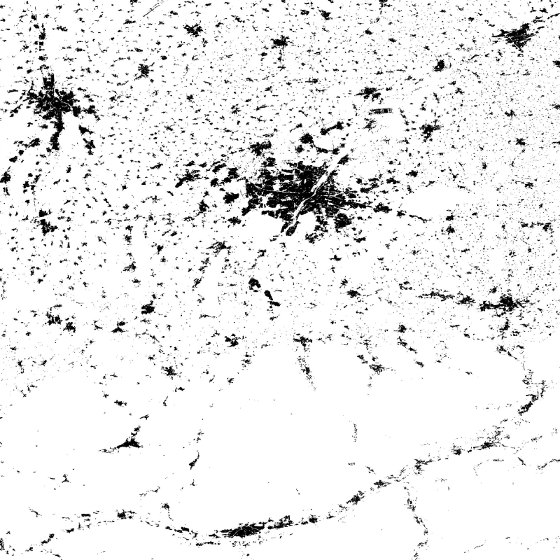
The Global Urban Footprint® (GUF®) dataset is based on the radar (SAR) satellite imagery of the German satellites TerraSAR-X and TanDEM-X. By creating the GUF database, scientists at the German Remote Sensing Data Center (DFD) of the German Aerospace Center (DLR) have succeeded in using a newly developed method to generate a global raster map of the world’s built-up pattern in a so far unprecedented spatial resolution of about 12m per raster cell. Using a fully automated processing system, a global coverage of more than 180,000 very high resolution SAR images (3m ground resolution) has been analyzed acquired between 2010 and 2013. Thereby, the backscatter amplitudes of the SAR data have been used in combination with derived textural information to delineate human settlements in a highly automated, complex decision-making process. The evaluation procedure based mainly on radar signals detects the characteristic vertical structures of human habitations – primarily built-up areas. In addition, auxiliary data such as digital elevation models have been included to improve the classification process. In total, over 20 million datasets were processed with a combined volume of about 320 terabytes. The final global maps show three coverage categories (e. g. in a B/W representation): Built-up areas (vertical structures only) in black, non-built-up surfaces in white, areas of no coverage by TSX/TDX satellites (NoData) as most parts of the oceans in grey. The final product has been optimized for fast online access through web services by merging the 5 x 5 degree GUF tiles into a single global mosaic. Furthermore reduced resolution overviews have been generated with an interpolation algorithm, that computes the average value of all contribution pixels. The global mosaic uses PackBits compression to reduce file size. (GUF® and Global Urban Footprint® are protected as trademarks.)
-
This dataset is a derivative of the WSF3D raster dataset tailored for the web. As a tiled vector dataset, it enables dynamic client-side visualization of the WSF3D metrics
-
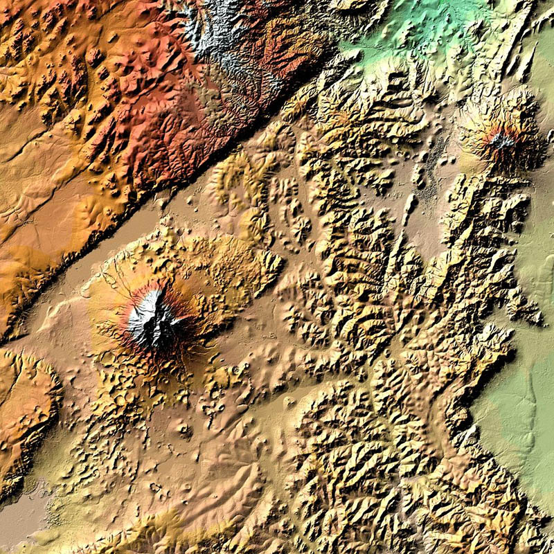
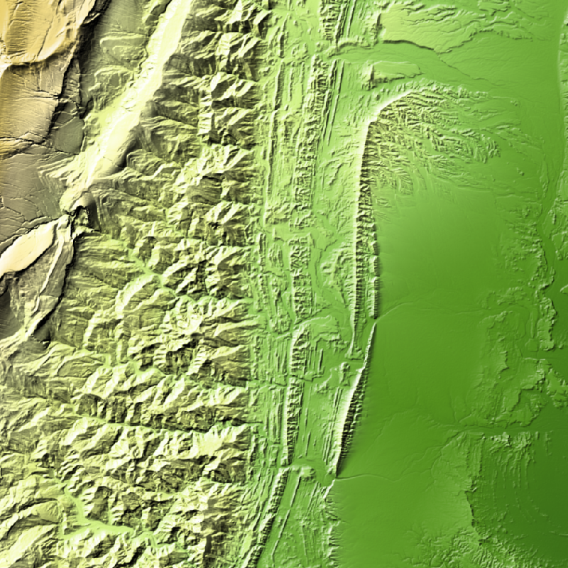
TanDEM-X (TerraSAR-X add-on for Digital Elevation Measurements) is an Earth observation radar mission that consists of a SAR interferometer built by two almost identical satellites flying in close formation. With a typical separation between the satellites of 120m to 500m a global Digital Elevation Model (DEM) has been generated. The main objective of the TanDEM-X mission is to create a precise 3D map of the Earth's land surfaces that is homogeneous in quality and unprecedented in accuracy. The data acquisition was completed in 2015 and production of the global DEM was completed in September 2016. The absolute height error is with about 1m an order of magnitude below the 10m requirement. The TanDEM-X 12m DEM is the nominal product variant of the global Digital Elevation Model (DEM) acquired in the frame of the German TanDEM-X mission between 2010 and 2015 with a spatial resolution of 0.4 arcseconds (12m at the equator). It covers all Earth’s landmasses from pole to pole. For more information concerning the TanDEM-X mission, the reader is referred to: https://www.dlr.de/dlr/en/desktopdefault.aspx/tabid-10378/
-
TanDEM-X (TerraSAR-X add-on for Digital Elevation Measurements) is an Earth observation radar mission that consists of a SAR interferometer built by two almost identical satellites flying in close formation. With a typical separation between the satellites of 120 m to 500 m a global Digital Elevation Model (DEM) has been generated. The TanDEM-X 30m EDEM is a product variant of the global Digital Elevation Model (DEM) acquired in the frame of the German TanDEM-X mission between 2010 and 2014, and has a reduced pixel spacing of 1 arcseconds (arsec), which corresponds to 30m at the equator. An automated edition was developed by the Microwaves and Radar Institute at the German Aerospace Center (DLR) to have a full and clean coverage of all Earth’s landmasses from pole to pole.
-

The World Settlement Footprint (WSF) 3D provides detailed quantification of the average height, total volume, total area and the fraction of buildings at 90 m resolution at a global scale. It is generated using a modified version of the World Settlement Footprint human settlements mask derived from Sentinel-1 and Sentinel-2 satellite imagery in combination with digital elevation data and radar imagery collected by the TanDEM-X mission. The framework includes three basic workflows: i) the estimation of the mean building height based on an analysis of height differences along potential building edges, ii) the determination of building fraction and total building area within each 90 m cell, and iii) the combination of the height information and building area in order to determine the average height and total built-up volume at 90 m gridding. In addition, global height information on skyscrapers and high-rise buildings provided by the Emporis database is integrated into the processing framework, to improve the WSF 3D Building Height and subsequently the Building Volume Layer. A comprehensive validation campaign has been performed to assess the accuracy of the dataset quantitatively by using VHR 3D building models from 19 globally distributed regions (~86,000 km2) as reference data. The WSF 3D standard layers are provided in the format of Lempel-Ziv-Welch (LZW)-compressed GeoTiff files, with each file - or image tile - covering an area of 1 x 1 ° geographical lat/lon at a geometric resolution of 2.8 arcsec (~ 90 m at the equator). Following the system established by the TDX-DEM mission, the latitude resolution is decreased in multiple steps when moving towards the poles to compensate for the reduced circumference of the Earth.
-
This WMS provides access to different elevation products provided by the Earth Observation Center (EOC) of the DLR.