 My GeoNetwork catalogue
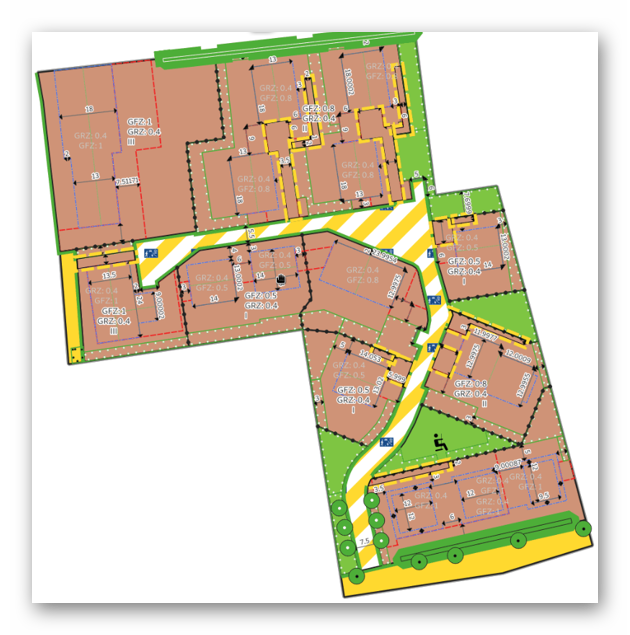
land use
Provided by
Type of resources
Available actions
Topics
Keywords
Contact for the resource
Update frequencies
Service types
-
The LANDMATE PFT dataset provides a land cover map for North America for the year 2015 in 0.1° (~10 km). The dataset is based on land cover data of the ESA Climate Change Initiative (ESA-CCI, native resolution: 300 m) which is translated into 16 plant functional types (PFTs) and non-vegetated classes employing the cross-walking procedure introduced by Reinhart et al. (2022), which was modified for North America. The translation is done under consideration of the Holdridge Life Zones (HLZs), a system that classifies land areas based on bioclimatic properties. Through the HLZs, regional distinction of the individual PFT distribution can be achieved. The land cover information is given as fractions per grid cell where each fraction represents the area covered by the respective land cover within each grid cell (0-1). The LANDMATE PFT dataset (0.1° resolution) serves as base map for the historical and future land use and land cover dataset LUCAS LUC developed by Hoffmann et al. (2023). Plant functional types and non-vegetative classes: 1 - Tropical broadleaf evergreen trees 2 - Tropical deciduous trees 3 - Temperate broadleaf evergreen trees 4 - Temperate deciduous trees 5 - Evergreen coniferous trees 6 - Deciduous coniferous trees 7 - Coniferous shrubs 8 - Deciduous shrubs 9 - C3 grass 10 - C4 grass 11 - Tundra 12 - Swamp 13 - Non-irrigated crops 14 - Irrigated crops 15 - Urban 16 - Bare Version 1.0 of this dataset does not exist. Here we use Version 1.1 in the name for consistency reasons.
-

-

-

-

-
This dataset comprises MPI-ESM-1.2 output from WP1 scenarios of the LAMACLIMA project. In LAMACLIMA, we analyzed the role of land use for global mitigation and local adaptation strategies and its impacts on local and remote climate and the carbon cycle across Earth system models (ESMs). Work package 1 (WP1) simulations of LAMACLIMA project consist of land-use-induced climate and carbon change sensitivity experiments. The scenarios do not represent realistic or policy relevant realizations. Instead, they simulate globally idealized constant land-use changes under present-day environmental conditions. This approach offers two main advantages. First, large-scale land-use simulations enhance the signal-to-noise ratio, enabling a clearer evaluation of the upper bound of potential impacts, despite their idealized nature. Second, applying global rather than regionally constrained changes permits a more comprehensive and comparative assessment of land-use impacts worldwide. The WP1 simulations consist of the five scenarios (CTL, CROP, FRST, IRR, and HARV); for example, “MPI-ESM-1.2 output of LAMACLIMA work package 1 (WP1): idealized constant global re-/afforestation (FRST) under present-day environmental conditions”. We use the MPI-ESM-1.2-LR climate model, which includes the following model components: - Atmosphere model: ECHAM6.3 (Triangular truncation: T63, approx. 1.88°×1.88°, 200 km; 47 vertical levels) - Land model: JSBACH3.2 (Triangular truncation: T63, approx. 1.88°×1.88°, 200 km) - Ocean dynamical model: MPIOM1.6 (GR1.5, approx. 150 km; 40 vertical levels) - Ocean biogeochemistry model: HAMOCC6 - Coupler: OASIS3-MCT We ran the land model JSBACH3.2 with the following options: - use_dynveg = false - use_disturbance = true - lcc_forcing_type = transitions - lcc_scheme = 2 The MPI-ESM output from the different model components was post-processed using the Climate Model Output Rewriter (CMOR) in accordance with CMIP data conventions. For further details, see: Mauritsen et al., 2019: https://doi.org/10.1029/2018MS001400
-
-
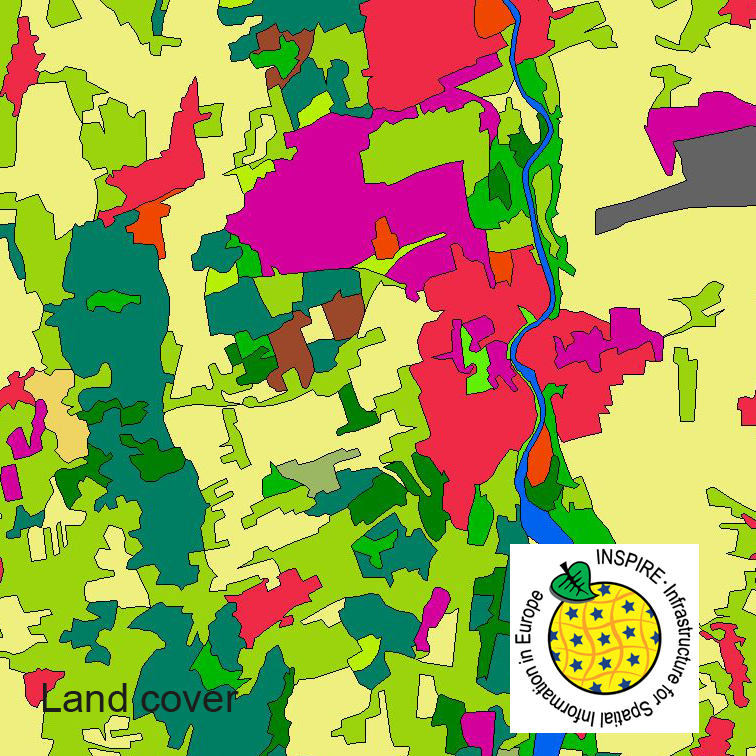
This serie clc5 describes the landscape according to the CORINE Land Cover (CLC) nomenclature. These classes contain mainly information about landcover mixed with some aspects of landuse. CLC5 is based on the more detailed German landcover model (LBM-DE) which uses separate classes for landcover and landuse and attribute-information about percentage of vegetation and sealing. The mimimum unit for an object is 1 ha. For the CLC5 dataset landcover and landuse classes are combined to unique CLC-classes taking into account the percentage of vegetation and sealing, followed by a generalisation process.
-
This dataset clc5 (2018) describes the landscape according to the CORINE Land Cover (CLC) nomenclature. These classes contain mainly information about landcover mixed with some aspects of landuse. CLC5 is based on the more detailed German landcover model from 2018 (LBM-DE2018) which uses separate classes for landcover and landuse and attribute-information about percentage of vegetation and sealing. The mimimum unit for an object is 1 ha. For the CLC5 dataset landcover and landuse classes are combined to unique CLC-classes taking into account the percentage of vegetation and sealing , followed by a generalisation process.
-
This dataset clc5 (2012) describes the landscape according to the CORINE Land Cover (CLC) nomenclature. These classes contain mainly information about landcover mixed with some aspects of landuse. CLC5 is based on the more detailed German landcover model from 2012 (LBM-DE2012) which uses separate classes for landcover and landuse and attribute-information about percentage of vegetation and sealing. The mimimum unit for an object is 1 ha. For the CLC5 dataset landcover and landuse classes are combined to unique CLC-classes taking into account the percentage of vegetation and sealing , followed by a generalisation process.