 My GeoNetwork catalogue
Landnutzung
Provided by
Type of resources
Available actions
Topics
Keywords
Contact for the resource
Update frequencies
Service types
-
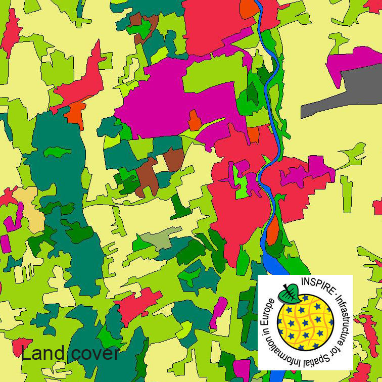
This serie clc5 describes the landscape according to the CORINE Land Cover (CLC) nomenclature. These classes contain mainly information about landcover mixed with some aspects of landuse. CLC5 is based on the more detailed German landcover model (LBM-DE) which uses separate classes for landcover and landuse and attribute-information about percentage of vegetation and sealing. The mimimum unit for an object is 1 ha. For the CLC5 dataset landcover and landuse classes are combined to unique CLC-classes taking into account the percentage of vegetation and sealing, followed by a generalisation process.
-
This dataset clc5 (2018) describes the landscape according to the CORINE Land Cover (CLC) nomenclature. These classes contain mainly information about landcover mixed with some aspects of landuse. CLC5 is based on the more detailed German landcover model from 2018 (LBM-DE2018) which uses separate classes for landcover and landuse and attribute-information about percentage of vegetation and sealing. The mimimum unit for an object is 1 ha. For the CLC5 dataset landcover and landuse classes are combined to unique CLC-classes taking into account the percentage of vegetation and sealing , followed by a generalisation process.
-
This dataset clc5 (2012) describes the landscape according to the CORINE Land Cover (CLC) nomenclature. These classes contain mainly information about landcover mixed with some aspects of landuse. CLC5 is based on the more detailed German landcover model from 2012 (LBM-DE2012) which uses separate classes for landcover and landuse and attribute-information about percentage of vegetation and sealing. The mimimum unit for an object is 1 ha. For the CLC5 dataset landcover and landuse classes are combined to unique CLC-classes taking into account the percentage of vegetation and sealing , followed by a generalisation process.
-
This dataset clc5 (2015) describes the landscape according to the CORINE Land Cover (CLC) nomenclature. These classes contain mainly information about landcover mixed with some aspects of landuse. CLC5 is based on the more detailed German landcover model from 2015 (LBM-DE2015) which uses separate classes for landcover and landuse and attribute-information about percentage of vegetation and sealing. The mimimum unit for an object is 1 ha. For the CLC5 dataset landcover and landuse classes are combined to unique CLC-classes taking into account the percentage of vegetation and sealing , followed by a generalisation process.
-
Stadtgrundkarte Brandenburg an der Havel, einfache farbige Ausprägung.
-
Stadtgrundkarte Brandenburg an der Havel, einfache farbige Ausprägung.
-
Gesamtinhalt der Stadtgrundkarte in sw Ausprägung
-
Die Daten bestehen aus dem Geltungsbereich und den inhaltlich generalisierten zeichnerischen Darstellungen wirksamer FNP. Die Daten werden im Rahmen von Beteiligungen der Raumordnungsbehörde zum jeweiligen Verfahren bzw. durch zusätzliche Recherchen des Landesamtes für Bauen und Verkehr erfasst. Weitere Auskünfte zu den Inhalten können nur die jeweiligen Kommunen erteilen.
-
Gesamtinhalt der Stadtgrundkarte in gelber Ausprägung
-
Gesamtinhalt der Stadtgrundkarte in Farbe