 My GeoNetwork catalogue
Landbedeckung
Provided by
Type of resources
Available actions
Topics
Keywords
Contact for the resource
Update frequencies
Service types
-
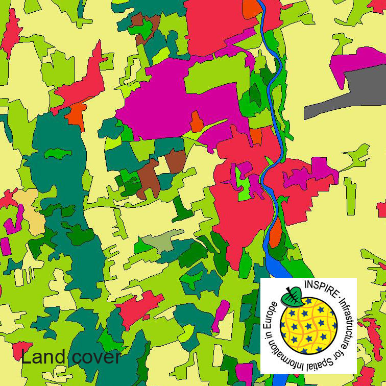
This serie clc5 describes the landscape according to the CORINE Land Cover (CLC) nomenclature. These classes contain mainly information about landcover mixed with some aspects of landuse. CLC5 is based on the more detailed German landcover model (LBM-DE) which uses separate classes for landcover and landuse and attribute-information about percentage of vegetation and sealing. The mimimum unit for an object is 1 ha. For the CLC5 dataset landcover and landuse classes are combined to unique CLC-classes taking into account the percentage of vegetation and sealing, followed by a generalisation process.
-
This dataset clc5 (2015) describes the landscape according to the CORINE Land Cover (CLC) nomenclature. These classes contain mainly information about landcover mixed with some aspects of landuse. CLC5 is based on the more detailed German landcover model from 2015 (LBM-DE2015) which uses separate classes for landcover and landuse and attribute-information about percentage of vegetation and sealing. The mimimum unit for an object is 1 ha. For the CLC5 dataset landcover and landuse classes are combined to unique CLC-classes taking into account the percentage of vegetation and sealing , followed by a generalisation process.
-
This dataset clc5 (2012) describes the landscape according to the CORINE Land Cover (CLC) nomenclature. These classes contain mainly information about landcover mixed with some aspects of landuse. CLC5 is based on the more detailed German landcover model from 2012 (LBM-DE2012) which uses separate classes for landcover and landuse and attribute-information about percentage of vegetation and sealing. The mimimum unit for an object is 1 ha. For the CLC5 dataset landcover and landuse classes are combined to unique CLC-classes taking into account the percentage of vegetation and sealing , followed by a generalisation process.
-
This dataset clc5 (2018) describes the landscape according to the CORINE Land Cover (CLC) nomenclature. These classes contain mainly information about landcover mixed with some aspects of landuse. CLC5 is based on the more detailed German landcover model from 2018 (LBM-DE2018) which uses separate classes for landcover and landuse and attribute-information about percentage of vegetation and sealing. The mimimum unit for an object is 1 ha. For the CLC5 dataset landcover and landuse classes are combined to unique CLC-classes taking into account the percentage of vegetation and sealing , followed by a generalisation process.
-

Es handelt sich um Satellitenbilder der Konstellation RapidEye mit einer Bodenauflösung von 5m und 5 Spektralkanälen. Neben dem sichtbaren Spektralbereich (Rot, Grün, Blau) wird auch Strahlung im Infrarot-Bereich detektiert (nahes Infrarot, RedEdge). Die zusätzlichen Spektralkanäle ermöglichen eine differenzierte Analyse der Vegetation.
-
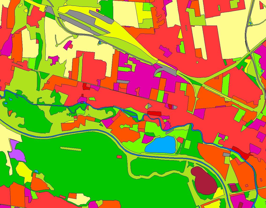
Das LBM-DE enthält Informationen zur Landbedeckung und Landnutzung. Der Datensatz wurde im Jahr 2009 erstmalig flächendeckend erfasst. Die Ersterfassung wurde auf Grundlage der ausgewählten flächenhaften Objektarten des ATKIS® Basis-DLM (2009) aus den Bereichen Siedlung, Verkehr, Vegetation und Gewässer durchgeführt. Das LBM-DE wird im Rhythmus von drei Jahren zum jeweiligen Stichjahr aktualisiert. Die Ersterfassung LBM-DE 2009 enthält flächenhafte Informationen im Sinne der europäischen Nomenklatur von CORINE Land Cover (CLC). Seit 2012 werden Landbedeckung (LB) und Landnutzung (LN) getrennt voneinander erfasst, da in der CLC-Nomenklatur keine klare Trennung der beiden Aspekte abgebildet wird. Als weitere beschreibende Attribute werden für alle Objekte der Grad der Versiegelung (SIE) und der Grad der Vegetationsbedeckung (VEG) angegeben. Die Fortführung des LBM-DE2012 wird mit Satellitenbildern (RapidEye und DMC -Disaster Monitoring Constellation) und den Daten des BasisDLM durchgeführt, wobei aus dem ATKIS® Basis-DLM (Stand 2012) insbesondere Objekte mit Spitzenaktualität (Straßen und Bebauung) von Interesse sind. Die Aktualisierung besteht in der inhaltlichen und geometrischen Überprüfung von Flächenobjekten auf Grundlage von LBM-DE aus dem vorangegangen Bezugszeitraum und der damit einhergehenden Erfassung von Veränderungen. Die Mindestkartierfläche des Datensatzes beträgt 1 Hektar. Im Zuge der Erstellung von LBM-DE2018 wurde eine Zusammenschau der Zeitreihe des LBM-DE seit 2012 durchgeführt. Basierend auf der aktuellsten Version 2018 wurde eine Rückrechnung für die Jahre 2012 und 2015 vorgenommen. Die Vergleichbarkeit der Datensätze wird erhöht, da im Lauf der Zeit vorgenommene Anpassungen in den Klassendefinitionen ausgeglichen werden. Somit kann auch die Aussagekraft von Veränderungsanalysen gesteigert werden.
-
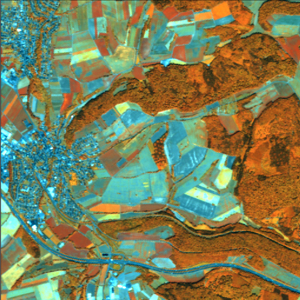
Es handelt sich um Satellitenbilder der Konstellation RapidEye mit einer Bodenauflösung von 5m und 5 Spektralkanälen. Neben dem sichtbaren Spektralbereich (Rot, Grün, Blau) wird auch Strahlung im Infrarot-Bereich detektiert (nahes Infrarot, RedEdge). Die zusätzlichen Spektralkanäle ermöglichen eine differenzierte Analyse der Vegetation.
-
Die schlichten, zehn mal zehn Zentimeter großen Betonquader mit Messingtafeln, in die mit Hammer und Schlagbuchstaben Name, Geburtsjahr und Angaben über das Schicksal eingestanzt sind, werden in Bürgersteigen vor den Häusern verlegt, in denen die Opfer des NS-Regimes einst wohnten. Der Betonstein wird versenkt, nur die Tafel bleibt sichtbar. Stolpern kann man nur im übertragenen Sinn. In Bremerhaven wurden bis heute insgesamt 120 Stolpersteine verlegt.
-
Es handelt sich um Satellitenbilder der Konstellation RapidEye mit einer Bodenauflösung von 5m und 5 Spektralkanälen. Neben dem sichtbaren Spektralbereich (Rot, Grün, Blau) wird auch Strahlung im Infrarot-Bereich detektiert (nahes Infrarot, RedEdge). Die zusätzlichen Spektralkanäle ermöglichen eine differenzierte Analyse der Vegetation.
-
Das Landbedeckungsmodell Deutschland (LBM-DE) besitzt eine detaillierten Gliederung in Landbedeckung (LB) und Landnutzung (LN) bei einer Mindestkartierfläche von 1ha. Aus den Kombinationen von LB und LN werden eindeutige CORINE LandCover-Klassen abgeleitet ("CLC").