 My GeoNetwork catalogue
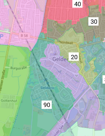
Geldern
Provided by
Type of resources
Available actions
Keywords
Contact for the resource
Update frequencies
Service types
-
In diesem Dienst werden Jagdbezirksgrenzen der gemeinschaftlichen Jagdbezirke (Jagdgenossenschaften) und Eigenjagdbezirke des Kreises Kleve ersichtlich.
-
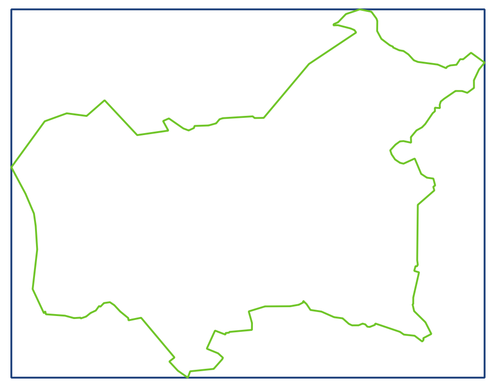
Dieser Datensatz enthält die vereinfachten Umringe und die minimal umgebenden Rechtecke (Bounding Box) um das Gemeindegebiet der Stadt Geldern. Grundlage sind die Gemeindegrenzen des Verbands. Da die zugrundeliegenden Daten einen sehr hohen Detailgrad haben, und die Punktmenge für viele weitere Anwendungen zu hoch ist, werden die Daten über einen Douglas-Peucker-Filter mit einer Toleranz von 20m generalisiert (vereinfacht) und anschließend als OGC WKT String in Textdateien ausgegeben. Diese Textdatei liegt jeweils sowohl in EPSG:4326 (WGS 84) als auch in EPSG:25832 (UTM-32N auf ETRS) vor.
-
Die Europawahlbezirke werden räumlich anhand der Einwohnerzahl aus den Stimmbezirken innerhalb von Geldern festgelegt. Die Daten umfassen die aktuellen Wahlbezirksgeometrien. Sie werden vor jeder Wahl neu beschlossen bzw. festgelegt.
-

Die Kreiswahlbezirke werden anhand der kommunalen Ratswahlbezirke vom Kreistag festgesetzt. Ihre Ausdehnung richtet sich nach der Anzahl der Wahlberechtigten. Die Daten umfassen die aktuellen Wahlbezirksgeometrien aller Wahlbezirke in Geldern.
-

Die Karte stellt die gesetzlich geschützten Landschafts-, Natur- und Biotopflächen dar und ergänzt sie durch bekannte Habitate ausgewählter Arten. Damit werden Bereiche mit besonderen Schutz- und Entwicklungszielen sichtbar, die dem Erhalt, der Optimierung und Entwicklung wertvoller Lebensräume dienen. Thematisch werden wassergeprägte, trockene und waldgeprägte Lebensräume sowie weitere artenschutzrelevante Bereiche dargestellt, die für den Biotop- und Artenschutz eine zentrale Rolle spielen.
-

Ein Baudenkmal ist ein geschütztes Gebäude oder Bauwerk von geschichtlicher, künstlerischer oder städtebaulicher Bedeutung. Hier dargestellten Baudenkmaler stehen unter Denkmalschutz und sind in der Denkmalliste NRW eingetragen. Eine abschließende und vollständige Auskunft über Denkmäler kann nur durch die zuständige Untere Denkmalbehörde der Kommune gegeben werden.
-

Die Karte zeigt Maßnahmen zur Entwicklung und Renaturierung von Fließgewässern und Auen, die als naturräumliche und ökologische Achsen erhalten und verbessert werden sollen. Grundlage sind Vorgaben der Wasserrahmenrichtlinie sowie hydromorphologische Zielsetzungen. Im Fokus stehen Bereiche mit hohem Entwicklungspotenzial, in denen Gewässerräume reaktiviert, Uferbereiche strukturell verbessert und ökologisch wertvolle Auenlebensräume entwickelt werden können.
-

Die Bundestagswahlbezirke werden räumlich anhand der Einwohnerzahl (< 2500 Einwohner je Wahlbezirk) aus den Stimmbezirken innerhalb von Geldern festgesetzt. Die Daten umfassen die aktuellen Wahlbezirksgeometrien. Sie werden vor jeder Wahl neu festgelegt bzw. beschlossen.
-

Der WFS (Web Feature Service) ist eine standardisierte Schnittstelle zum Download für Vektordaten. An einen WFS können mit verschiedenen Operationen (siehe Abschnitt Fachinformationen) Anfragen versendet werden. Üblicherweise übernimmt dies ein Geoinformationssystem, in welches die URL des WFS eingebunden wird. Dieser Datensatz umfasst das Kommunale Eigentum der Gemeinde Geldern. Nur für den internen Dienstgebrauch.
-

Die Karte stellt Flächen dar, die sich aufgrund der Biotoptypenkartierung, Luftbildauswertung und Waldfunktionskarten besonders zur Waldentwicklung eignen. Ziel ist es, defizitäre oder naturferne Waldbereiche durch Aufforstungen und begrünte Korridore zu vernetzen und in Bereichen wertvoller Laubwaldbestände naturnahe Laubmischwälder zu fördern. Dadurch sollen bestehende Laubwaldflächen arrondiert und verbunden sowie langfristig klimaangepasste Waldstrukturen entwickelt werden.