Keyword
Ressource
2970 record(s)
Provided by
Type of resources
Available actions
Topics
Keywords
Contact for the resource
Update frequencies
Service types
-

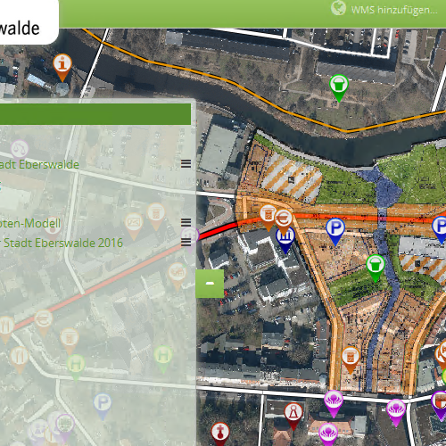
Im Geoportal der Stadt Eberswalde können die Bebaungspläne, die Geltungsbereiche der Satzungsgebiete, Informationen zum Parkraumbewirtschaftungskonzept, Gewerbegebiete sowie weitere räumliche Informationen visualisiert und abgefragt werden
-
Das Geoportal Rangsdorf visualisiert alle Geodienste, welche von der Gemeinde Rangsdorf veröffentlicht wurden. Zusätzlich werden verschiedene Geobasisdaten der LGB dargestellt. Das Portal bietet Suchfunktionen nach den verschiedenen Geodatenthemen, eine Legende sowie eine Druckfunktion.
-

Das Geoportal Potsdam-Mittelmark ist zentraler Zugangspunkt für Geodaten, Geodienste und Informationen zu raumbezogenen Informationen des Landkreises Potsdam-Mittelmark. Als Bestandteil der Geodateninfrastruktur Berlin/Brandenburg werden deren Standards und Ziele unterstützt. Das Geoportal gehört zum Internetauftritt des Landkreises Potsdam-Mittelmark, die enthaltenen Daten-Themen sind u.a.: Verwaltungsgrenzen, Naturschutz, Tourismus und Soziales.
-
Präsentiert eine Auswajhl der Dienste, die von die GDI.BRB bereitgestellt werden
-
Konzeption und Bereitstellung der Software für die Implementierung eines Infrastrukturknotens im Rahmen der GDI als gemeinsamer Hub für die Geodaten verschiedener Datenlieferanten unter Ausnutzung möglicher Synergien hinsichtlich Effektivität und Effizienz des Angebotes und den dadurch entstehenden Kostenvorteilen. Der Infrastrukturknoten ist universell verwendbar und nicht auf einen spezifischen Raumbezug beschränkt. Zielgruppe sind öffentlichkeitswirksame Akteure mit dem Ziel der Bereitstellung von punktbezogenen Geodaten wie zum Beispiel Verbände, Kammern und Kooperationsnetzwerke im Allgemeinen.
-

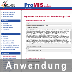
ProMIS-Online ist ein Metadateneditor zur nutzerbezogenen Erfassung und Verwaltung von Metadaten vom Typ 19115 und 19119 mit der Möglichkeit der Freigabe der Metadaten für die GDI Brandenburg.
-

Geoportal der Stadt Fürstenwalde/Spree
-
Geoportal Landkreis Märkisch-Oder-Land und Amt Seelow-Land
-

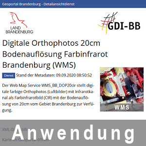
Der Detailansichtdienst ist ein Tool der Geodateninfrastruktur Brandenburg zur nutzerfreundlichen Visualisierung von Metadaten in einem einheitlichen Landeslayout. Durch den dienstebasierten Aufbau kann diese Komponente in bestehende Portale (Metadatenerfassungssystem ProMIS-Online, Geoportal Brandenburg etc.) eingebunden werden, aber auch als Standalone-Komponente fungieren. Zur Verfügung stehen dabei auch verschiedene Sichten und Styles, die es ermöglichen, die Metadaten über Verlinkungen zur Komponente indirekt anzuzeigen oder durch Einbindung eines HTML-Schnipsels in den bestehenden Programmcode eigener Systeme zu implementieren.
-

Der GEOBROKER ist das Internet-Bestell-Portal für Geodaten der Landesvermessung und Geobasisinformation Brandenburg (LGB). „Rund um die Uhr und unabhängig von allen Öffnungszeiten“ hat der Internetnutzer die Möglichkeit, sich über alle Geobasisinformationen der Landesvermessung Brandenburg aktuell zu informieren, eine Auswahl zu treffen und diese über die Funktionalitäten des Internets zu bestellen.
 www.geodatenkatalog.de (S1L)