 www.geodatenkatalog.de (S3L)
Keyword
Sand
160 record(s)
Provided by
Type of resources
Available actions
Topics
Keywords
Contact for the resource
Update frequencies
Service types
-
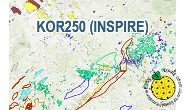
The WMS KOR250 (INSPIRE) in the scale of 1:250,000 shows occurrences and deposits of mineral resources in Germany, which lie close to the Earth’s surface, i.e. can be mined in open-pits, quarries or near-surface mines. These mineral resources include industrial minerals, aggregates, peat, lignite, oil shales, and natural brines. The map is derived from the KOR250, the digital successor of the map series KOR200 „Map of Near-Surface Deposits of the Federal Republic of Germany 1:200,000”, which has been published since 1984. The KOR200 and KOR250 have been published by the Federal Institute for Geosciences and Natural Resources together with the State Geological Surveys of the federal states on behalf of the Federal Ministry for Economic Affairs and Energy. Primary purpose of the KOR250 is to display Germany’s potential of domestic raw materials in a comparable way. The explanations given in the printed booklets accompanying the KOR200 are not available in the digital KOR250. In the KOR250 besides the defined deposits and differently coloured areas of raw materials, "active mines" (= operations) at time of publication or "focal points of several active mines" are marked with one symbol each. These mines are not included in the KOR250 (INSPIRE) as often the headquarters of the mining company and not the mining site itself is displayed as well as in many regions the dataset is outdated. As the map sheets of the KOR200 have been generated over more than three decades the timeliness of data is extremely different. For more detail, the current large-scale raw material maps of the Federal State Geological Surveys should always be consulted. The point data displayed in KOR250 (INSPIRE) indicate very small, but worth mentioning prospects of certain raw materials. The WMS KOR250 (INSPIRE) contains the two layers MR.MineralOccurence.Commodity.Polygon (mineral resources as polygons) and MR.MineralOccurence.Commodity.Point (mineral resources as points). Via the getFeatureInfo request the user obtains additional information on the mineral resources. Notes: The colouring of the raw material occurrences in the KOR250 (INSPIRE) largely corresponds to the colouring of the original KOR250. In the INSPIRE Data Specification on Mineral Resources (D2.8.III.21) there are no portrayal rules for building raw materials and dimension stones, which constitute a large part of the raw material occurrences. It should be noted that according to the INSPIRE commodity code list, most magmatites and metamorphites were assigned to the two values "granite" and "basalt". From a geological point of view and with regard to its origin, this assignment is often misleading. For more information on the outcropping rock of a specific raw material occurrence, the German name from the original KOR250 was mapped to the attribute name of the class GeologicFeature. Link KOR200: https://www.bgr.bund.de/EN/Themen/Min_rohstoffe/Projekte/Rohstoffverfuegbarkeit_laufend_en/KOR_200_en.html
-
The KOR250 (INSPIRE) in the scale of 1:250,000 shows occurrences and deposits of mineral resources in Germany, which lie close to the Earth’s surface, i.e. can be mined in open-pits, quarries or near-surface mines. These mineral resources include industrial minerals, aggregates, peat, lignite, oil shales, and natural brines. The map is derived from the KOR250, the digital successor of the map series KOR200 „Map of Near-Surface Deposits of the Federal Republic of Germany 1:200,000”, which has been published since 1984. The KOR200 and KOR250 have been published by the Federal Institute for Geosciences and Natural Resources together with the State Geological Surveys of the federal states on behalf of the Federal Ministry for Economic Affairs and Energy. Primary purpose of the KOR250 is to display Germany’s potential of domestic raw materials in a comparable way. The explanations given in the printed booklets accompanying the KOR200 are not available in the digital KOR250. In the KOR250 besides the defined deposits and differently coloured areas of raw materials, "active mines" (= operations) at time of publication or "focal points of several active mines" are marked with one symbol each. These mines are not included in the KOR250 (INSPIRE) as often the headquarters of the mining company and not the mining site itself is displayed as well as in many regions the dataset is outdated. As the map sheets of the KOR200 have been generated over more than three decades the timeliness of data is extremely different. For more detail, the current large-scale raw material maps of the Federal State Geological Surveys should always be consulted. The point data displayed in KOR250 (INSPIRE) indicate very small, but worth mentioning prospects of certain raw materials. According to the Data Specification on Mineral Resources (D2.8.III.21) the content of the map is stored in two INSPIRE-compliant GML files: KOR250_EarthResource_polygon.gml comprises the mineral resources as polygons. KOR250_EarthResource_point.gml comprises the mineral resources as points. The GML files together with a Readme.txt file are provided in ZIP format (KOR250-INSPIRE.zip). The Readme.text file (German/English) contains detailed information on the GML files content. Data transformation was proceeded by using the INSPIRE Solution Pack for FME according to the INSPIRE requirements. Notes: It should be noted that according to the INSPIRE commodity code list, most magmatites and metamorphites were assigned to the two values "granite" and "basalt". From a geological point of view and with regard to its origin, this assignment is often misleading. For more information on the outcropping rock of a specific raw material occurrence, the German name from the original KOR250 was mapped to the attribute name of the class GeologicFeature. Link KOR200: https://www.bgr.bund.de/EN/Themen/Min_rohstoffe/Projekte/Rohstoffverfuegbarkeit_laufend_en/KOR_200_en.html
-
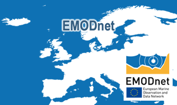
The European Marine Observation and Data Network (EMODnet) consists of more than 100 organisations assembling marine data, products and metadata to make these fragmented data resources more available to public and private users relying on quality-assured, standardised and harmonised marine data which are interoperable and free of restrictions on use. EMODnet is currently in its fourth phase. BGR participates in the EMODnet Geology theme and is coordinating the “seafloor geology” work package from the beginning. In cooperation with the project partners BGR compiles and harmonises GIS data layers on the topics geomorphology, pre-Quaternary and Quaternary geology and provides those, based on INSPIRE principles, via the EMODnet Geology portal https://www. emodnet-geology.eu/map-viewer/. These map layers present the pre-Quaternary and Quaternary sea-floor geology and Geomorphology of the European Seas, semantically harmonized based on the INSPIRE data specifications including the terms for lithology, age, event environment, event process and geomorphology. The data are compiled from the project partners, the national geological survey organizations of the participating countries. The data set represents the most detailed available data compilation of the European Seas using a multiresolution approach. Data completeness depending on the availability of data and actual mapping campaigns. This open and freely accessible product was made available by the EMODnet Geology project (https://www.emodnet-geology.eu/), implemented by EMODnet Geology Phase IV partners, and funded by the European Commission Directorate General for Maritime Affairs and Fisheries. These data were compiled by BGR from the EMODnet IV Geology partners. All ownership rights of the original data remain with the data originators, who are acknowledged within the attribute values of each map feature.
-
The European Marine Observation and Data Network (EMODnet) consists of more than 100 organisations assembling marine data, products and metadata to make these fragmented data resources more available to public and private users relying on quality-assured, standardised and harmonised marine data which are interoperable and free of restrictions on use. EMODnet is currently in its fourth phase. BGR participates in the EMODnet Geology theme and is coordinating the “seafloor geology” work package from the beginning. In cooperation with the project partners BGR compiles and harmonises GIS data layers on the topics geomorphology, pre-Quaternary and Quaternary geology and provides those, based on INSPIRE principles, via the EMODnet Geology portal https://www.emodnet-geology.eu/map-viewer/. These map layers present the pre-Quaternary and the Quaternary sea-floor geology and Geomorphology of the European Seas, semantically harmonized based on the INSPIRE data specifications for Geology, including the terms for lithology, age, event environment, event process. The data are compiled from the project partners, the national geological survey organizations of the participating countries. The data set represents the most detailed available data compilation of the European Seas using a multi-resolution approach. Data completeness depending on the availability of data and actual mapping campaigns. This open and freely accessible product was made available by the EMODnet Geology project (https://www.emodnet-geology.eu/), implemented by EMODnet Geology Phase IV partners, and funded by the European Commission Directorate General for Maritime Affairs and Fisheries. These data were compiled by BGR from the EMODnet IV Geology partners. All ownership rights of the original data remain with the data originators, who are acknowledged within the attribute values of each map feature.
-
Bebauungspläne und Umringe der Kreisstadt Saarlouis (Saarland) Stadtteil Fraulautern:Bebauungsplan "Westlich Grosser Sand Teilplan 2 1.Aenderung Nr.31_1" der Kreisstadt Saarlouis, Stadtteil Fraulautern
-
- rechtliche Wirkung der Raumordnung und Landesplanung in bergrechtlichen Verfahren zur Aufsuchung und Gewinnung von Kies/Sand - Beeinflußbarkeit des bergrechtlichen Geschehens durch Aussagen der Raumordnung und Landesplanung
-
Bebauungspläne und Umringe der Kreisstadt Saarlouis (Saarland) Stadtteil Fraulautern:Bebauungsplan "Westlich Grosser Sand Nr.31_0" der Kreisstadt Saarlouis, Stadtteil Fraulautern
-
Karte der Verbreitung oberflächennaher Sande, inkl. Spezialsande. Attributwerte lassen eine Gliederung nach dem Erkundungsgrad in vermutet, gefolgert und erkundet zu.
-
Das Informationssystem umfasst qualitative und quantitative Angaben über Lagerstätten und Vorkommen nichtenergetischer oberflächennaher Rohstoffe in Nordrhein-Westfalen. Regionalplanerisch festgelegte Siedlungsflächen sind ausgespart. Das Informationssystem wurde in der Vergangenheit auch unter dem Namen „Karte oberflächennaher nichtenergetischer Rohstoffe in Nordrhein-Westfalen“ geführt. Verfügbare Kartenthemen: Verbreitung von 24 Rohstoffarten; Überlagerung oberflächennaher Rohstoffe; Vorkommen in ihrer gesamten geologischen Verbreitung; wirtschaftlich bedeutsame Lagerstättenflächen; Differenzierung nach Mächtigkeit (Kies und Sand); punktuelle Angaben (u. a. Mächtigkeit); Angaben zu möglichen Verwendungszwecken der Rohstoffe. Dieser Datenbestand wird nicht weiter gepflegt und ist daher nur auf Anfrage erhältlich.
-
WFS-Dienst des nach INSPIRE transformierten Bebauungsplans „Sand“ der Gemeinde Frickenhausen basierend auf einem XPlanung-Datensatz in der Version 5.0.