Keyword
Quartär
186 record(s)
Provided by
Type of resources
Available actions
Topics
Keywords
Contact for the resource
Update frequencies
Service types
-

The European Marine Observation and Data Network (EMODnet) consists of more than 100 organisations assembling marine data, products and metadata to make these fragmented data resources more available to public and private users relying on quality-assured, standardised and harmonised marine data which are interoperable and free of restrictions on use. EMODnet is currently in its fourth phase. BGR participates in the EMODnet Geology theme and is coordinating the “seafloor geology” work package from the beginning. In cooperation with the project partners BGR compiles and harmonises GIS data layers on the topics geomorphology, pre-Quaternary and Quaternary geology and provides those, based on INSPIRE principles, via the EMODnet Geology portal https://www. emodnet-geology.eu/map-viewer/. These map layers present the pre-Quaternary and Quaternary sea-floor geology and Geomorphology of the European Seas, semantically harmonized based on the INSPIRE data specifications including the terms for lithology, age, event environment, event process and geomorphology. The data are compiled from the project partners, the national geological survey organizations of the participating countries. The data set represents the most detailed available data compilation of the European Seas using a multiresolution approach. Data completeness depending on the availability of data and actual mapping campaigns. This open and freely accessible product was made available by the EMODnet Geology project (https://www.emodnet-geology.eu/), implemented by EMODnet Geology Phase IV partners, and funded by the European Commission Directorate General for Maritime Affairs and Fisheries. These data were compiled by BGR from the EMODnet IV Geology partners. All ownership rights of the original data remain with the data originators, who are acknowledged within the attribute values of each map feature.
-

The European Marine Observation and Data Network (EMODnet) consists of more than 100 organisations assembling marine data, products and metadata to make these fragmented data resources more available to public and private users relying on quality-assured, standardised and harmonised marine data which are interoperable and free of restrictions on use. EMODnet is currently in its fourth phase. BGR participates in the EMODnet Geology theme and is coordinating the “seafloor geology” work package from the beginning. In cooperation with the project partners BGR compiles and harmonises GIS data layers on the topics geomorphology, pre-Quaternary and Quaternary geology and provides those, based on INSPIRE principles, via the EMODnet Geology portal https://www.emodnet-geology.eu/map-viewer/. These map layers present the pre-Quaternary and the Quaternary sea-floor geology and Geomorphology of the European Seas, semantically harmonized based on the INSPIRE data specifications for Geology, including the terms for lithology, age, event environment, event process. The data are compiled from the project partners, the national geological survey organizations of the participating countries. The data set represents the most detailed available data compilation of the European Seas using a multi-resolution approach. Data completeness depending on the availability of data and actual mapping campaigns. This open and freely accessible product was made available by the EMODnet Geology project (https://www.emodnet-geology.eu/), implemented by EMODnet Geology Phase IV partners, and funded by the European Commission Directorate General for Maritime Affairs and Fisheries. These data were compiled by BGR from the EMODnet IV Geology partners. All ownership rights of the original data remain with the data originators, who are acknowledged within the attribute values of each map feature.
-

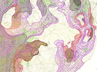
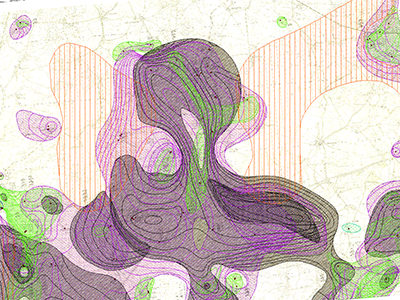
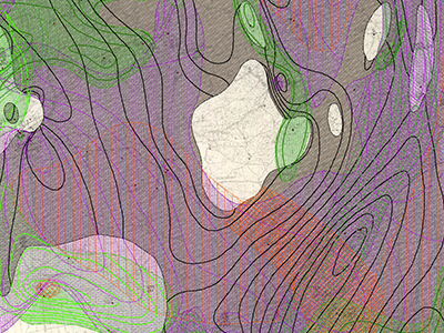
The Lithofacial Map of the Quaternary 1 : 50,000 (LKQ 50) is a map series of the GDR covering nearly the whole former state territory besides the South of Saxony and Thuringia. The series consists of 123 map sheets, each of which encompassing several horizon maps mostly complemented by about five cross sections. Specifications concerning map content and structure provides Cepek (1999). The data provided here were digitised in frame of the Geo3D-Oder project of the German Federal Institute for Geosciences and Natural Resources (BGR). Reference: Cepek, A. G. (1999): Die Lithofazieskarte Quartär 1 : 50.000 (LKQ 50) – Eine Erläuterung des Kartenkonzepts mit Hinweisen zum Gebrauch. - Brandenburgisch. Geowiss. Beitr. 6, 2: 3-38, 3 Abb., 2 Tab.; Kleinmachnow
-

The Lithofacial Map of the Quaternary 1 : 50,000 (LKQ 50) is a map series of the GDR covering nearly the whole former state territory besides the South of Saxony and Thuringia. The series consists of 123 map sheets, each of which encompassing several horizon maps mostly complemented by about five cross sections. Specifications concerning map content and structure provides Cepek (1999). The data of the LKQ 50 map sheet 1769 Schwedt provided here were digitised in frame of the Geo3D-Oder project of the German Federal Institute for Geosciences and Natural Resources (BGR). The data includes elements of the five horizon maps 1769-2, 1769-3, 1769-4, 1769-5 and 1769-6 and of the five cross sections schnitt 1 to schnitt 5. The topics of these maps and sections are defined in a general legend (version 3). Furthermore, the legends of the single horizon maps provide a stratigraphic and genetic classification of the depicted strata. For each horizon map the digitised elements comprise several polygon shapefiles of the single layers, a polyline shapefile of isohypses related to layer bases, a point shapefile of lithological profiles and a polygon shapefile of additional information concerning areas of heavy strata deformation and insufficient investigation. The data of each cross section includes a polygon shapefile of the horizon section areas, a polygon shapefile of the section areas concerning regions with heavy layer deformation or insufficient investigation and a shapefile showing the transect line to locate the cross section. Non-numeric contents of the attribute tables are encoded by numbers and are translated in full text by means of key tables. The key table Normalprofil allows the stratigraphic and genetic classification of horizons displayed in horizon maps and cross sections by code numbers of the column N_ID. Detailed descriptions concerning the data structure are provided in the attachments. Reference: Cepek, A. G. (1999): Die Lithofazieskarte Quartär 1 : 50.000 (LKQ 50) – Eine Erläuterung des Kartenkonzepts mit Hinweisen zum Gebrauch. - Brandenburgisch. Geowiss. Beitr. 6, 2: 3-38, 3 Abb., 2 Tab.; Kleinmachnow
-

The Lithofacial Map of the Quaternary 1 : 50,000 (LKQ 50) is a map series of the GDR covering nearly the whole former state territory besides the South of Saxony and Thuringia. The series consists of 123 map sheets, each of which encompassing several horizon maps mostly complemented by about five cross sections. Specifications concerning map content and structure provides Cepek (1999). The data of the LKQ 50 map sheet 1669 Brüssow provided here were digitised in frame of the Geo3D-Oder project of the German Federal Institute for Geosciences and Natural Resources (BGR). The data include elements of the six horizon maps 1669-2, 1669-3, 1669-4, 1669-5, 1669-6 and 1669-7. The topics of these maps are defined in a general legend (version 3). Furthermore, the legends of the single horizon maps provide a stratigraphic and genetic classification of the depicted strata. For each horizon map the digitised elements comprise several polygon shapefiles of the single layers, a polyline shapefile of isohypses related to layer bases, a point shapefile of lithological profiles and a polygon shapefile of additional information concerning areas of heavy strata deformation and insufficient investigation. Non-numeric contents of the attribute tables are encoded by numbers and are translated in full text by means of key tables. The key table Normalprofil allows the stratigraphic and genetic classification of horizons displayed in horizon maps by code numbers of the column N_ID. Detailed descriptions concerning the data structure are provided in the attachments. Reference: Cepek, A. G. (1999): Die Lithofazieskarte Quartär 1 : 50.000 (LKQ 50) – Eine Erläuterung des Kartenkonzepts mit Hinweisen zum Gebrauch. - Brandenburgisch. Geowiss. Beitr. 6, 2: 3-38, 3 Abb., 2 Tab.; Kleinmachnow
-
Der Kartendienst (WMS-Gruppe) stellt die Geodaten aus dem Bereich Boden des Saarlandes bereit.:Der Kartendienst (WMS-Gruppe) gibt einen Einblick in den jüngsten erdgeschichtlichen Zeitraum des Saarlandes. Die Quartärkarte zeigt die Verbreitung quartärer Ablagerungen und periglazialer Lagen über präquartärem Untergrund im Saarland. Die Karte wurde auf Grundlage der BÜK 100 und geologischer Karten entwickelt (Maßstabsbeschränkung).
-

The Lithofacial Map of the Quaternary 1 : 50,000 (LKQ 50) is a map series of the GDR covering nearly the whole former state territory besides the South of Saxony and Thuringia. The series consists of 123 map sheets, each of which encompassing several horizon maps mostly complemented by about five cross sections. Specifications concerning map content and structure provides Cepek (1999). The data of the LKQ 50 map sheet 1768 Templin provided here were digitised in frame of the Geo3D-Oder project of the German Federal Institute for Geosciences and Natural Resources (BGR). The data include elements of the five horizon maps 1768-2, 1768-3, 1768-4, 1768-5 and 1768-6 and of the five cross sections Schnitt 1 to Schnitt 5. The topics of these maps and cross sections are defined in a general legend (version 3). Furthermore, the legends of the single horizon maps provide a stratigraphic and genetic classification of the depicted strata. For each horizon map the digitised elements comprise several polygon shapefiles of the single layers, a polyline shapefile of isohypses related to layer bases, a point shapefile of lithological profiles and a polygon shapefile of additional information concerning areas of heavy strata deformation and insufficient investigation. The data of each cross section includes a polygon shapefile of the horizon section areas, a polygon shapefile of the section areas concerning regions with heavy layer deformation or insufficient investigation and a shapefile showing the transect line to locate the cross section. Non-numeric contents of the attribute tables are encoded by numbers and are translated in full text by means of key tables. The key table Normalprofil allows the stratigraphic and genetic classification of horizons displayed in horizon maps and cross sections by code numbers of the column N_ID. Detailed descriptions concerning the data structure are provided in the attachments. Reference: Cepek, A. G. (1999): Die Lithofazieskarte Quartär 1 : 50.000 (LKQ 50) – Eine Erläuterung des Kartenkonzepts mit Hinweisen zum Gebrauch. - Brandenburgisch. Geowiss. Beitr. 6, 2: 3-38, 3 Abb., 2 Tab.; Kleinmachnow
-
Der Kartendienst (WFS-Gruppe) stellt Daten aus dem Thema Boden dar.:Der Kartendienst zeigt die Verbreitung von Sinterkalk im Saarland (Punktdaten). Maximalmaßstab 1:25000.
-
Der Kartendienst (WFS-Gruppe) stellt Daten aus dem Thema Boden dar.:Quartäre Ablagerungen
-
Der Kartendienst (WFS-Gruppe) stellt Daten aus dem Thema Boden dar.:Lössvorkommen
 www.geodatenkatalog.de (S3L)