 My GeoNetwork catalogue
Geomorphologie
Provided by
Type of resources
Available actions
Topics
Keywords
Contact for the resource
Update frequencies
Service types
-

-

-

-
-
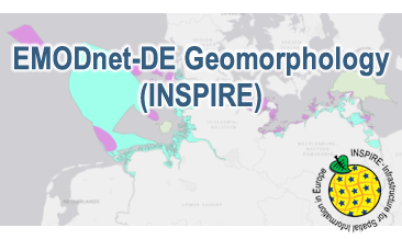
Compilation of the European marine geomorphology (section of Germany). According to the Data Specification on Geology (D2.8.II.4_v3.0) the geological map provides INSPIRE-compliant data. The WMS EMODnet-DE Geomorphology (INSPIRE) contains layers of the natural geomorphologic features (GE.GeomorphologicFeature) displayed correspondingly to the INSPIRE portrayal rules. Via the getFeatureInfo request the user obtains detailed information on the natural geomorphologic features.
-
Compilation of the European marine geomorphology (section of Germany). According to the Data Specification on Geology (D2.8.II.4_v3.0) the content of the geological map is stored in an INSPIRE-compliant GML file: EMODnet-DE_Geomorphology_NaturalGeomorphologicFeature.gml contains the natural geomorphologic features. The GML file together with a Readme.txt file are provided in ZIP format (EMODnet-DE_Geomorphology-INSPIRE.zip). The Readme.text file (German/English) contains detailed information on the GML file content. Data transformation was proceeded by using the INSPIRE Solution Pack for FME according to the INSPIRE requirements.
-

The Weser estuary at the German North Sea coast serves as a fairway to the harbours of Bremerhaven and Bremen. To ensure safe shipping and navigation, the navigation channel depths are nowadays intensively monitored, and have been so in the past. These are valuable data for consulting and research purposes, and enables investigations leading to a better understanding of hydrodynamics, salt intrusion and morphological processes in the estuary, in the present as well as the past. For recent years, thanks to modern monitoring techniques and digitalization, measuring data has been compiled to consistent digital terrain models of high quality and accuracy. For time periods before the 1990ies however, measurements were scarcer and the data are available only in form of printed bathymetrical and nautical charts. The objective of the project “Historical system states of the Weser estuary (HIWEST)” was to: • digitalize depths measurements starting from 1960, • georeference the data points and • process and compile them to digital terrain models that can be used for research and consulting. The project was led and financed by the Federal Waterways Engineering and Research Institute (BAW). It was supported by the Federal Maritime and Hydrographic Agency (BSH) and by the German Water and Shipping Administration (WSV) who provided printed charts and scanned data sets. The smile consulting GmbH was contracted to process the data and compile digital terrain models. One of the main challenges of the project was georeferencing. While georeferencing and projecting in the horizontal domain was comparatively straightforward, the transformation of depths below different chart datums to the Germans mean height reference system represented a challenge. This was accomplished by an algorithm considering spatial polygons provided by BSH and further meta information on the different levelling systems. The accuracy of the data sets differs depending on the quality of the original data. Since the 1990ies, powerful measurement methods such as airborne laser scanning (ALS) and multibeam echo-sounding has led to high resolutions and high data accuracy. In past surveys, the depths were measured in single-beam echo-soundings, often along individual cross sections, and there is no information between these soundings. As a result, the older terrain models are much smoother then the newer ones and contain less detailed information. More technical details can be found in the appendix of the technical report. The following digital terrain models (DTM, in the following the German abbreviation DGM is used) of the Lower and Outer Weser estuary were made available: • DGM 1966, marking the situation before deepening the Outer Weser to SKN-12 m</li> • DGM 1972, marking the situation before deepening the Lower Weser to SKN-9 m</li> • DGM 1981, marking the situation before extensive river works in the Lower Weser</li> • DGM 1996, marking the situation before deepening the Outer Weser to SKN-14 m</li> • DGM 2002, marking the situation after deepening the Outer Weser to SKN-14 m, reference digital terrain model. The years were chosen so they would represent consistent periods not affected by constructive engineering measures such as channel deepenings, and secondly based on optimal data availability. Each data set however consists not only of data from the respective year, but data had to be added from adjacent years. To close gaps, data from recent surveys were used. The data sets span the whole estuary from the North Sea to the tidal weir in the city of Bremen and are available as 1x1 m raster data sets. How to cite the HIWEST data: <strong style="color: red;"> The data set is only to be quoted together with the Technical Report.</strong> Report: Bundesanstalt für Wasserbau (2020): Historical digital terrain models of the Weser Estuary (HIWEST). Technical Report B3955.02.04.70168-6. Bundesanstalt für Wasserbau. https://henry.baw.de/handle/20.500.11970/107521 Data set: Bundesanstalt für Wasserbau (2020): Historical digital terrain model data of the Weser Estuary (HIWEST) [Data set]. Bundesanstalt für Wasserbau. https://doi.org/10.48437/02.2020.K2.5200.0001
-
The European Marine Observation and Data Network (EMODnet) consists of more than 100 organisations assembling marine data, products and metadata to make these fragmented data resources more available to public and private users relying on quality-assured, standardised and harmonised marine data which are interoperable and free of restrictions on use. EMODnet is currently in its fourth phase. BGR participates in the EMODnet Geology theme and is coordinating the “seafloor geology” work package from the beginning. In cooperation with the project partners BGR compiles and harmonises GIS data layers on the topics geomorphology, pre-Quaternary and Quaternary geology and provides those, based on INSPIRE principles, via the EMODnet Geology portal https://www.emodnet-geology.eu/map-viewer/. These map layers present the pre-Quaternary and the Quaternary sea-floor geology and Geomorphology of the European Seas, semantically harmonized based on the INSPIRE data specifications for Geology, including the terms for lithology, age, event environment, event process. The data are compiled from the project partners, the national geological survey organizations of the participating countries. The data set represents the most detailed available data compilation of the European Seas using a multi-resolution approach. Data completeness depending on the availability of data and actual mapping campaigns. This open and freely accessible product was made available by the EMODnet Geology project (https://www.emodnet-geology.eu/), implemented by EMODnet Geology Phase IV partners, and funded by the European Commission Directorate General for Maritime Affairs and Fisheries. These data were compiled by BGR from the EMODnet IV Geology partners. All ownership rights of the original data remain with the data originators, who are acknowledged within the attribute values of each map feature.
-
The European Marine Observation and Data Network (EMODnet) consists of more than 100 organisations assembling marine data, products and metadata to make these fragmented data resources more available to public and private users relying on quality-assured, standardised and harmonised marine data which are interoperable and free of restrictions on use. EMODnet is currently in its fourth phase. BGR participates in the EMODnet Geology theme and is coordinating the “seafloor geology” work package from the beginning. In cooperation with the project partners BGR compiles and harmonises GIS data layers on the topics geomorphology, pre-Quaternary and Quaternary geology and provides those, based on INSPIRE principles, via the EMODnet Geology portal https://www. emodnet-geology.eu/map-viewer/. These map layers present the pre-Quaternary and Quaternary sea-floor geology and Geomorphology of the European Seas, semantically harmonized based on the INSPIRE data specifications including the terms for lithology, age, event environment, event process and geomorphology. The data are compiled from the project partners, the national geological survey organizations of the participating countries. The data set represents the most detailed available data compilation of the European Seas using a multiresolution approach. Data completeness depending on the availability of data and actual mapping campaigns. This open and freely accessible product was made available by the EMODnet Geology project (https://www.emodnet-geology.eu/), implemented by EMODnet Geology Phase IV partners, and funded by the European Commission Directorate General for Maritime Affairs and Fisheries. These data were compiled by BGR from the EMODnet IV Geology partners. All ownership rights of the original data remain with the data originators, who are acknowledged within the attribute values of each map feature.
-
Der Kartendienst (WFS-Gruppe) stellt Daten aus dem Thema Boden dar.:Referenzvorkommen Paläoböden