 My GeoNetwork catalogue
Erdbeobachtung und Umwelt
Provided by
Type of resources
Available actions
Topics
Keywords
Contact for the resource
Update frequencies
Service types
-
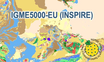
The IGME5000-EU (INSPIRE) represents the pre-quaternary bedrock geology (onshore and offshore) of the European map on a scale of 1:5,000,000. According to the Data Specification on Geology (D2.8.II.4_v3.0) the content of the geological map is stored in two INSPIRE-compliant GML files: IGME5000-EU_GeologicUnit.gml contains the geologic units and IGME5000-EU_GeologicStructure.gml comprises the faults. The GML files together with a Readme.txt file are provided in ZIP format (IGME5000-EU-INSPIRE.zip). The Readme.text file (German/English) contains detailed information on the GML files content. Data transformation was proceeded by using the INSPIRE Solution Pack for FME according to the INSPIRE requirements.
-
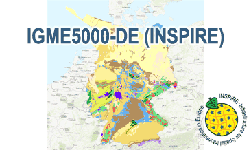
The IGME5000-DE (INSPIRE) represents the pre-quaternary bedrock geology (section of Germany) of the European map on a scale of 1:5,000,000. According to the Data Specification on Geology (D2.8.II.4_v3.0) the content of the geological map is stored in two INSPIRE-compliant GML files: IGME5000-DE_GeologicUnit.gml contains the geologic units and IGME5000-DE_GeologicStructure.gml comprises the faults. The GML files together with a Readme.txt file are provided in ZIP format (IGME5000-DE-INSPIRE.zip). The Readme.text file (German/English) contains detailed information on the GML files content. Data transformation was proceeded by using the INSPIRE Solution Pack for FME according to the INSPIRE requirements.
-
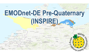
Compilation of the European Pre-Quaternary marine geology (section of Germany). Project partners are the national geological services of the participating countries. The map consists of data at highest available spatial resolution, map scale („multi-resolution“-concept) and data completeness vary depending on the project partner (as of 2016 September). According to the Data Specification on Geology (D2.8.II.4_v3.0) the content of the geological map is stored in a INSPIRE-compliant GML file: EMODnet-DE_Pre-Quaternary_GeologicUnit.gml contains the geologic units. The GML files together with a Readme.txt file are provided in ZIP format (EMODnet-DE_Pre-Quaternary-INSPIRE.zip). The Readme.text file (German/English) contains detailed information on the GML file content. Data transformation was proceeded by using the INSPIRE Solution Pack for FME according to the INSPIRE requirements.
-
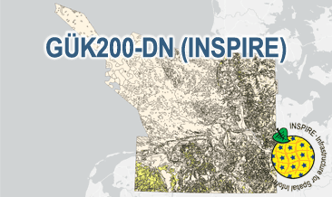
The General Geological Map of the Federal Republic of Germany 1:200,000 (GÜK200) provides detailed information on the stratigraphy, petrography and genesis of the geological units shown. In this revised GÜK200-DN, the onshore surface geology is shown in up to two overlays. The thin overlying soil is not shown. In the marine environment, only the petrography of the recent seabed is shown, which comprises the uppermost 20 cm of the seabed. In accordance with the original GÜK200 map sheets, the seabed is referred to stratigraphically as the recent seabed. According to the Data Specification on Geology (D2.8.II.4_v3.0) the geological map provides INSPIRE-compliant data. A base layer and two overlay layers are displayed correspondingly to the INSPIRE portrayal rules. The geologic units are represented graphically by stratigraphy (GE.GeologicUnit.BaseLayer.AgeOfRocks, GE.GeologicUnit.OverlayLayer1.AgeOfRocks, and GE.GeologicUnit.OverlayLayer2.AgeOfRocks) and lithology (GE.GeologicUnit.BaseLayer.Lithology, GE.GeologicUnit.OverlayLayer1.Lithology, and GE.GeologicUnit.OverlayLayer2.Lithology). The user obtains detailed information via the getFeatureInfo request on the lithology, stratigraphy (age) and genesis (event environment and event process).
-
The General Geological Map of the Federal Republic of Germany 1:200,000 (GÜK200) provides detailed information on the stratigraphy, petrography and genesis of the geological units shown. In this revised GÜK200-DN, the onshore surface geology is shown in up to two overlayers. The thin overlying soil is not shown. In the marine environment, only the petrography of the recent seabed is shown, which comprises the uppermost 20 cm of the seabed. In accordance with the original GÜK200 map sheets, the seabed is referred to stratigraphically as the recent seabed. According to the Data Specification on Geology (D2.8.II.4_v3.0) the content of the geological map is stored in three INSPIRE-compliant GML files: GUEK200_DN_GeologicUnit_BaseLayer.gml, GUEK200_DN_GeologicUnit_OverlayLayer1.gml, and GUEK200_DN_GeologicUnit_OverlayLayer2.gml contain the geologic units. The GML files together with a Readme.txt file are provided in ZIP format (GUEK200_DN-INSPIRE.zip). The Readme.text file (German/English) contains detailed information on the GML files content. Data transformation was proceeded by using the INSPIRE Solution Pack for FME according to the INSPIRE requirements.
-

The digital terrain model of waterways for the estuary of river Elbe (DGM-W 2016) in high resolution based on airborne laser scanning and echo sounder data is produced and published by the German Federal Waterways and Shipping Administration (Wasserstraßen- und Schifffahrtsverwaltung des Bundes, WSV). The data includes the Outer Elbe and the tidally influenced side branches of the Elbe estuary upstream to the town Geesthacht. The data is available in a raster resolution of 1 meter. Coordinate reference system: EPSG 25852, ETRS89 / UTM Zone 32N Elevation reference system: DHHN92, NHN Survey methods: Airborne laser scanning (ALS) 02. - 04.2016 Multibeam echo sounder, single beam echo sounder 2015-2017 It is strongly recommended to use the data source map for quality assessment.
-
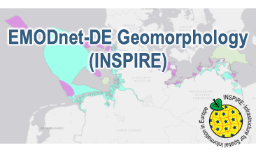
Compilation of the European marine geomorphology (section of Germany). According to the Data Specification on Geology (D2.8.II.4_v3.0) the content of the geological map is stored in an INSPIRE-compliant GML file: EMODnet-DE_Geomorphology_NaturalGeomorphologicFeature.gml contains the natural geomorphologic features. The GML file together with a Readme.txt file are provided in ZIP format (EMODnet-DE_Geomorphology-INSPIRE.zip). The Readme.text file (German/English) contains detailed information on the GML file content. Data transformation was proceeded by using the INSPIRE Solution Pack for FME according to the INSPIRE requirements.
-

The digital terrain model of waterways for the estuary of river Elbe (DGM-W 2022) in high resolution based on airborne laser scanning and echo sounder data is produced and published by the German Federal Waterways and Shipping Administration (Wasserstraßen- und Schifffahrtsverwaltung des Bundes, WSV). The data includes the Outer Elbe and the tidally influenced tributaries and branches of the Elbe estuary upstream to the town Geesthacht. The data is available in a raster resolution of 1 meter. Coordinate reference system: EPSG 25852, ETRS89 / UTM Zone 32N Elevation reference system: DHHN2016, NHN Survey methods: Airborne laser scanning (ALS) 02.04.2022 - 19.04.2022 Multibeam echo sounder, single beam echo sounder 09.02.2017 - 09.04.2023 It is strongly recommended to use the data source map for quality assessment.
-
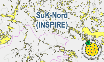
The SuK-Nord (INSPIRE) shows the geological distribution of aggregates (sand and gravel) in Northern Germany, especially north of the southernmost maximum of the Scandinavian inland ice sheet (Saalian and Elsterian glaciation). According to the Data Specifications on Mineral Resources (D2.8.III.21) and Geology (D2.8.II.4_v3.0) the content of the map is stored in two INSPIRE-compliant GML files: SuK_Nord_EarthResource_polygon.gml contains the distribution of aggreagtes (sand and gravel) as polygons. SuK_Nord_GeomorphologicFeature.gml contains the southernmost maximum of the Scandinavian inland ice sheet (Saalian and Elsterian glaciation) as lines. The GML files together with a Readme.txt file are provided in ZIP format (SuK_Nord-INSPIRE.zip). The Readme.text file (German/English) contains detailed information on the GML files content. Data transformation was proceeded by using the INSPIRE Solution Pack for FME according to the INSPIRE requirements.
-
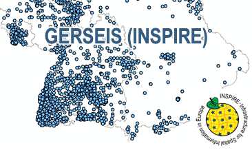
The German Earthquake Catalogue is based on a database providing information on the seismicity in Germany an adjacent areas. It contains locations of seismic events since year 800 where their epicentre determinations are based on historical sources as well as on measurements at seismometer stations since the start of instrumental seismological recording in the 20th century. Today, digital data acquisition at seismometer stations of the German regional seismic network (GRSN), the seismic GERES array, and the Gräfenberg array (GRF) takes place. All events with a local magnitude ML 2.0 and higher are listed. The GML file together with a Readme.txt file are provided in ZIP format (GERSEIS-INSPIRE.zip). The Readme.text file (German/English) contains detailed information on the GML file content. Data transformation was proceeded by using the INSPIRE Solution Pack for FME according to the INSPIRE requirements. Due to the continuous processing of the seismic events, the INSPIRE dataset is updated annually.