Keyword
**
752031 record(s)
Provided by
Type of resources
Available actions
Topics
Keywords
Contact for the resource
Update frequencies
Service types
-
High resolution radar data (lmax) of Ummendorf
-
GNSS Pegelmonitoring der Bundesanstalt für Gewässerkunde. Inhalt sind alle relevanten Informationen zur Auswertung von GNSS-Beobachtungen aller GNSS-Stationen entlang der Deutschen Bucht, die einen Pegelbezug aufweisen. Dies beinhaltet neben den BfG eigenen Stationen auch sechs GREF-Stationen des Bundesamt fpr kartografie und Geodäsie (BKG). Neben Informationen zu den GNSS-Systemen werden auch aktuelle Höhendifferenzen zwischen den GNSS-Markern und den Pegelnullpunkten bereitgestellt. Die Stationen der BfG sind mit den Pegelanlagen fest verbunden (GNSS@tide gauge), während der Pegelbezug der sechs GREF Stationen im Rahmen einer Kooperation durch die WSV/BfG realisiert wird. BfG MapService 'KLIWAS_Projekt202', OGC:WMS 1.3.0
-
BfG MapService 'CC_GAR_Prec_2000_2100', OGC:WMS 1.3.0; The maps and data sets summarise climate change information resulting from a well defined ensemble of 14 regional climate simulations (mainly based on EU-ENSEMBLES) for periods 2021 to 2050 and 2071 to 2100. The information are expressed as change of air temperature and precipitation with respect to the simulated present (1971-2000) averaged over meteorological seasons and 50km grid boxes. Based on the ensemble, a high, central and low estimate of the possible future development is given.
-

The European Marine Observation and Data Network (EMODnet) consists of more than 100 organisations assembling marine data, products and metadata to make these fragmented data resources more available to public and private users relying on quality-assured, standardised and harmonised marine data which are interoperable and free of restrictions on use. EMODnet is currently in its fourth phase. BGR participates in the EMODnet Geology theme and is coordinating the “seafloor geology” work package from the beginning. In cooperation with the project partners BGR compiles and harmonises GIS data layers on the topics geomorphology, pre-Quaternary and Quaternary geology and provides those, based on INSPIRE principles, via the EMODnet Geology portal https://www. emodnet-geology.eu/map-viewer/. These map layers present the pre-Quaternary and Quaternary sea-floor geology and Geomorphology of the European Seas, semantically harmonized based on the INSPIRE data specifications including the terms for lithology, age, event environment, event process and geomorphology. The data are compiled from the project partners, the national geological survey organizations of the participating countries. The data set represents the most detailed available data compilation of the European Seas using a multiresolution approach. Data completeness depending on the availability of data and actual mapping campaigns. This open and freely accessible product was made available by the EMODnet Geology project (https://www.emodnet-geology.eu/), implemented by EMODnet Geology Phase IV partners, and funded by the European Commission Directorate General for Maritime Affairs and Fisheries. These data were compiled by BGR from the EMODnet IV Geology partners. All ownership rights of the original data remain with the data originators, who are acknowledged within the attribute values of each map feature.
-
High resolution radar data (lmax) of Eisberg
-
DWD’s fully automatic MOSMIX product optimizes and interprets the forecast calculations of the NWP models ICON (DWD) and IFS (ECMWF), combines these and calculates statistically optimized weather forecasts in terms of point forecasts (PFCs). Thus, statistically corrected, updated forecasts for the next ten days are calculated for about 5400 locations around the world. Most forecasting locations are spread over Germany and Europe. MOSMIX forecasts (PFCs) include nearly all common meteorological parameters measured by weather stations. For further information please refer to: [in German: https://www.dwd.de/DE/leistungen/met_verfahren_mosmix/met_verfahren_mosmix.html ] [in English: https://www.dwd.de/EN/ourservices/met_application_mosmix/met_application_mosmix.html ]
-
The PWAE60 TTAAii Data Designators decode as: T1 (P): Pictorial information (Binary coded) T1T2 (PW): Wind A1 (A): 0° - 90°W northern hemisphere A2 (E): 24 hours forecast T1ii (P60): 600 hPa (Remarks from Volume-C: WAFS W+T H+24 FL 140 (ICAO H))
-
DWD’s fully automatic MOSMIX product optimizes and interprets the forecast calculations of the NWP models ICON (DWD) and IFS (ECMWF), combines these and calculates statistically optimized weather forecasts in terms of point forecasts (PFCs). Thus, statistically corrected, updated forecasts for the next ten days are calculated for about 5400 locations around the world. Most forecasting locations are spread over Germany and Europe. MOSMIX forecasts (PFCs) include nearly all common meteorological parameters measured by weather stations. For further information please refer to: [in German: https://www.dwd.de/DE/leistungen/met_verfahren_mosmix/met_verfahren_mosmix.html ] [in English: https://www.dwd.de/EN/ourservices/met_application_mosmix/met_application_mosmix.html ]
-

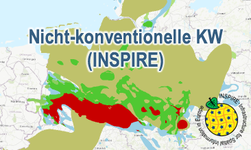
The WMS Nicht-konventionelle KW (INSPIRE) presents the results of the NiKo project according to data specifications Energy Resources (D2.8.III.20) und Geology (D2.8.II.4_v3.0). NiKo stands for „unconventional hydrocarbons“, „Nicht-konventionelle Kohlenwasserstoffe“ in German. In the NiKo project the Federal Institute for Geosciences and Natural Resources (BGR) has investigated the potential resources for shale oil and shale gas in Germany. The study was published in 2016 as a report titled „Schieferöl und Schiefergas in Deutschland – Ressourcen und Umweltaspekte“ (available in German only). The colloquial terms shale oil and shale gas refer to oil and natural gas resources in sedimentary shale rock formations, with high organic matter content. In the study, seven formations were identified to have a shale oil and/or gas potential in Germany and their distribution has been mapped in small scale. For each of the formations the organic-rich facies distribution is provided as layer and, if appropriate, the regional potential resource distribution: Fischschiefer (Oligocene), Blättertone (Barremium - Lower-Aptian), Wealden (Berriasium), Posidonienschiefer (Lower-Toarcium), Middel-Rhaetium (Oberkeuper), Permokarbon (Stefanium - Rotliegend) und Lower Carboniferous (Upper Alaunschiefer (Kulm-Facies) + Kohlenkalk-Facies). According to the overview maps in the report the following layers are provided, omitting however the sub-category “possible potential regions”. Bituminous facies distribution (0-5000 m depth) – data specification Geology: GE.GeologicUnit.Fischschiefer_distribution, GE.GeologicUnit.Blaettertone_distribution, GE.GeologicUnit.Wealden_distribution, GE.GeologicUnit.Posidonienschiefer_distribution, GE.GeologicUnit.Mittelrhaetium_black_shale_thicker_20m_distribution, GE.GeologicUnit.Permokarbon_black_shale_distribution, GE.GeologicUnit.Unterkarbon_Hangende_Alaunschiefer_distribution und GE.GeologicUnit.Unterkarbon_Kohlenkalk Facies layers are coloured according to the corresponding oldest formation age (olderNamedAge). Distribution shale oil and shale gas – potential resources (1000 - 5000 m depth) – data specification Energy Resources: ER.FossilFuelRessource.Blaettertone, ER.FossilFuelRessource.Wealden, ER.FossilFuelRessource.Posidonienschiefer, ER.FossilFuelRessource.Mittelrhaetschiefer, ER.FossilFuelRessource.Permokarbon und ER.FossilFuelRessource.Unterkarbon The shale oil and shale gas distribution layers are not coloured according to INSPIRE guidelines, but rather as common international practice in green and red, respectively. The distribution maps of the potential resources for shale oil and gas are based on geoscientific criteria. Further non-geoscientific limiting criteria, e.g. exclusion areas, have not been taken into account for the assessment. These assessments are based on appraisements of input parameters naturally with large uncertainties for the potential resources and their distribution in the deep underground. Based on the incipient exploration status of unconventionals in Germany, these resources are considered as undiscovered. The assessed shale oil and gas resources for Germany, represent the order of magnitude of potential resources. Source: BGR 2016 - Schieferöl und Schieferöl in Deutschland in 2016: - Potenziale und Umweltaspekte https://www.bgr.bund.de/DE/Themen/Energie/Downloads/Abschlussbericht_13MB_Schieferoelgaspotenzial_Deutschland_2016.html
-

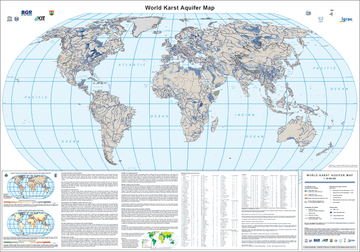
The World-wide Hydrogeological Mapping and Assessment Programme (WHYMAP) provides data and information about the earth´s major groundwater resources. The World Karst Aquifer Map (WOKAM) allows a more precise global quantification of karst systems. The map will help to increase awareness of karst groundwater resources in the context of global water issues and will serve as a basis for other karst-related research questions at global scales: for example those related to climate change, biodiversity, food production, geochemical cycles and urbanisation.
 www.geodatenkatalog.de (S3L)